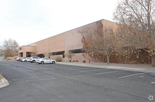
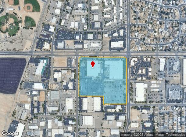
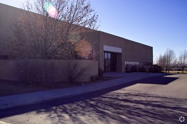
Property Record
4700 Alameda Blvd Ne, Albuquerque, NM 87113
NEARBY LISTINGS FOR SALE OR LEASE
Property Detail
4700 Alameda Blvd Ne
Albuquerque, NM
Lt1 Unit Iv Loope Industrial Dis
1-017-064-314320-4-03-40
* 1-A MOTOROLA - SUMMARY PLAT SHOWING MOTOROLA LT 1-A COMPRI SING POR OF LT 1 UNI T II & ALL OF LT1 UNIT IV LOOPE INDUSTR IAL
Manufacturinglight
Bernalillo
X
New Mexico
35001C0137H
1
0
20.74 AC
2025
North I-25
003736
Albuquerque
165,342 SF
DEMOGRAPHICS near 4700 Alameda Blvd Ne
1 Mile
3 Mile
5 Mile
2024 Total Population
2,883
52,368
165,615
2029 Population
2,842
52,077
165,930
Pop Growth 2024-2029
(1.42%)
(0.56%)
+ 0.19%
Average Age
40
43
43
2024 Total Households
1,314
22,424
72,840
HH Growth 2024-2029
(1.60%)
(0.74%)
+ 0.17%
Median Household Inc
$54,230
$75,880
$67,727
Avg Household Size
2.10
2.30
2.20
2024 Avg HH Vehicles
2.00
2.00
2.00
Median Home Value
$243,307
$319,882
$323,851
Median Year Built
1988
1986
1983
Nearby Places
Map Layers
Map Styles
 Street
 Aerial
- Restaurants
- Banks
- Shops
- Fitness
- Groceries
PUBLIC TRANSPORTATION
COMMUTER RAIL
Los Ranchos-Journal Center (Rail Runner Express - New Mexico Rail Runner Express)
DRIVE
WALK
Distance
Los Ranchos-Journal Center (Rail Runner Express - New Mexico Rail Runner Express)
5 min
2.1 mi
Sandia Pueblo (Rail Runner Express - New Mexico Rail Runner Express)
DRIVE
WALK
Distance
Sandia Pueblo (Rail Runner Express - New Mexico Rail Runner Express)
7 min
3.4 mi
AIRPORT
Albuquerque International Sunport
DRIVE
WALK
Distance
Albuquerque International Sunport
32 min
15.7 mi
Santa Fe Regional
DRIVE
WALK
Distance
Santa Fe Regional
54 min
48.7 mi
Nearby Properties
Address
Land Use
TOTAL SIZE
Lot Size
Zoning
Address
Land Use
TOTAL SIZE
Lot Size
Zoning
2,880 SF
162.53 AC
Address
Land Use
TOTAL SIZE
Lot Size
Zoning
380,827 SF
42 AC
Address
Land Use
TOTAL SIZE
Lot Size
Zoning
17,809 SF
6.58 AC
Address
Land Use
TOTAL SIZE
Lot Size
Zoning
34,585 SF
10.16 AC
Address
Land Use
TOTAL SIZE
Lot Size
Zoning
519,680 SF
59.70 AC
Address
Land Use
TOTAL SIZE
Lot Size
Zoning
386,293 SF
44.14 AC
Address
Land Use
TOTAL SIZE
Lot Size
Zoning
406,554 SF
31.72 AC
Address
Land Use
TOTAL SIZE
Lot Size
Zoning
59,072 SF
17.86 AC
Address
Land Use
TOTAL SIZE
Lot Size
Zoning
165,312 SF
14.86 AC
Address
Land Use
TOTAL SIZE
Lot Size
Zoning
395,175 SF
54.49 AC
Address
Land Use
TOTAL SIZE
Lot Size
Zoning
20,680 SF
13.99 AC
Address
Land Use
TOTAL SIZE
Lot Size
Zoning
257,532 SF
3.04 AC
Address
Land Use
TOTAL SIZE
Lot Size
Zoning
Address
Land Use
TOTAL SIZE
Lot Size
Zoning
102,000 SF
4.43 AC
Address
Land Use
TOTAL SIZE
Lot Size
Zoning
11,049 SF
184.54 AC
Address
Land Use
TOTAL SIZE
Lot Size
Zoning
68,004 SF
9.99 AC
Address
Land Use
TOTAL SIZE
Lot Size
Zoning
21,892 SF
6.43 AC
Address
Land Use
TOTAL SIZE
Lot Size
Zoning
37,232 SF
11.57 AC
Address
Land Use
TOTAL SIZE
Lot Size
Zoning
66,816 SF
10.89 AC
Address
Land Use
TOTAL SIZE
Lot Size
Zoning
Address
Land Use
TOTAL SIZE
Lot Size
Zoning
208,496 SF
4.08 AC
Address
Land Use
TOTAL SIZE
Lot Size
Zoning
169,352 SF
3.90 AC
Address
Land Use
TOTAL SIZE
Lot Size
Zoning
165,665 SF
17.73 AC
Address
Land Use
TOTAL SIZE
Lot Size
Zoning
5.22 AC
Address
Land Use
TOTAL SIZE
Lot Size
Zoning
15,773 SF
4.79 AC
Address
Land Use
TOTAL SIZE
Lot Size
Zoning
23,264 SF
9.27 AC
Address
Land Use
TOTAL SIZE
Lot Size
Zoning
3,000 SF
23.06 AC
The World's #1 Commercial Real Estate Marketplace
Connect with us
© 2025 CoStar Group
The information above has been obtained from sources believed reliable. While we do not doubt its accuracy we have not verified it and make no guarantee, warranty or representation about it. It is your responsibility to independently confirm its accuracy and completeness. Any projections, opinions, assumptions, or estimates used are for example only and do not represent the current or future performance of the property. The value of this transaction to you depends on tax and other factors which should be evaluated by your tax, financial, and legal advisors. You and your advisors should conduct a careful, independent investigation of the property to determine to your satisfaction the suitability of the property for your needs.