Property Record
614 Canal St, New Orleans, LA 70130


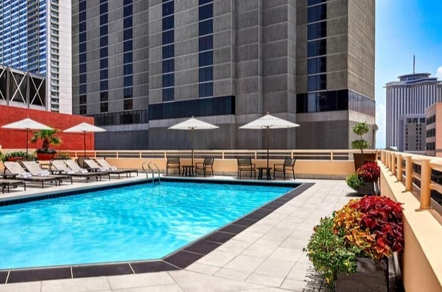
Property Detail
614 Canal St
New Orleans-Metairie, LA
SQ 170 CANAL ST, COMMON ST, ST CHARLES AV AND CAMP ST VARIOUS LOTS 614 CANAL ST
1-05-1-011-28
Orleans
Hotel
Louisiana
CBD-2
614
C and X Area of minimal flood hazard, usually depicted on FIRMs as above the 500-year flood level.
0.88 AC
2025
New Orleans CBD/French Quarter
2025
New Orleans/Metairie/Kenner
013400
NEARBY LISTINGS FOR SALE OR LEASE
DEMOGRAPHICS near 614 Canal St
1 mile
3 mile
5 mile
2025 Total Population
17,988
168,625
348,370
2030 Population
18,378
165,184
339,079
Pop Growth 2025-2030
+ 2.17%
(2.04%)
(2.67%)
Average Age
46
42
41
2025 Total Households
11,324
81,428
153,653
HH Growth 2025-2030
+ 2.41%
(2.14%)
(2.82%)
Median Household Inc
$65,869
$57,388
$57,204
Avg Household Size
1.50
1.90
2.10
2025 Avg HH Vehicles
1.00
1.00
1.00
Median Home Value
$514,855
$386,061
$329,381
Median Year Built
1947
1948
1954
Nearby Places
Map Layers
Map Styles
 Street
 Aerial
Transit
 Traffic
 Biking
Places
Listings with unknown addresses are not visible on the map
- Restaurants
- Banks
- Shops
- Fitness
- Groceries
PUBLIC TRANSPORTATION
TRANSIT/SUBWAY
Canal and Chartres/Camp (Canal-Cemeteries Streetcar - New Orleans Regional Transit Authority Streetcars (New Orleans Streetcars), Canal-Museum Streetcar - New Orleans Regional Transit Authority Streetcars (New Orleans Streetcars))
Drive
Walk
Distance
Canal and Chartres/Camp (Canal-Cemeteries Streetcar - New Orleans Regional Transit Authority Streetcars (New Orleans Streetcars), Canal-Museum Streetcar - New Orleans Regional Transit Authority Streetcars (New Orleans Streetcars))
0 min
1 min
0.1 mi
St Charles and Common (St. Charles Streetcar - New Orleans Regional Transit Authority Streetcars (New Orleans Streetcars))
Drive
Walk
Distance
St Charles and Common (St. Charles Streetcar - New Orleans Regional Transit Authority Streetcars (New Orleans Streetcars))
2 min
2 min
0.1 mi
Canal and Bourbon/Carondelet (Canal-Cemeteries Streetcar - New Orleans Regional Transit Authority Streetcars (New Orleans Streetcars), Canal-Museum Streetcar - New Orleans Regional Transit Authority Streetcars (New Orleans Streetcars))
Drive
Walk
Distance
Canal and Bourbon/Carondelet (Canal-Cemeteries Streetcar - New Orleans Regional Transit Authority Streetcars (New Orleans Streetcars), Canal-Museum Streetcar - New Orleans Regional Transit Authority Streetcars (New Orleans Streetcars))
2 min
2 min
0.1 mi
Carondelet and Canal (St. Charles Streetcar - New Orleans Regional Transit Authority Streetcars (New Orleans Streetcars))
Drive
Walk
Distance
Carondelet and Canal (St. Charles Streetcar - New Orleans Regional Transit Authority Streetcars (New Orleans Streetcars))
1 min
2 min
0.1 mi
Canal and Peters (Canal-Cemeteries Streetcar - New Orleans Regional Transit Authority Streetcars (New Orleans Streetcars), Canal-Museum Streetcar - New Orleans Regional Transit Authority Streetcars (New Orleans Streetcars))
Drive
Walk
Distance
Canal and Peters (Canal-Cemeteries Streetcar - New Orleans Regional Transit Authority Streetcars (New Orleans Streetcars), Canal-Museum Streetcar - New Orleans Regional Transit Authority Streetcars (New Orleans Streetcars))
1 min
5 min
0.2 mi
COMMUTER RAIL
Drive
Walk
Distance
4 min
19 min
1.0 mi
AIRPORT
Louis Armstrong New Orleans International
Drive
Walk
Distance
Louis Armstrong New Orleans International
23 min
15.3 mi
Freight Ports
Port of New Orleans
Drive
Walk
Distance
Port of New Orleans
10 min
2.7 mi
SALE & LEASE HISTORY
LISTING DATE
SALE/LEASE

Nov 24, 2020
For Lease
Apr 17, 2019
For Lease
Nearby Properties
Address
Land Use
TOTAL SIZE
Lot Size
Zoning
Address
Land Use
TOTAL SIZE
Lot Size
Zoning
Address
Land Use
TOTAL SIZE
Lot Size
Zoning
300 SF
2.19 AC
LS
Address
Land Use
TOTAL SIZE
Lot Size
Zoning
85,052 SF
2.19 AC
LS
Address
Land Use
TOTAL SIZE
Lot Size
Zoning
44.43 AC
CBD-4
Address
Land Use
TOTAL SIZE
Lot Size
Zoning
68.69 AC
CBD-4
Address
Land Use
TOTAL SIZE
Lot Size
Zoning
Address
Land Use
TOTAL SIZE
Lot Size
Zoning
2.02 AC
CBD-7
Address
Land Use
TOTAL SIZE
Lot Size
Zoning
3.66 AC
MC
Address
Land Use
TOTAL SIZE
Lot Size
Zoning
834,043 SF
1.40 AC
CBD-2
Address
Land Use
TOTAL SIZE
Lot Size
Zoning
18.31 AC
CBD-4
Address
Land Use
TOTAL SIZE
Lot Size
Zoning
1.87 AC
CBD-2
Address
Land Use
TOTAL SIZE
Lot Size
Zoning
6.64 AC
Address
Land Use
TOTAL SIZE
Lot Size
Zoning
844,362 SF
5.85 AC
CBD-4
Address
Land Use
TOTAL SIZE
Lot Size
Zoning
0.12 AC
Address
Land Use
TOTAL SIZE
Lot Size
Zoning
30.63 AC
Address
Land Use
TOTAL SIZE
Lot Size
Zoning
444,121 SF
1.46 AC
CBD-1
Address
Land Use
TOTAL SIZE
Lot Size
Zoning
1.91 AC
CBD-1
Address
Land Use
TOTAL SIZE
Lot Size
Zoning
576,962 SF
3.31 AC
CBD-4
Address
Land Use
TOTAL SIZE
Lot Size
Zoning
1.79 AC
Address
Land Use
TOTAL SIZE
Lot Size
Zoning
512,729 SF
6.60 AC
Address
Land Use
TOTAL SIZE
Lot Size
Zoning
1.24 AC
CBD-1
Address
Land Use
TOTAL SIZE
Lot Size
Zoning
190,708 SF
1.09 AC
CBD-2
Address
Land Use
TOTAL SIZE
Lot Size
Zoning
499,287 SF
1.44 AC
VCE
Address
Land Use
TOTAL SIZE
Lot Size
Zoning
0.67 AC
CBD-3
Address
Land Use
TOTAL SIZE
Lot Size
Zoning
0.14 AC
HMC-2
Address
Land Use
TOTAL SIZE
Lot Size
Zoning
202,291 SF
4.04 AC
HU-RD2
Address
Land Use
TOTAL SIZE
Lot Size
Zoning
162,382 SF
1.25 AC
CBD-2
Address
Land Use
TOTAL SIZE
Lot Size
Zoning
258,024 SF
0.63 AC
CBD-2
Address
Land Use
TOTAL SIZE
Lot Size
Zoning
2.94 AC
CBD-1
The World's #1 Commercial Real Estate Marketplace
Connect with us
© 2026 CoStar Group
The information above has been obtained from sources believed reliable. While we do not doubt its accuracy we have not verified it and make no guarantee, warranty or representation about it. It is your responsibility to independently confirm its accuracy and completeness. Any projections, opinions, assumptions, or estimates used are for example only and do not represent the current or future performance of the property. The value of this transaction to you depends on tax and other factors which should be evaluated by your tax, financial, and legal advisors. You and your advisors should conduct a careful, independent investigation of the property to determine to your satisfaction the suitability of the property for your needs.