Property Record
31100 Stephenson Hwy, Madison Heights, MI 48071


Property Detail
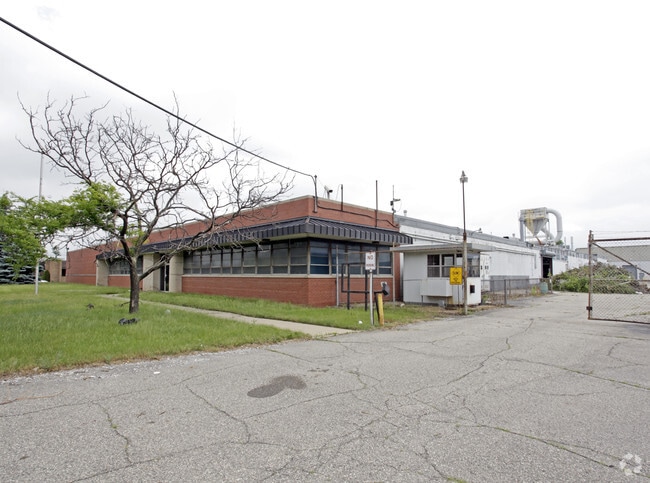
31100 Stephenson Hwy
25-02-378-021
T1N, R11E, SEC 2 PART OF SW 1/4 BEG AT PT DIST N 89-35-00 W 832.90 FT & N 00-06-00 E 310.00 FT FROM S 1/4 COR, TH N 00-06-00 E 260.00 FT, TH S 89-35-00 E 504.59 FT, TH S 00-56-00 W 260.00 FT, TH N 89-35-00 W 503.60 FT TO BEG, ALSO BEG AT PT DIST N 89
Warehouse
Oakland
M-2 HEA
Michigan
B and X Area of moderate flood hazard, usually the area between the limits of the 100-year and 500-year floods.
3.86 AC
2024
Troy Area Central
2025
Detroit
181100
Detroit-Warren-Dearborn, MI
54,869 SF
NEARBY LISTINGS FOR SALE OR LEASE
DEMOGRAPHICS near 31100 Stephenson Hwy
1 mile
3 mile
5 mile
2025 Total Population
12,070
118,052
321,796
2030 Population
12,328
119,881
326,927
Pop Growth 2025-2030
+ 2.14%
+ 1.55%
+ 1.59%
Average Age
41
41
41
2025 Total Households
6,003
55,218
141,182
HH Growth 2025-2030
+ 2.35%
+ 1.70%
+ 1.77%
Median Household Inc
$69,471
$80,373
$84,290
Avg Household Size
2.00
2.10
2.20
2025 Avg HH Vehicles
2.00
2.00
2.00
Median Home Value
$263,693
$263,580
$270,334
Median Year Built
1965
1960
1962
Nearby Places
Map Layers
Map Styles
 Street
 Aerial
Transit
 Traffic
 Biking
Places
Listings with unknown addresses are not visible on the map
- Restaurants
- Banks
- Shops
- Fitness
- Groceries
PUBLIC TRANSPORTATION
COMMUTER RAIL
Royal Oak Amtrak (Wolverine - Amtrak)
Drive
Walk
Distance
Royal Oak Amtrak (Wolverine - Amtrak)
9 min
4.0 mi
Troy Amtrak Station (Wolverine - Amtrak)
Drive
Walk
Distance
Troy Amtrak Station (Wolverine - Amtrak)
12 min
5.5 mi
AIRPORT
Windsor International
Drive
Walk
Distance
Windsor International
43 min
24.4 mi
Detroit Metro Wayne County
Drive
Walk
Distance
Detroit Metro Wayne County
48 min
34.0 mi
Freight Ports
Port of Toledo
Drive
Walk
Distance
Port of Toledo
93 min
74.9 mi
Nearby Properties
Address
Land Use
TOTAL SIZE
Lot Size
Zoning
Address
Land Use
TOTAL SIZE
Lot Size
Zoning
4.20 AC
REG BUS
Address
Land Use
TOTAL SIZE
Lot Size
Zoning
136,137 SF
12.28 AC
RM2
Address
Land Use
TOTAL SIZE
Lot Size
Zoning
0.81 AC
CBD
Address
Land Use
TOTAL SIZE
Lot Size
Zoning
21.76 AC
Address
Land Use
TOTAL SIZE
Lot Size
Zoning
476,388 SF
23 AC
Address
Land Use
TOTAL SIZE
Lot Size
Zoning
10,734 SF
3.52 AC
SPEC REDEV
Address
Land Use
TOTAL SIZE
Lot Size
Zoning
399,212 SF
26.18 AC
RM1
Address
Land Use
TOTAL SIZE
Lot Size
Zoning
12.16 AC
PUD
Address
Land Use
TOTAL SIZE
Lot Size
Zoning
251,735 SF
10.57 AC
RM3
Address
Land Use
TOTAL SIZE
Lot Size
Zoning
362,816 SF
29 AC
Address
Land Use
TOTAL SIZE
Lot Size
Zoning
157,004 SF
1.78 AC
PUD
Address
Land Use
TOTAL SIZE
Lot Size
Zoning
94,228 SF
17.66 AC
Address
Land Use
TOTAL SIZE
Lot Size
Zoning
228,421 SF
17.18 AC
RMMUL
Address
Land Use
TOTAL SIZE
Lot Size
Zoning
348,256 SF
46.10 AC
MZ
Address
Land Use
TOTAL SIZE
Lot Size
Zoning
349,226 SF
21.62 AC
RMMUL
Address
Land Use
TOTAL SIZE
Lot Size
Zoning
276,235 SF
14.49 AC
OM
Address
Land Use
TOTAL SIZE
Lot Size
Zoning
146,981 SF
4.11 AC
Address
Land Use
TOTAL SIZE
Lot Size
Zoning
236,900 SF
20.34 AC
RM1
Address
Land Use
TOTAL SIZE
Lot Size
Zoning
378,412 SF
M1LT
Address
Land Use
TOTAL SIZE
Lot Size
Zoning
1.46 AC
CBD
Address
Land Use
TOTAL SIZE
Lot Size
Zoning
804 SF
1.50 AC
CBD
Address
Land Use
TOTAL SIZE
Lot Size
Zoning
132,512 SF
0.50 AC
CBD
Address
Land Use
TOTAL SIZE
Lot Size
Zoning
204,086 SF
18.72 AC
RM1
Address
Land Use
TOTAL SIZE
Lot Size
Zoning
126,450 SF
17.25 AC
RM-2
Address
Land Use
TOTAL SIZE
Lot Size
Zoning
230,192 SF
B3GEN
Address
Land Use
TOTAL SIZE
Lot Size
Zoning
94,228 SF
17.66 AC
B2
Address
Land Use
TOTAL SIZE
Lot Size
Zoning
171,259 SF
1.26 AC
CBD
Address
Land Use
TOTAL SIZE
Lot Size
Zoning
62,528 SF
5.27 AC
M-1 LT
Address
Land Use
TOTAL SIZE
Lot Size
Zoning
120,678 SF
13.31 AC
RM-2
Address
Land Use
TOTAL SIZE
Lot Size
Zoning
13.89 AC
PUD
The World's #1 Commercial Real Estate Marketplace
Connect with us
© 2026 CoStar Group
The information above has been obtained from sources believed reliable. While we do not doubt its accuracy we have not verified it and make no guarantee, warranty or representation about it. It is your responsibility to independently confirm its accuracy and completeness. Any projections, opinions, assumptions, or estimates used are for example only and do not represent the current or future performance of the property. The value of this transaction to you depends on tax and other factors which should be evaluated by your tax, financial, and legal advisors. You and your advisors should conduct a careful, independent investigation of the property to determine to your satisfaction the suitability of the property for your needs.