Property Record
8139 Highway 33 N, Lakeland, FL 33809
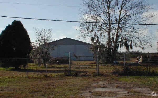


Property Detail
8139 Highway 33 N
24-27-11-000000-044030
OMM INTER NLY R/W I-4 WITH W-LINE OF SEC RUN N 72 DEG 50 MIN 19 SEC E ALONG R/W 600 FT FOR POB RUN N 1481.23 FT TO SLY R/W SR 33 N 72 DEG 50 MIN 50 SEC E ALONG R/W 154.69 FT S 1482.58 FT TO NLY R/W I-4 S 72 DEG 50 MIN 19 SEC W ALONG R/W 150 FT TO POB
Warehouse
POLK
C4
Florida
A Areas with a 1% annual chance of flooding and a 26% chance of flooding over the life of a 30-year mortgage.
14.54 AC
2024
Polk County
2025
Tampa/St Petersburg
012303
Lakeland-Winter Haven, FL
16,000 SF
NEARBY LISTINGS FOR SALE OR LEASE
DEMOGRAPHICS near 8139 Highway 33 N
1 mile
3 mile
5 mile
2024 Total Population
76
13,687
46,960
2029 Population
86
15,620
53,565
Pop Growth 2024-2029
+ 13.16%
+ 14.12%
+ 14.07%
Average Age
42
42
42
2024 Total Households
28
4,983
17,947
HH Growth 2024-2029
+ 10.71%
+ 14.43%
+ 14.33%
Median Household Inc
$112,500
$94,999
$80,717
Avg Household Size
2.80
2.70
2.60
2024 Avg HH Vehicles
3.00
2.00
2.00
Median Home Value
$364,999
$354,574
$324,372
Median Year Built
1994
1996
1995
Nearby Places
Map Layers
Map Styles
 Street
 Aerial
Transit
 Traffic
 Biking
Places
Listings with unknown addresses are not visible on the map
- Restaurants
- Banks
- Shops
- Fitness
- Groceries
PUBLIC TRANSPORTATION
COMMUTER RAIL
Drive
Walk
Distance
17 min
9.7 mi
AIRPORT
Orlando International
Drive
Walk
Distance
Orlando International
60 min
47.2 mi
Freight Ports
Port of Tampa Bay
Drive
Walk
Distance
Port of Tampa Bay
52 min
41.0 mi
Nearby Properties
Address
Land Use
TOTAL SIZE
Lot Size
Zoning
Address
Land Use
TOTAL SIZE
Lot Size
Zoning
1,013,375 SF
59.99 AC
Address
Land Use
TOTAL SIZE
Lot Size
Zoning
1,004,929 SF
138.29 AC
RC
Address
Land Use
TOTAL SIZE
Lot Size
Zoning
415,651 SF
170.58 AC
Address
Land Use
TOTAL SIZE
Lot Size
Zoning
586,592 SF
30.87 AC
Address
Land Use
TOTAL SIZE
Lot Size
Zoning
710,790 SF
59.77 AC
PUD
Address
Land Use
TOTAL SIZE
Lot Size
Zoning
650,460 SF
45.79 AC
RC
Address
Land Use
TOTAL SIZE
Lot Size
Zoning
358,929 SF
65.46 AC
XX
Address
Land Use
TOTAL SIZE
Lot Size
Zoning
605,400 SF
59.85 AC
RC
Address
Land Use
TOTAL SIZE
Lot Size
Zoning
537,608 SF
41.93 AC
RC
Address
Land Use
TOTAL SIZE
Lot Size
Zoning
430,813 SF
43.97 AC
RC
Address
Land Use
TOTAL SIZE
Lot Size
Zoning
400,000 SF
34.91 AC
Address
Land Use
TOTAL SIZE
Lot Size
Zoning
400,000 SF
18.51 AC
Address
Land Use
TOTAL SIZE
Lot Size
Zoning
338,930 SF
24.33 AC
Address
Land Use
TOTAL SIZE
Lot Size
Zoning
359,142 SF
22.39 AC
Address
Land Use
TOTAL SIZE
Lot Size
Zoning
275,184 SF
16.32 AC
Address
Land Use
TOTAL SIZE
Lot Size
Zoning
139,302 SF
16.50 AC
RC
Address
Land Use
TOTAL SIZE
Lot Size
Zoning
221,600 SF
45.53 AC
PUD
Address
Land Use
TOTAL SIZE
Lot Size
Zoning
100,740 SF
17.62 AC
RC
Address
Land Use
TOTAL SIZE
Lot Size
Zoning
69,238 SF
8.42 AC
RC
Address
Land Use
TOTAL SIZE
Lot Size
Zoning
80,000 SF
9.76 AC
Address
Land Use
TOTAL SIZE
Lot Size
Zoning
68,747 SF
9.69 AC
RC
Address
Land Use
TOTAL SIZE
Lot Size
Zoning
61,000 SF
9 AC
PUD
Address
Land Use
TOTAL SIZE
Lot Size
Zoning
56,203 SF
43.81 AC
C3
Address
Land Use
TOTAL SIZE
Lot Size
Zoning
32,580 SF
7.73 AC
C3
Address
Land Use
TOTAL SIZE
Lot Size
Zoning
47,580 SF
7.16 AC
Address
Land Use
TOTAL SIZE
Lot Size
Zoning
28,350 SF
15.97 AC
Address
Land Use
TOTAL SIZE
Lot Size
Zoning
4,650 SF
4.01 AC
Address
Land Use
TOTAL SIZE
Lot Size
Zoning
19.25 AC
Address
Land Use
TOTAL SIZE
Lot Size
Zoning
27.02 AC
RC
Address
Land Use
TOTAL SIZE
Lot Size
Zoning
44,750 SF
17.88 AC
RC
The World's #1 Commercial Real Estate Marketplace
Connect with us
© 2026 CoStar Group
The information above has been obtained from sources believed reliable. While we do not doubt its accuracy we have not verified it and make no guarantee, warranty or representation about it. It is your responsibility to independently confirm its accuracy and completeness. Any projections, opinions, assumptions, or estimates used are for example only and do not represent the current or future performance of the property. The value of this transaction to you depends on tax and other factors which should be evaluated by your tax, financial, and legal advisors. You and your advisors should conduct a careful, independent investigation of the property to determine to your satisfaction the suitability of the property for your needs.