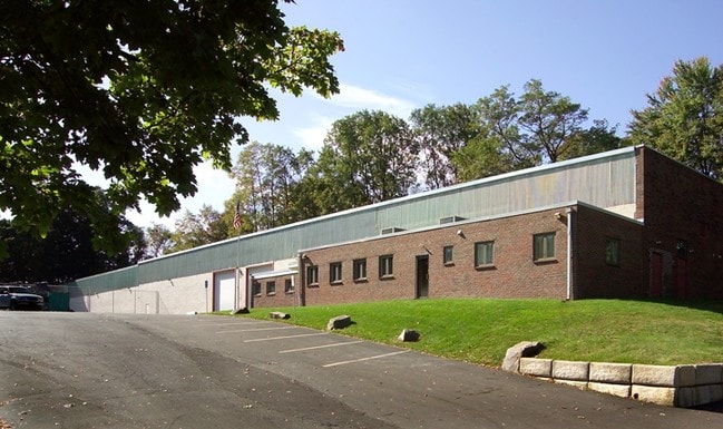
Property Record
2997 Franks Rd, Huntingdon Valley, PA 19006


Property Detail
2997 Franks Rd
41-00-03076-006
INCLUDES UNIT 195
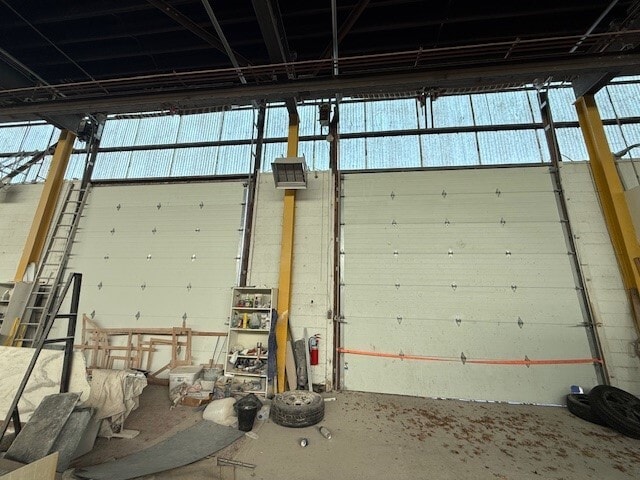
Warehouse
MONTGOMERY
I
Pennsylvania
B and X Area of moderate flood hazard, usually the area between the limits of the 100-year and 500-year floods.
161
2024
1.51 AC
2025
East Montgomery Cty
200104
Philadelphia
20,336 SF
Philadelphia-Camden-Wilmington, PA-NJ-DE-MD
NEARBY LISTINGS FOR SALE OR LEASE
DEMOGRAPHICS near 2997 Franks Rd
1 mile
3 mile
5 mile
2025 Total Population
16,735
94,426
319,105
2030 Population
16,145
93,290
316,804
Pop Growth 2025-2030
(3.53%)
(1.20%)
(0.72%)
Average Age
41
44
43
2025 Total Households
6,045
34,947
123,286
HH Growth 2025-2030
(3.94%)
(1.50%)
(0.81%)
Median Household Inc
$73,765
$85,538
$80,565
Avg Household Size
2.70
2.60
2.50
2025 Avg HH Vehicles
2.00
2.00
2.00
Median Home Value
$349,217
$379,568
$347,931
Median Year Built
1968
1967
1964
Nearby Places
Map Layers
Map Styles
 Street
 Aerial
Transit
 Traffic
 Biking
Places
Listings with unknown addresses are not visible on the map
- Restaurants
- Banks
- Shops
- Fitness
- Groceries
SALE & LEASE HISTORY
LISTING DATE
SALE/LEASE

Dec 13, 2024
For Lease
Nearby Properties
Address
Land Use
TOTAL SIZE
Lot Size
Zoning
Address
Land Use
TOTAL SIZE
Lot Size
Zoning
70,995 SF
5.34 AC
RSD1
Address
Land Use
TOTAL SIZE
Lot Size
Zoning
1,015,495 SF
70.51 AC
I1
Address
Land Use
TOTAL SIZE
Lot Size
Zoning
627,076 SF
36.89 AC
RSA1
Address
Land Use
TOTAL SIZE
Lot Size
Zoning
464,814 SF
23.90 AC
I1
Address
Land Use
TOTAL SIZE
Lot Size
Zoning
385,557 SF
5.10 AC
V
Address
Land Use
TOTAL SIZE
Lot Size
Zoning
68,850 SF
16.42 AC
I1
Address
Land Use
TOTAL SIZE
Lot Size
Zoning
283,878 SF
63.36 AC
RSA3
Address
Land Use
TOTAL SIZE
Lot Size
Zoning
250,000 SF
58.32 AC
I2
Address
Land Use
TOTAL SIZE
Lot Size
Zoning
358,323 SF
27.42 AC
CA1
Address
Land Use
TOTAL SIZE
Lot Size
Zoning
282,736 SF
21.32 AC
I1
Address
Land Use
TOTAL SIZE
Lot Size
Zoning
213,065 SF
16.12 AC
CA2
Address
Land Use
TOTAL SIZE
Lot Size
Zoning
233,520 SF
14.03 AC
I1
Address
Land Use
TOTAL SIZE
Lot Size
Zoning
325,000 SF
12.47 AC
RMX1
Address
Land Use
TOTAL SIZE
Lot Size
Zoning
118,001 SF
25.60 AC
I2
Address
Land Use
TOTAL SIZE
Lot Size
Zoning
406,343 SF
6.59 AC
V
Address
Land Use
TOTAL SIZE
Lot Size
Zoning
636,126 SF
43.18 AC
AP
Address
Land Use
TOTAL SIZE
Lot Size
Zoning
447,375 SF
26.32 AC
I2
Address
Land Use
TOTAL SIZE
Lot Size
Zoning
43.93 AC
RSD1
Address
Land Use
TOTAL SIZE
Lot Size
Zoning
203,573 SF
9.94 AC
I1
Address
Land Use
TOTAL SIZE
Lot Size
Zoning
184,500 SF
5.40 AC
RSD3
Address
Land Use
TOTAL SIZE
Lot Size
Zoning
222,500 SF
14.58 AC
I1
Address
Land Use
TOTAL SIZE
Lot Size
Zoning
166,782 SF
8.45 AC
RSD3
Address
Land Use
TOTAL SIZE
Lot Size
Zoning
237,425 SF
15.30 AC
I1
Address
Land Use
TOTAL SIZE
Lot Size
Zoning
309,000 SF
0.14 AC
RM2
Address
Land Use
TOTAL SIZE
Lot Size
Zoning
386,320 SF
21.41 AC
I1
Address
Land Use
TOTAL SIZE
Lot Size
Zoning
179,718 SF
6.61 AC
RM2
Address
Land Use
TOTAL SIZE
Lot Size
Zoning
248,178 SF
19.36 AC
I1
Address
Land Use
TOTAL SIZE
Lot Size
Zoning
223,170 SF
6.41 AC
RM2
Address
Land Use
TOTAL SIZE
Lot Size
Zoning
282,292 SF
74.30 AC
IN
Address
Land Use
TOTAL SIZE
Lot Size
Zoning
309,254 SF
12.76 AC
I1
The World's #1 Commercial Real Estate Marketplace
Connect with us
© 2026 CoStar Group
The information above has been obtained from sources believed reliable. While we do not doubt its accuracy we have not verified it and make no guarantee, warranty or representation about it. It is your responsibility to independently confirm its accuracy and completeness. Any projections, opinions, assumptions, or estimates used are for example only and do not represent the current or future performance of the property. The value of this transaction to you depends on tax and other factors which should be evaluated by your tax, financial, and legal advisors. You and your advisors should conduct a careful, independent investigation of the property to determine to your satisfaction the suitability of the property for your needs.