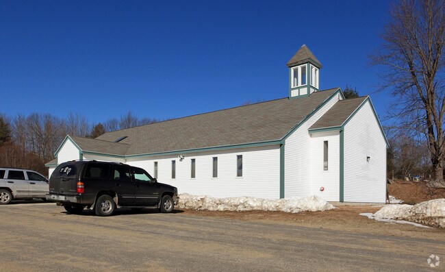
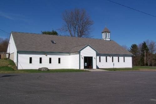
Property Record
1152 Main St, Lewiston, ME 04240

Property Detail
1152 Main St
LEWI-000138-000000-000001
Androscoggin
Transientlodging
Maine
B and X Area of moderate flood hazard, usually the area between the limits of the 100-year and 500-year floods.
1
2025
1.56 AC
2025
Other Market Areas
020900
Lewiston-Auburn, ME
4,344 SF
NEARBY LISTINGS FOR SALE OR LEASE
-
-
View all Lewiston listings for sale on LoopNet.com
DEMOGRAPHICS near 1152 Main St
1 mile
3 mile
5 mile
2024 Total Population
1,070
15,992
59,588
2029 Population
1,094
16,356
60,960
Pop Growth 2024-2029
+ 2.24%
+ 2.28%
+ 2.30%
Average Age
44
41
40
2024 Total Households
402
5,772
24,064
HH Growth 2024-2029
+ 2.49%
+ 1.91%
+ 2.29%
Median Household Inc
$77,678
$61,867
$56,620
Avg Household Size
2.30
2.20
2.20
2024 Avg HH Vehicles
2.00
2.00
2.00
Median Home Value
$242,803
$262,562
$253,382
Median Year Built
1966
1964
1955
Nearby Places
Map Layers
Map Styles
 Street
 Aerial
Transit
 Traffic
 Biking
Places
Listings with unknown addresses are not visible on the map
- Restaurants
- Banks
- Shops
- Fitness
- Groceries
PUBLIC TRANSPORTATION
AIRPORT
Portland International Jetport
Drive
Walk
Distance
Portland International Jetport
51 min
39.9 mi
Freight Ports
Portland, ME
Drive
Walk
Distance
Portland, ME
51 min
39.5 mi
Nearby Properties
Address
Land Use
TOTAL SIZE
Lot Size
Zoning
Address
Land Use
TOTAL SIZE
Lot Size
Zoning
1,728 SF
53.55 AC
Address
Land Use
TOTAL SIZE
Lot Size
Zoning
295,277 SF
124.77 AC
Address
Land Use
TOTAL SIZE
Lot Size
Zoning
67,873 SF
Address
Land Use
TOTAL SIZE
Lot Size
Zoning
290,142 SF
33.80 AC
Address
Land Use
TOTAL SIZE
Lot Size
Zoning
93.89 AC
Address
Land Use
TOTAL SIZE
Lot Size
Zoning
220,227 SF
35.93 AC
Address
Land Use
TOTAL SIZE
Lot Size
Zoning
260,479 SF
23.56 AC
Address
Land Use
TOTAL SIZE
Lot Size
Zoning
Address
Land Use
TOTAL SIZE
Lot Size
Zoning
93,343 SF
16.41 AC
Address
Land Use
TOTAL SIZE
Lot Size
Zoning
127,660 SF
9.24 AC
Address
Land Use
TOTAL SIZE
Lot Size
Zoning
77,416 SF
2.88 AC
Address
Land Use
TOTAL SIZE
Lot Size
Zoning
Address
Land Use
TOTAL SIZE
Lot Size
Zoning
144,665 SF
36.25 AC
Address
Land Use
TOTAL SIZE
Lot Size
Zoning
134,613 SF
26.87 AC
Address
Land Use
TOTAL SIZE
Lot Size
Zoning
Address
Land Use
TOTAL SIZE
Lot Size
Zoning
125,449 SF
Address
Land Use
TOTAL SIZE
Lot Size
Zoning
94,914 SF
Address
Land Use
TOTAL SIZE
Lot Size
Zoning
60,728 SF
0.86 AC
Address
Land Use
TOTAL SIZE
Lot Size
Zoning
104,958 SF
15.15 AC
Address
Land Use
TOTAL SIZE
Lot Size
Zoning
73,700 SF
66.95 AC
Address
Land Use
TOTAL SIZE
Lot Size
Zoning
136,901 SF
10.50 AC
Address
Land Use
TOTAL SIZE
Lot Size
Zoning
70,094 SF
8.53 AC
Address
Land Use
TOTAL SIZE
Lot Size
Zoning
96,073 SF
Address
Land Use
TOTAL SIZE
Lot Size
Zoning
110,728 SF
10.77 AC
Address
Land Use
TOTAL SIZE
Lot Size
Zoning
22,184 SF
Address
Land Use
TOTAL SIZE
Lot Size
Zoning
89,092 SF
9.68 AC
Address
Land Use
TOTAL SIZE
Lot Size
Zoning
114,670 SF
12.85 AC
Address
Land Use
TOTAL SIZE
Lot Size
Zoning
95,299 SF
67 AC
Address
Land Use
TOTAL SIZE
Lot Size
Zoning
6,273 SF
140.70 AC
Address
Land Use
TOTAL SIZE
Lot Size
Zoning
2,306 SF
1.56 AC
The World's #1 Commercial Real Estate Marketplace
Connect with us
© 2026 CoStar Group
The information above has been obtained from sources believed reliable. While we do not doubt its accuracy we have not verified it and make no guarantee, warranty or representation about it. It is your responsibility to independently confirm its accuracy and completeness. Any projections, opinions, assumptions, or estimates used are for example only and do not represent the current or future performance of the property. The value of this transaction to you depends on tax and other factors which should be evaluated by your tax, financial, and legal advisors. You and your advisors should conduct a careful, independent investigation of the property to determine to your satisfaction the suitability of the property for your needs.