Property Record
310 W Bradley Rd, Milwaukee, WI 53217


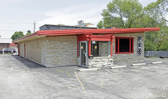
Property Detail
310 W Bradley Rd
Milwaukee-Waukesha, WI
COMM 1,323.00 FT, W OF SE COR OF SE 1/4 SEC. 8-8-22; TH W 138.13 FT, N 208.12 FT, E 138.13 FT, TH S 208.12 FT TO POB.
060-9975-000
MILWAUKEE
Commercialnec
Wisconsin
B and X Area of moderate flood hazard, usually the area between the limits of the 100-year and 500-year floods.
0.66 AC
2024
North Shore
2024
Milwaukee/Madison
060101
NEARBY LISTINGS FOR SALE OR LEASE
DEMOGRAPHICS near 310 W Bradley Rd
1 mile
3 mile
5 mile
2024 Total Population
5,966
35,313
125,645
2029 Population
5,965
35,332
125,966
Pop Growth 2024-2029
(0.02%)
+ 0.05%
+ 0.26%
Average Age
43
43
40
2024 Total Households
2,533
14,479
50,909
HH Growth 2024-2029
(0.12%)
(0.02%)
+ 0.18%
Median Household Inc
$133,238
$108,864
$71,721
Avg Household Size
2.30
2.40
2.40
2024 Avg HH Vehicles
2.00
2.00
2.00
Median Home Value
$409,317
$388,483
$300,863
Median Year Built
1958
1962
1958
Nearby Places
Map Layers
Map Styles
 Street
 Aerial
Transit
 Traffic
 Biking
Places
Listings with unknown addresses are not visible on the map
- Restaurants
- Banks
- Shops
- Fitness
- Groceries
PUBLIC TRANSPORTATION
COMMUTER RAIL
Drive
Walk
Distance
18 min
9.7 mi
AIRPORT
General Mitchell International
Drive
Walk
Distance
General Mitchell International
28 min
16.3 mi
Freight Ports
Port Milwaukee
Drive
Walk
Distance
Port Milwaukee
21 min
12.1 mi
SALE & LEASE HISTORY
LISTING DATE
SALE/LEASE

Sep 07, 2017
For Sale
Nearby Properties
Address
Land Use
TOTAL SIZE
Lot Size
Zoning
Address
Land Use
TOTAL SIZE
Lot Size
Zoning
305,573 SF
3.20 AC
Address
Land Use
TOTAL SIZE
Lot Size
Zoning
527,776 SF
33.23 AC
Address
Land Use
TOTAL SIZE
Lot Size
Zoning
19.64 AC
Address
Land Use
TOTAL SIZE
Lot Size
Zoning
Address
Land Use
TOTAL SIZE
Lot Size
Zoning
Address
Land Use
TOTAL SIZE
Lot Size
Zoning
145,218 SF
10.23 AC
Address
Land Use
TOTAL SIZE
Lot Size
Zoning
72,824 SF
11.57 AC
Address
Land Use
TOTAL SIZE
Lot Size
Zoning
Address
Land Use
TOTAL SIZE
Lot Size
Zoning
Address
Land Use
TOTAL SIZE
Lot Size
Zoning
294,553 SF
6.19 AC
Address
Land Use
TOTAL SIZE
Lot Size
Zoning
235,364 SF
7.20 AC
Address
Land Use
TOTAL SIZE
Lot Size
Zoning
90,714 SF
4.18 AC
Address
Land Use
TOTAL SIZE
Lot Size
Zoning
4.26 AC
Address
Land Use
TOTAL SIZE
Lot Size
Zoning
74,526 SF
5.42 AC
Address
Land Use
TOTAL SIZE
Lot Size
Zoning
48,540 SF
4.28 AC
Address
Land Use
TOTAL SIZE
Lot Size
Zoning
127,584 SF
3.28 AC
Address
Land Use
TOTAL SIZE
Lot Size
Zoning
Address
Land Use
TOTAL SIZE
Lot Size
Zoning
81,300 SF
0.71 AC
Address
Land Use
TOTAL SIZE
Lot Size
Zoning
Address
Land Use
TOTAL SIZE
Lot Size
Zoning
128,512 SF
3.57 AC
Address
Land Use
TOTAL SIZE
Lot Size
Zoning
13.08 AC
Address
Land Use
TOTAL SIZE
Lot Size
Zoning
34,949 SF
6.01 AC
Address
Land Use
TOTAL SIZE
Lot Size
Zoning
56,706 SF
4.53 AC
Address
Land Use
TOTAL SIZE
Lot Size
Zoning
7.84 AC
Address
Land Use
TOTAL SIZE
Lot Size
Zoning
87,286 SF
6.02 AC
Address
Land Use
TOTAL SIZE
Lot Size
Zoning
97,330 SF
3.18 AC
Address
Land Use
TOTAL SIZE
Lot Size
Zoning
21.20 AC
Address
Land Use
TOTAL SIZE
Lot Size
Zoning
62,080 SF
7.47 AC
Address
Land Use
TOTAL SIZE
Lot Size
Zoning
54,000 SF
2.28 AC
Address
Land Use
TOTAL SIZE
Lot Size
Zoning
58,805 SF
2.82 AC
The World's #1 Commercial Real Estate Marketplace
Connect with us
© 2026 CoStar Group
The information above has been obtained from sources believed reliable. While we do not doubt its accuracy we have not verified it and make no guarantee, warranty or representation about it. It is your responsibility to independently confirm its accuracy and completeness. Any projections, opinions, assumptions, or estimates used are for example only and do not represent the current or future performance of the property. The value of this transaction to you depends on tax and other factors which should be evaluated by your tax, financial, and legal advisors. You and your advisors should conduct a careful, independent investigation of the property to determine to your satisfaction the suitability of the property for your needs.