Log In/Sign Up
Your email has been sent.
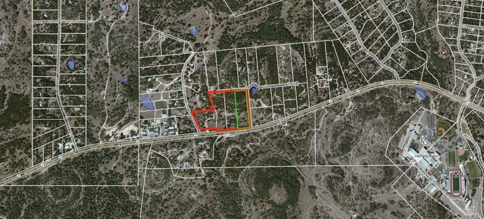
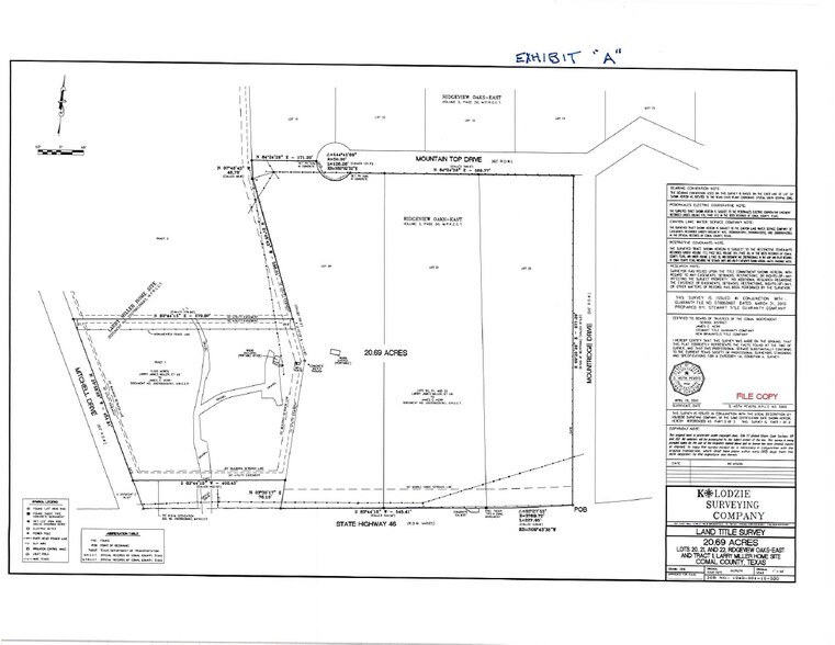
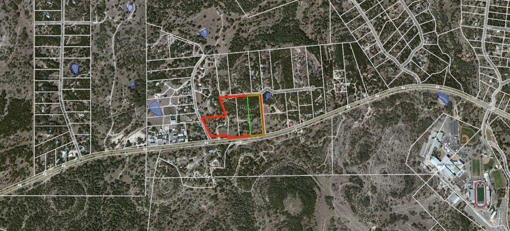
16260 State Hwy 46 - 20+ ACS - SH 46 @ MITCHELL DR & MOUNTRIDGE 20.69 Acres of Commercial Land in Spring Branch, TX 78070
Investment Highlights
- S.H. 46 FRONTAGE
- 2.5+ MILES EAST OF HWY 281
- COMAL ISD
Executive Summary
20+ ACRES - Highway 46 Frontage
Surrounded by single-family residential subdivisions to the north, east and west. Homes typically range from $300,000 to $600,000, with an average home price of $350,000.
Located on the north side of Hwy 46, between Mitchell Dr and Mountridge Drive in one of the fastest growing areas north of San Antonio. Comal ISD, just west of Smithson Valley High School.
Property Facts
| Sale Type | Investment | Property Subtype | Commercial |
| No. Lots | 1 | Proposed Use | Commercial |
| Property Type | Land | Total Lot Size | 20.69 AC |
| Sale Type | Investment |
| No. Lots | 1 |
| Property Type | Land |
| Property Subtype | Commercial |
| Proposed Use | Commercial |
| Total Lot Size | 20.69 AC |
1 Lot Available
Lot 1
| Lot Size | 20.69 AC |
| Lot Size | 20.69 AC |
1 1

1 of 3
Videos
Matterport 3D Exterior
Matterport 3D Tour
Photos
Street View
Street
Map
1 of 1
Presented by

16260 State Hwy 46 - 20+ ACS - SH 46 @ MITCHELL DR & MOUNTRIDGE
Already a member? Log In
Hmm, there seems to have been an error sending your message. Please try again.
Thanks! Your message was sent.