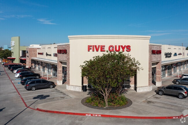
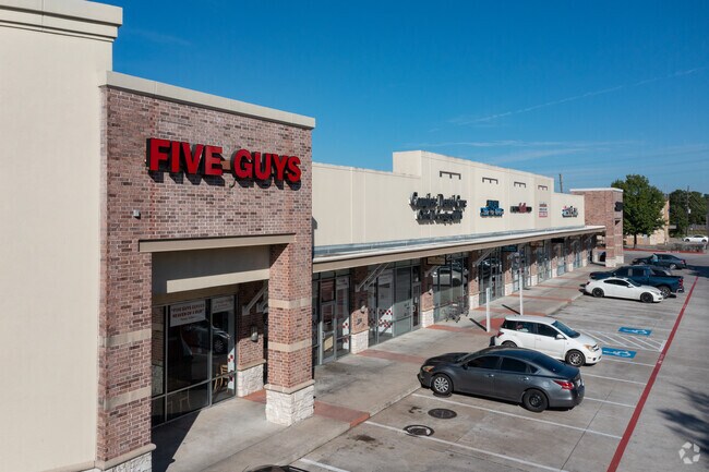
Property Record
7405 Fm 1960 Rd E, Humble, TX 77346

Property Detail
7405 Fm 1960 Rd E
1178720010001
RES A BLK 1 R/P & EXTENSION ATASCOCITA TOWN CENTER SEC 4
Regionalshoppingcenterormallwithanchorstore
HARRIS
B and X Area of moderate flood hazard, usually the area between the limits of the 100-year and 500-year floods.
Texas
2024
11.97 AC
2025
Kingwood Area
250702
Houston
103,467 SF
Houston-Pasadena-The Woodlands, TX
NEARBY LISTINGS FOR SALE OR LEASE
-
-
-
No Photo
-
-
-
-
-
View all Humble listings for lease on LoopNet.com
DEMOGRAPHICS near 7405 Fm 1960 Rd E
1 mile
3 mile
5 mile
2025 Total Population
13,661
73,175
153,241
2030 Population
14,413
77,911
164,089
Pop Growth 2025-2030
+ 5.50%
+ 6.47%
+ 7.08%
Average Age
40
37
38
2025 Total Households
4,685
24,568
51,818
HH Growth 2025-2030
+ 5.61%
+ 6.65%
+ 7.26%
Median Household Inc
$106,261
$114,928
$115,010
Avg Household Size
2.90
2.90
2.90
2025 Avg HH Vehicles
2.00
2.00
2.00
Median Home Value
$286,244
$321,772
$333,573
Median Year Built
1993
2002
2001
Nearby Places
Map Layers
Map Styles
 Street
 Aerial
Transit
 Traffic
 Biking
Places
Listings with unknown addresses are not visible on the map
- Restaurants
- Banks
- Shops
- Fitness
- Groceries
PUBLIC TRANSPORTATION
AIRPORT
George Bush Intcntl/Houston
Drive
Walk
Distance
George Bush Intcntl/Houston
24 min
15.2 mi
William P Hobby
Drive
Walk
Distance
William P Hobby
53 min
32.0 mi
Freight Ports
Port of Houston
Drive
Walk
Distance
Port of Houston
39 min
24.0 mi
SALE & LEASE HISTORY
LISTING DATE
SALE/LEASE

Sep 20, 2022
For Lease
Oct 01, 2018
For Lease
Nearby Properties
Address
Land Use
TOTAL SIZE
Lot Size
Zoning
Address
Land Use
TOTAL SIZE
Lot Size
Zoning
431,427 SF
14.62 AC
Address
Land Use
TOTAL SIZE
Lot Size
Zoning
403,142 SF
17.32 AC
Address
Land Use
TOTAL SIZE
Lot Size
Zoning
313,899 SF
16.47 AC
Address
Land Use
TOTAL SIZE
Lot Size
Zoning
356,311 SF
15.60 AC
Address
Land Use
TOTAL SIZE
Lot Size
Zoning
299,944 SF
14.63 AC
Address
Land Use
TOTAL SIZE
Lot Size
Zoning
303,243 SF
17.74 AC
Address
Land Use
TOTAL SIZE
Lot Size
Zoning
293,416 SF
13.27 AC
Address
Land Use
TOTAL SIZE
Lot Size
Zoning
446,886 SF
4.82 AC
Address
Land Use
TOTAL SIZE
Lot Size
Zoning
326,166 SF
11.84 AC
Address
Land Use
TOTAL SIZE
Lot Size
Zoning
309,259 SF
15.06 AC
Address
Land Use
TOTAL SIZE
Lot Size
Zoning
183,966 SF
7 AC
Address
Land Use
TOTAL SIZE
Lot Size
Zoning
135,332 SF
12.32 AC
Address
Land Use
TOTAL SIZE
Lot Size
Zoning
274,992 SF
11.55 AC
Address
Land Use
TOTAL SIZE
Lot Size
Zoning
196,934 SF
6.39 AC
Address
Land Use
TOTAL SIZE
Lot Size
Zoning
203,282 SF
15.53 AC
Address
Land Use
TOTAL SIZE
Lot Size
Zoning
159,519 SF
16.73 AC
Address
Land Use
TOTAL SIZE
Lot Size
Zoning
174,820 SF
13.30 AC
Address
Land Use
TOTAL SIZE
Lot Size
Zoning
100,202 SF
11.72 AC
Address
Land Use
TOTAL SIZE
Lot Size
Zoning
196,633 SF
12.69 AC
Address
Land Use
TOTAL SIZE
Lot Size
Zoning
208,856 SF
23.08 AC
Address
Land Use
TOTAL SIZE
Lot Size
Zoning
128,886 SF
6.36 AC
Address
Land Use
TOTAL SIZE
Lot Size
Zoning
109,866 SF
10.66 AC
Address
Land Use
TOTAL SIZE
Lot Size
Zoning
160,575 SF
3.62 AC
Address
Land Use
TOTAL SIZE
Lot Size
Zoning
214,640 SF
5.84 AC
Address
Land Use
TOTAL SIZE
Lot Size
Zoning
160,038 SF
8.96 AC
Address
Land Use
TOTAL SIZE
Lot Size
Zoning
158,660 SF
6.08 AC
Address
Land Use
TOTAL SIZE
Lot Size
Zoning
73,901 SF
8.58 AC
Address
Land Use
TOTAL SIZE
Lot Size
Zoning
68,448 SF
7.17 AC
Address
Land Use
TOTAL SIZE
Lot Size
Zoning
176,838 SF
13.67 AC
The World's #1 Commercial Real Estate Marketplace
Connect with us
© 2026 CoStar Group
The information above has been obtained from sources believed reliable. While we do not doubt its accuracy we have not verified it and make no guarantee, warranty or representation about it. It is your responsibility to independently confirm its accuracy and completeness. Any projections, opinions, assumptions, or estimates used are for example only and do not represent the current or future performance of the property. The value of this transaction to you depends on tax and other factors which should be evaluated by your tax, financial, and legal advisors. You and your advisors should conduct a careful, independent investigation of the property to determine to your satisfaction the suitability of the property for your needs.