Property Record
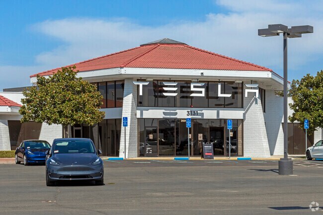
3131 Auto Center Cir, Stockton, CA 95212


NEARBY LISTINGS FOR SALE OR LEASE
Property Detail
3131 Auto Center Cir
Stockton-Lodi, CA
Stockton Auto Center
128-020-14
REDRAWN FEB-03-2004 FROM ORIGINAL APN 092-220-12
Vehiclerentalsvehiclesales
San Joaquin
X
California
06077C0320F
12
2025
7 AC
2025
Stockton
003504
Stockton/Modesto
33,485 SF
DEMOGRAPHICS near 3131 Auto Center Cir
1 Mile
3 Mile
5 Mile
2024 Total Population
21,646
122,136
285,260
2029 Population
22,697
128,937
300,913
Pop Growth 2024-2029
+ 4.86%
+ 5.57%
+ 5.49%
Average Age
35
36
37
2024 Total Households
5,532
36,653
91,691
HH Growth 2024-2029
+ 4.88%
+ 5.56%
+ 5.57%
Median Household Inc
$69,352
$67,007
$68,250
Avg Household Size
3.70
3.20
3.00
2024 Avg HH Vehicles
2.00
2.00
2.00
Median Home Value
$356,915
$362,325
$380,022
Median Year Built
1992
1979
1975
Nearby Places
Map Layers
Map Styles
 Street
 Aerial
- Restaurants
- Banks
- Shops
- Fitness
- Groceries
PUBLIC TRANSPORTATION
COMMUTER RAIL
Stockton (Altamont Corridor Express - Altamont Commuter Express (ACE))
DRIVE
WALK
Distance
Stockton (Altamont Corridor Express - Altamont Commuter Express (ACE))
13 min
6.1 mi
DRIVE
WALK
Distance
14 min
8.2 mi
AIRPORT
Stockton Metro
DRIVE
WALK
Distance
Stockton Metro
20 min
11.9 mi
Freight Ports
Port of Stockton
DRIVE
WALK
Distance
Port of Stockton
17 min
8.5 mi
SALE & LEASE HISTORY
LISTING DATE
SALE/LEASE

Aug 05, 2019
For Lease
Nearby Properties
Address
Land Use
TOTAL SIZE
Lot Size
Zoning
Address
Land Use
TOTAL SIZE
Lot Size
Zoning
105,083 SF
24.90 AC
O
Address
Land Use
TOTAL SIZE
Lot Size
Zoning
4,495 SF
11.76 AC
Address
Land Use
TOTAL SIZE
Lot Size
Zoning
9,750 SF
136.94 AC
AU20
Address
Land Use
TOTAL SIZE
Lot Size
Zoning
254,378 SF
17.07 AC
Address
Land Use
TOTAL SIZE
Lot Size
Zoning
121,574 SF
5.49 AC
RHD
Address
Land Use
TOTAL SIZE
Lot Size
Zoning
21,204 SF
3.19 AC
Address
Land Use
TOTAL SIZE
Lot Size
Zoning
207,540 SF
21.16 AC
Address
Land Use
TOTAL SIZE
Lot Size
Zoning
1,312 SF
7.44 AC
Address
Land Use
TOTAL SIZE
Lot Size
Zoning
14,212 SF
26.11 AC
Address
Land Use
TOTAL SIZE
Lot Size
Zoning
90,142 SF
26.25 AC
Address
Land Use
TOTAL SIZE
Lot Size
Zoning
21,204 SF
3.13 AC
Address
Land Use
TOTAL SIZE
Lot Size
Zoning
107,184 SF
34.13 AC
Address
Land Use
TOTAL SIZE
Lot Size
Zoning
Address
Land Use
TOTAL SIZE
Lot Size
Zoning
51,892 SF
5.33 AC
Address
Land Use
TOTAL SIZE
Lot Size
Zoning
52,644 SF
2 AC
Address
Land Use
TOTAL SIZE
Lot Size
Zoning
5,458 SF
13.01 AC
Address
Land Use
TOTAL SIZE
Lot Size
Zoning
21,204 SF
3.52 AC
Address
Land Use
TOTAL SIZE
Lot Size
Zoning
117,320 SF
2.86 AC
Address
Land Use
TOTAL SIZE
Lot Size
Zoning
2.42 AC
Address
Land Use
TOTAL SIZE
Lot Size
Zoning
2,876 SF
10.54 AC
Address
Land Use
TOTAL SIZE
Lot Size
Zoning
67,195 SF
5.30 AC
Address
Land Use
TOTAL SIZE
Lot Size
Zoning
102,190 SF
10.34 AC
Address
Land Use
TOTAL SIZE
Lot Size
Zoning
135,198 SF
13.37 AC
Address
Land Use
TOTAL SIZE
Lot Size
Zoning
119,341 SF
7.98 AC
Address
Land Use
TOTAL SIZE
Lot Size
Zoning
95,838 SF
10.10 AC
Address
Land Use
TOTAL SIZE
Lot Size
Zoning
126,108 SF
12.43 AC
Address
Land Use
TOTAL SIZE
Lot Size
Zoning
129,750 SF
8.63 AC
Address
Land Use
TOTAL SIZE
Lot Size
Zoning
44,752 SF
2.31 AC
Address
Land Use
TOTAL SIZE
Lot Size
Zoning
11,720 SF
4.28 AC
The World's #1 Commercial Real Estate Marketplace
Connect with us
© 2026 CoStar Group
The information above has been obtained from sources believed reliable. While we do not doubt its accuracy we have not verified it and make no guarantee, warranty or representation about it. It is your responsibility to independently confirm its accuracy and completeness. Any projections, opinions, assumptions, or estimates used are for example only and do not represent the current or future performance of the property. The value of this transaction to you depends on tax and other factors which should be evaluated by your tax, financial, and legal advisors. You and your advisors should conduct a careful, independent investigation of the property to determine to your satisfaction the suitability of the property for your needs.