Property Record
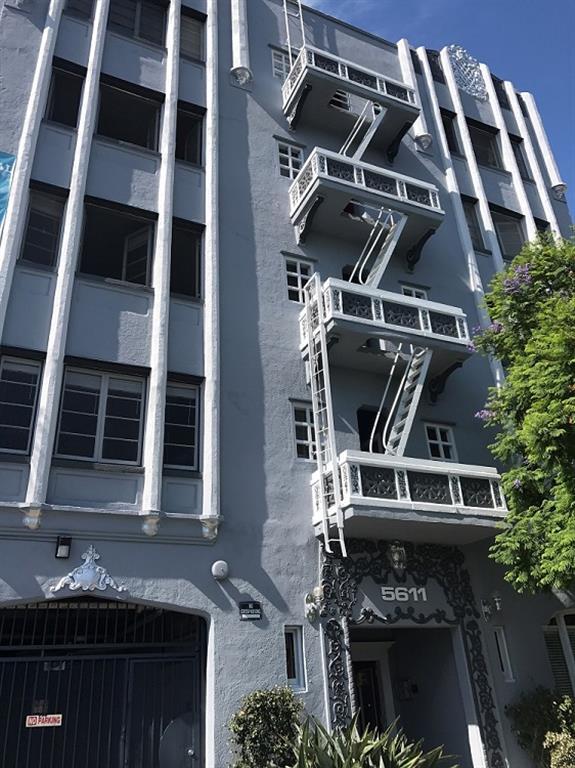
5611 Carlton Way, Los Angeles, CA 90028


Property Detail
5611 Carlton Way
5544-026-012
IRVING PARK LOT 15
Multifamilydwelling
Los Angeles
LAR4
California
B and X Area of moderate flood hazard, usually the area between the limits of the 100-year and 500-year floods.
15
2024
0.20 AC
2025
Hollywood
190510
Los Angeles
22,520 SF
Los Angeles-Long Beach-Glendale, CA
NEARBY LISTINGS FOR SALE OR LEASE
DEMOGRAPHICS near 5611 Carlton Way
1 mile
3 mile
5 mile
2025 Total Population
67,833
372,985
1,001,569
2030 Population
68,359
374,378
1,001,926
Pop Growth 2025-2030
+ 0.78%
+ 0.37%
+ 0.04%
Average Age
41
40
40
2025 Total Households
32,579
175,570
442,784
HH Growth 2025-2030
+ 0.74%
+ 0.21%
(0.03%)
Median Household Inc
$60,464
$72,464
$73,733
Avg Household Size
1.90
2.00
2.20
2025 Avg HH Vehicles
1.00
1.00
1.00
Median Home Value
$1,095,277
$1,091,459
$1,068,747
Median Year Built
1963
1962
1963
Nearby Places
Map Layers
Map Styles
 Street
 Aerial
Transit
 Traffic
 Biking
Places
Listings with unknown addresses are not visible on the map
- Restaurants
- Banks
- Shops
- Fitness
- Groceries
PUBLIC TRANSPORTATION
TRANSIT/SUBWAY
Hollywood/Western Station (Red Line - Los Angeles County Metropolitan Transportation Authority (Metro))
Drive
Walk
Distance
Hollywood/Western Station (Red Line - Los Angeles County Metropolitan Transportation Authority (Metro))
0 min
4 min
0.2 mi
Hollywood/Vine Station (Red Line - Los Angeles County Metropolitan Transportation Authority (Metro))
Drive
Walk
Distance
Hollywood/Vine Station (Red Line - Los Angeles County Metropolitan Transportation Authority (Metro))
2 min
17 min
0.9 mi
COMMUTER RAIL
Glendale (Antelope Valley Line - Southern California Regional Rail Authority (Metrolink), Ventura County Line - Southern California Regional Rail Authority (Metrolink))
Drive
Walk
Distance
Glendale (Antelope Valley Line - Southern California Regional Rail Authority (Metrolink), Ventura County Line - Southern California Regional Rail Authority (Metrolink))
8 min
4.5 mi
Los Angeles (Coast Starlight - Amtrak, Pacific Surfliner - Amtrak, Southwest Chief - Amtrak, Texas Eagle - Amtrak)
Drive
Walk
Distance
Los Angeles (Coast Starlight - Amtrak, Pacific Surfliner - Amtrak, Southwest Chief - Amtrak, Texas Eagle - Amtrak)
10 min
6.0 mi
AIRPORT
Bob Hope
Drive
Walk
Distance
Bob Hope
16 min
9.3 mi
Los Angeles International
Drive
Walk
Distance
Los Angeles International
27 min
14.4 mi
Long Beach (Daugherty Field)
Drive
Walk
Distance
Long Beach (Daugherty Field)
38 min
28.5 mi
Freight Ports
Port of Long Beach
Drive
Walk
Distance
Port of Long Beach
41 min
30.0 mi
Nearby Properties
Address
Land Use
TOTAL SIZE
Lot Size
Zoning
Address
Land Use
TOTAL SIZE
Lot Size
Zoning
930,249 SF
7.39 AC
LAC2
Address
Land Use
TOTAL SIZE
Lot Size
Zoning
709,584 SF
1.80 AC
LAPB
Address
Land Use
TOTAL SIZE
Lot Size
Zoning
161,046 SF
6.88 AC
LAM1
Address
Land Use
TOTAL SIZE
Lot Size
Zoning
67,126 SF
48.09 AC
LAM1
Address
Land Use
TOTAL SIZE
Lot Size
Zoning
497,377 SF
3.29 AC
LAC4
Address
Land Use
TOTAL SIZE
Lot Size
Zoning
724,958 SF
5.88 AC
LAC2
Address
Land Use
TOTAL SIZE
Lot Size
Zoning
520,825 SF
2.13 AC
LAC2
Address
Land Use
TOTAL SIZE
Lot Size
Zoning
289,633 SF
1.55 AC
LAP
Address
Land Use
TOTAL SIZE
Lot Size
Zoning
255,868 SF
9.58 AC
WDC2C*
Address
Land Use
TOTAL SIZE
Lot Size
Zoning
556,235 SF
4.22 AC
LAC4
Address
Land Use
TOTAL SIZE
Lot Size
Zoning
406,948 SF
8.04 AC
LAC2
Address
Land Use
TOTAL SIZE
Lot Size
Zoning
341,221 SF
1.84 AC
LAC4
Address
Land Use
TOTAL SIZE
Lot Size
Zoning
490,689 SF
3.60 AC
LAM1
Address
Land Use
TOTAL SIZE
Lot Size
Zoning
256,032 SF
4.69 AC
LAC4
Address
Land Use
TOTAL SIZE
Lot Size
Zoning
366,349 SF
2.98 AC
WDC2C*
Address
Land Use
TOTAL SIZE
Lot Size
Zoning
216,433 SF
1.38 AC
LAR5
Address
Land Use
TOTAL SIZE
Lot Size
Zoning
320,944 SF
1.97 AC
LAC4
Address
Land Use
TOTAL SIZE
Lot Size
Zoning
264,720 SF
4.69 AC
LAC4
Address
Land Use
TOTAL SIZE
Lot Size
Zoning
310,063 SF
2.22 AC
LAC2
Address
Land Use
TOTAL SIZE
Lot Size
Zoning
93,785 SF
3.95 AC
LAR5
Address
Land Use
TOTAL SIZE
Lot Size
Zoning
347,880 SF
0.41 AC
LAC4
Address
Land Use
TOTAL SIZE
Lot Size
Zoning
292,714 SF
1.90 AC
LAR5
Address
Land Use
TOTAL SIZE
Lot Size
Zoning
347,123 SF
1.66 AC
Address
Land Use
TOTAL SIZE
Lot Size
Zoning
306,924 SF
2.11 AC
LAC4
Address
Land Use
TOTAL SIZE
Lot Size
Zoning
261,945 SF
1.24 AC
LAC4
Address
Land Use
TOTAL SIZE
Lot Size
Zoning
251,159 SF
2.84 AC
LAPB
Address
Land Use
TOTAL SIZE
Lot Size
Zoning
529,791 SF
8.43 AC
LAR4
Address
Land Use
TOTAL SIZE
Lot Size
Zoning
247,587 SF
2.10 AC
LAC4
Address
Land Use
TOTAL SIZE
Lot Size
Zoning
224,569 SF
1.62 AC
LARAS4
Address
Land Use
TOTAL SIZE
Lot Size
Zoning
221,785 SF
1.67 AC
LAR3
The World's #1 Commercial Real Estate Marketplace
Connect with us
© 2026 CoStar Group
The information above has been obtained from sources believed reliable. While we do not doubt its accuracy we have not verified it and make no guarantee, warranty or representation about it. It is your responsibility to independently confirm its accuracy and completeness. Any projections, opinions, assumptions, or estimates used are for example only and do not represent the current or future performance of the property. The value of this transaction to you depends on tax and other factors which should be evaluated by your tax, financial, and legal advisors. You and your advisors should conduct a careful, independent investigation of the property to determine to your satisfaction the suitability of the property for your needs.