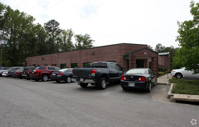
Property Record
700 Caldwell Trce, Birmingham, AL 35242


Property Detail
700 Caldwell Trce
Birmingham, AL
SEC/TWNSHP/RAN 15 19S 02W GBS DEVELOPMENT CO LLC RECORD PLAT MB 27 PAGE 13 NBRHD: 13 (JOE) HOOVER COMMERCIAL R-2
10-5-15-0-001-054-003
Shelby
Officebuilding
Alabama
B and X Area of moderate flood hazard, usually the area between the limits of the 100-year and 500-year floods.
3a
2025
3.01 AC
2025
Hwy 280/Shelby County
030305
Birmingham
11,443 SF
NEARBY LISTINGS FOR SALE OR LEASE
-
-
View all Birmingham listings for sale on LoopNet.com
DEMOGRAPHICS near 700 Caldwell Trce
1 mile
3 mile
5 mile
2025 Total Population
3,069
31,332
101,783
2030 Population
3,159
31,605
102,104
Pop Growth 2025-2030
+ 2.93%
+ 0.87%
+ 0.32%
Average Age
44
42
40
2025 Total Households
1,057
12,523
43,384
HH Growth 2025-2030
+ 3.03%
+ 0.59%
+ 0.08%
Median Household Inc
$129,076
$105,657
$89,027
Avg Household Size
2.80
2.40
2.30
2025 Avg HH Vehicles
2.00
2.00
2.00
Median Home Value
$446,575
$394,457
$407,911
Median Year Built
1983
1987
1988
Nearby Places
Map Layers
Map Styles
 Street
 Aerial
Layers
 Traffic
 Biking
Places
Listings with unknown addresses are not visible on the map
- Restaurants
- Banks
- Shops
- Fitness
- Groceries
PUBLIC TRANSPORTATION
AIRPORT
Birmingham-Shuttlesworth International
Drive
Walk
Distance
Birmingham-Shuttlesworth International
29 min
16.1 mi
Freight Ports
Port of Mobile
Drive
Walk
Distance
Port of Mobile
271 min
246.8 mi
Nearby Properties
Address
Land Use
TOTAL SIZE
Lot Size
Zoning
Address
Land Use
TOTAL SIZE
Lot Size
Zoning
347,636 SF
136.83 AC
Address
Land Use
TOTAL SIZE
Lot Size
Zoning
267,122 SF
26 AC
PC
Address
Land Use
TOTAL SIZE
Lot Size
Zoning
11,492 SF
21.30 AC
Address
Land Use
TOTAL SIZE
Lot Size
Zoning
16,385 SF
4.95 AC
Address
Land Use
TOTAL SIZE
Lot Size
Zoning
294,855 SF
30 AC
R4
Address
Land Use
TOTAL SIZE
Lot Size
Zoning
229,194 SF
39.55 AC
Address
Land Use
TOTAL SIZE
Lot Size
Zoning
446,170 SF
19 AC
PR2
Address
Land Use
TOTAL SIZE
Lot Size
Zoning
114,557 SF
42 AC
Address
Land Use
TOTAL SIZE
Lot Size
Zoning
102,342 SF
11 AC
Address
Land Use
TOTAL SIZE
Lot Size
Zoning
7,861 SF
29 AC
Address
Land Use
TOTAL SIZE
Lot Size
Zoning
188,040 SF
28 AC
Address
Land Use
TOTAL SIZE
Lot Size
Zoning
7,280 SF
35 AC
Address
Land Use
TOTAL SIZE
Lot Size
Zoning
134,434 SF
10.14 AC
Address
Land Use
TOTAL SIZE
Lot Size
Zoning
243,359 SF
16 AC
Address
Land Use
TOTAL SIZE
Lot Size
Zoning
1,148 SF
23 AC
Address
Land Use
TOTAL SIZE
Lot Size
Zoning
182,702 SF
15 AC
R4
Address
Land Use
TOTAL SIZE
Lot Size
Zoning
76,816 SF
5 AC
PO
Address
Land Use
TOTAL SIZE
Lot Size
Zoning
77,616 SF
8 AC
C-1
Address
Land Use
TOTAL SIZE
Lot Size
Zoning
14,965 SF
17.44 AC
Address
Land Use
TOTAL SIZE
Lot Size
Zoning
9,534 SF
22 AC
Address
Land Use
TOTAL SIZE
Lot Size
Zoning
29,535 SF
29 AC
Address
Land Use
TOTAL SIZE
Lot Size
Zoning
54,541 SF
5 AC
PO
Address
Land Use
TOTAL SIZE
Lot Size
Zoning
1 SF
15 AC
Address
Land Use
TOTAL SIZE
Lot Size
Zoning
19,374 SF
15 AC
Address
Land Use
TOTAL SIZE
Lot Size
Zoning
Address
Land Use
TOTAL SIZE
Lot Size
Zoning
32,373 SF
7.42 AC
Address
Land Use
TOTAL SIZE
Lot Size
Zoning
184,522 SF
21 AC
R4
Address
Land Use
TOTAL SIZE
Lot Size
Zoning
84,800 SF
14 AC
I1
Address
Land Use
TOTAL SIZE
Lot Size
Zoning
179,004 SF
23 AC
R4
Address
Land Use
TOTAL SIZE
Lot Size
Zoning
126,612 SF
6.48 AC
The World's #1 Commercial Real Estate Marketplace
Connect with us
© 2026 CoStar Group
The information above has been obtained from sources believed reliable. While we do not doubt its accuracy we have not verified it and make no guarantee, warranty or representation about it. It is your responsibility to independently confirm its accuracy and completeness. Any projections, opinions, assumptions, or estimates used are for example only and do not represent the current or future performance of the property. The value of this transaction to you depends on tax and other factors which should be evaluated by your tax, financial, and legal advisors. You and your advisors should conduct a careful, independent investigation of the property to determine to your satisfaction the suitability of the property for your needs.