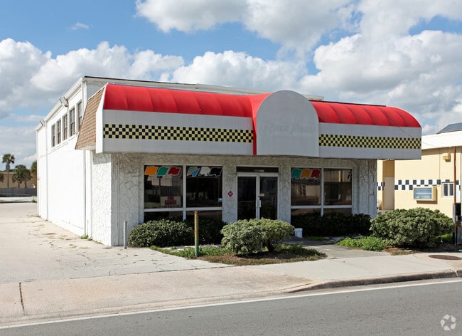
Property Record
2122 S Atlantic Ave, Daytona Beach, FL 32118


Property Detail
2122 S Atlantic Ave
Deltona-Daytona Beach-Ormond Beach, FL
LOT 9 PENNLANTIC SUB MB 11 PG 123 EXC N 50 FT OF W 100 FT & EXC N 109.91 FT OF S 134.37 FT MEAS ON W/L OF W 128.32 FT MEAS ON N/L PER OR 45 PG 262 & EXC TRI IN NE CORNER BEING E 42.72 FT ON N/L & 45 FT ON W/L & INC N 200 FT OF S 1190 FT OF BLOCK 3 CO
5315-02-03-0011
Volusia
Commercialacreage
Florida
B and X Area of moderate flood hazard, usually the area between the limits of the 100-year and 500-year floods.
9
2025
0.14 AC
2026
Coastal Daytona Beach
081300
Deltona/Daytona Beach
5,670 SF
NEARBY LISTINGS FOR SALE OR LEASE
DEMOGRAPHICS near 2122 S Atlantic Ave
1 mile
3 mile
5 mile
2025 Total Population
4,438
48,805
120,091
2030 Population
4,922
52,928
129,914
Pop Growth 2025-2030
+ 10.91%
+ 8.45%
+ 8.18%
Average Age
51
45
44
2025 Total Households
2,322
22,567
54,114
HH Growth 2025-2030
+ 10.94%
+ 8.54%
+ 8.37%
Median Household Inc
$54,388
$48,514
$52,308
Avg Household Size
1.90
2.00
2.00
2025 Avg HH Vehicles
1.00
1.00
1.00
Median Home Value
$489,582
$300,752
$272,673
Median Year Built
1978
1974
1977
Nearby Places
Map Layers
Map Styles
 Street
 Aerial
Transit
 Traffic
 Biking
Places
Listings with unknown addresses are not visible on the map
- Restaurants
- Banks
- Shops
- Fitness
- Groceries
PUBLIC TRANSPORTATION
AIRPORT
Daytona Beach International
Drive
Walk
Distance
Daytona Beach International
16 min
7.1 mi
Freight Ports
Port Canaveral
Drive
Walk
Distance
Port Canaveral
90 min
72.5 mi
Nearby Properties
Address
Land Use
TOTAL SIZE
Lot Size
Zoning
Address
Land Use
TOTAL SIZE
Lot Size
Zoning
664,082 SF
38.16 AC
02BA
Address
Land Use
TOTAL SIZE
Lot Size
Zoning
880,289 SF
4.98 AC
02T3
Address
Land Use
TOTAL SIZE
Lot Size
Zoning
Address
Land Use
TOTAL SIZE
Lot Size
Zoning
542,849 SF
1.56 AC
02T1
Address
Land Use
TOTAL SIZE
Lot Size
Zoning
472,750 SF
16.76 AC
Address
Land Use
TOTAL SIZE
Lot Size
Zoning
223,127 SF
14.47 AC
Address
Land Use
TOTAL SIZE
Lot Size
Zoning
Address
Land Use
TOTAL SIZE
Lot Size
Zoning
300,038 SF
0.22 AC
Address
Land Use
TOTAL SIZE
Lot Size
Zoning
226,459 SF
0.57 AC
Address
Land Use
TOTAL SIZE
Lot Size
Zoning
269,133 SF
6.33 AC
Address
Land Use
TOTAL SIZE
Lot Size
Zoning
5,774 SF
0.94 AC
B4
Address
Land Use
TOTAL SIZE
Lot Size
Zoning
155,620 SF
1.81 AC
02T1
Address
Land Use
TOTAL SIZE
Lot Size
Zoning
105,866 SF
5.14 AC
Address
Land Use
TOTAL SIZE
Lot Size
Zoning
146,732 SF
2.12 AC
02T1
Address
Land Use
TOTAL SIZE
Lot Size
Zoning
460,245 SF
2.92 AC
Address
Land Use
TOTAL SIZE
Lot Size
Zoning
209,027 SF
1.37 AC
03T
Address
Land Use
TOTAL SIZE
Lot Size
Zoning
324,364 SF
11.59 AC
02RPUD
Address
Land Use
TOTAL SIZE
Lot Size
Zoning
146,580 SF
2.80 AC
02R3
Address
Land Use
TOTAL SIZE
Lot Size
Zoning
185,175 SF
7.50 AC
Address
Land Use
TOTAL SIZE
Lot Size
Zoning
116,858 SF
5.45 AC
Address
Land Use
TOTAL SIZE
Lot Size
Zoning
195,700 SF
2.61 AC
02BR1
Address
Land Use
TOTAL SIZE
Lot Size
Zoning
191,450 SF
27.21 AC
02R3
Address
Land Use
TOTAL SIZE
Lot Size
Zoning
339,961 SF
6.02 AC
Address
Land Use
TOTAL SIZE
Lot Size
Zoning
87,317 SF
5.84 AC
Address
Land Use
TOTAL SIZE
Lot Size
Zoning
131,376 SF
1.88 AC
03T
Address
Land Use
TOTAL SIZE
Lot Size
Zoning
268,938 SF
0.52 AC
Address
Land Use
TOTAL SIZE
Lot Size
Zoning
154,753 SF
14.66 AC
Address
Land Use
TOTAL SIZE
Lot Size
Zoning
Address
Land Use
TOTAL SIZE
Lot Size
Zoning
327,223 SF
21.66 AC
Address
Land Use
TOTAL SIZE
Lot Size
Zoning
104,591 SF
3.26 AC
02BR1
The World's #1 Commercial Real Estate Marketplace
Connect with us
© 2026 CoStar Group
The information above has been obtained from sources believed reliable. While we do not doubt its accuracy we have not verified it and make no guarantee, warranty or representation about it. It is your responsibility to independently confirm its accuracy and completeness. Any projections, opinions, assumptions, or estimates used are for example only and do not represent the current or future performance of the property. The value of this transaction to you depends on tax and other factors which should be evaluated by your tax, financial, and legal advisors. You and your advisors should conduct a careful, independent investigation of the property to determine to your satisfaction the suitability of the property for your needs.