Property Record
620 Valley Forge Rd, Hillsborough, NC 27278
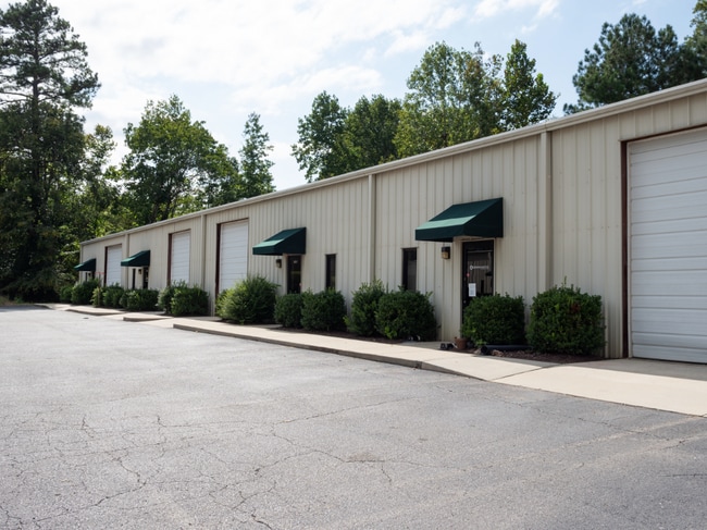


Property Detail
620 Valley Forge Rd
9874421227
5B CORNERSTONE P74/127
Industrialgeneral
Orange
HI
North Carolina
AE The base floodplain where base flood elevations are provided. AE Zones are now used on new format FIRMs instead of A1-A30 Zones.
2.91 AC
2025
Orange County
2025
Raleigh/Durham
011002
Durham-Chapel Hill, NC
10,850 SF
NEARBY LISTINGS FOR SALE OR LEASE
DEMOGRAPHICS near 620 Valley Forge Rd
1 mile
3 mile
5 mile
2025 Total Population
2,530
19,804
27,111
2030 Population
2,605
20,308
27,810
Pop Growth 2025-2030
+ 2.96%
+ 2.54%
+ 2.58%
Average Age
43
42
42
2025 Total Households
990
7,879
10,714
HH Growth 2025-2030
+ 3.33%
+ 2.83%
+ 2.85%
Median Household Inc
$118,786
$92,031
$98,054
Avg Household Size
2.30
2.40
2.40
2025 Avg HH Vehicles
2.00
2.00
2.00
Median Home Value
$525,915
$431,498
$431,947
Median Year Built
2000
1988
1988
Nearby Places
Map Layers
Map Styles
 Street
 Aerial
Transit
 Traffic
 Biking
Places
Listings with unknown addresses are not visible on the map
- Restaurants
- Banks
- Shops
- Fitness
- Groceries
PUBLIC TRANSPORTATION
AIRPORT
Raleigh-Durham International
Drive
Walk
Distance
Raleigh-Durham International
36 min
26.3 mi
Freight Ports
Virginia Port Authority - Richmond
Drive
Walk
Distance
Virginia Port Authority - Richmond
179 min
156.8 mi
SALE & LEASE HISTORY
LISTING DATE
SALE/LEASE

Jun 28, 2021
For Lease
Dec 02, 2025
For Lease
Nearby Properties
Address
Land Use
TOTAL SIZE
Lot Size
Zoning
Address
Land Use
TOTAL SIZE
Lot Size
Zoning
113,000 SF
57.70 AC
Address
Land Use
TOTAL SIZE
Lot Size
Zoning
189,774 SF
69.58 AC
Address
Land Use
TOTAL SIZE
Lot Size
Zoning
22,620 SF
21.26 AC
Address
Land Use
TOTAL SIZE
Lot Size
Zoning
27,606 SF
24.07 AC
Address
Land Use
TOTAL SIZE
Lot Size
Zoning
8,080 SF
21.81 AC
HI
Address
Land Use
TOTAL SIZE
Lot Size
Zoning
96,483 SF
33.67 AC
R1RB
Address
Land Use
TOTAL SIZE
Lot Size
Zoning
39,139 SF
34.34 AC
Address
Land Use
TOTAL SIZE
Lot Size
Zoning
32,868 SF
15.84 AC
HI
Address
Land Use
TOTAL SIZE
Lot Size
Zoning
182,655 SF
22.42 AC
HI
Address
Land Use
TOTAL SIZE
Lot Size
Zoning
61,329 SF
9.85 AC
Address
Land Use
TOTAL SIZE
Lot Size
Zoning
40,223 SF
20 AC
HI
Address
Land Use
TOTAL SIZE
Lot Size
Zoning
Address
Land Use
TOTAL SIZE
Lot Size
Zoning
12,150 SF
36.17 AC
HI
Address
Land Use
TOTAL SIZE
Lot Size
Zoning
2,745 SF
52.71 AC
Address
Land Use
TOTAL SIZE
Lot Size
Zoning
58,370 SF
7.04 AC
Address
Land Use
TOTAL SIZE
Lot Size
Zoning
144,303 SF
17.41 AC
Address
Land Use
TOTAL SIZE
Lot Size
Zoning
82,008 SF
16.20 AC
HIR1
Address
Land Use
TOTAL SIZE
Lot Size
Zoning
56,146 SF
11.92 AC
Address
Land Use
TOTAL SIZE
Lot Size
Zoning
74,820 SF
20 AC
R1
Address
Land Use
TOTAL SIZE
Lot Size
Zoning
43,401 SF
10.02 AC
HI
Address
Land Use
TOTAL SIZE
Lot Size
Zoning
40,236 SF
1.05 AC
HI
Address
Land Use
TOTAL SIZE
Lot Size
Zoning
56,100 SF
11.93 AC
Address
Land Use
TOTAL SIZE
Lot Size
Zoning
34,175 SF
33.02 AC
Address
Land Use
TOTAL SIZE
Lot Size
Zoning
39,200 SF
17.68 AC
HI
Address
Land Use
TOTAL SIZE
Lot Size
Zoning
104,769 SF
12.92 AC
HIR1
Address
Land Use
TOTAL SIZE
Lot Size
Zoning
66,920 SF
5.69 AC
Address
Land Use
TOTAL SIZE
Lot Size
Zoning
38,810 SF
11.25 AC
Address
Land Use
TOTAL SIZE
Lot Size
Zoning
86,400 SF
10.15 AC
HI
Address
Land Use
TOTAL SIZE
Lot Size
Zoning
24,828 SF
2.91 AC
The World's #1 Commercial Real Estate Marketplace
Connect with us
© 2026 CoStar Group
The information above has been obtained from sources believed reliable. While we do not doubt its accuracy we have not verified it and make no guarantee, warranty or representation about it. It is your responsibility to independently confirm its accuracy and completeness. Any projections, opinions, assumptions, or estimates used are for example only and do not represent the current or future performance of the property. The value of this transaction to you depends on tax and other factors which should be evaluated by your tax, financial, and legal advisors. You and your advisors should conduct a careful, independent investigation of the property to determine to your satisfaction the suitability of the property for your needs.