Property Record
2105 Morrill Ave, San Jose, CA 95132


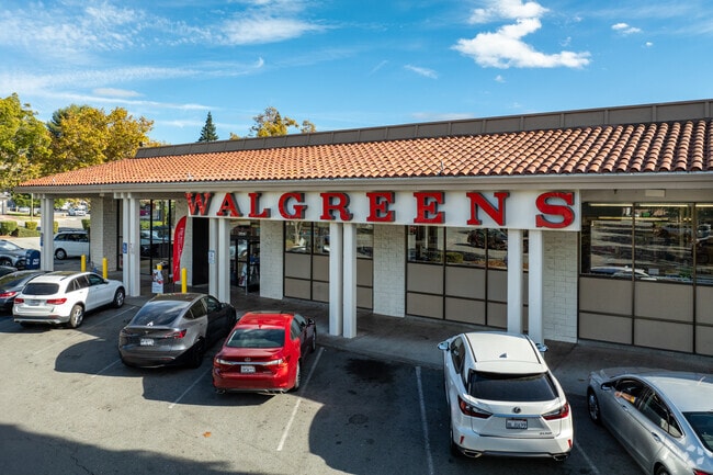
Property Detail
2105 Morrill Ave
092-09-012
LOT 1 RECORDER'S BOOK 279 PAGE 49
Regionalshoppingcenterormallwithanchorstore
Santa Clara
CG
California
B and X Area of moderate flood hazard, usually the area between the limits of the 100-year and 500-year floods.
3.30 AC
2024
San Jose-Berryessa
2025
South Bay/San Jose
504410
San Jose-Sunnyvale-Santa Clara, CA
37,712 SF
NEARBY LISTINGS FOR SALE OR LEASE
DEMOGRAPHICS near 2105 Morrill Ave
1 mile
3 mile
5 mile
2024 Total Population
30,769
164,303
348,917
2029 Population
31,580
168,069
355,205
Pop Growth 2024-2029
+ 2.64%
+ 2.29%
+ 1.80%
Average Age
39
40
39
2024 Total Households
9,386
51,163
111,823
HH Growth 2024-2029
+ 2.88%
+ 2.43%
+ 1.92%
Median Household Inc
$179,242
$180,328
$158,133
Avg Household Size
3.20
3.10
3.00
2024 Avg HH Vehicles
2.00
2.00
2.00
Median Home Value
$1,106,882
$1,095,056
$1,070,031
Median Year Built
1977
1983
1983
Nearby Places
Map Layers
Map Styles
 Street
 Aerial
Transit
 Traffic
 Biking
Places
Listings with unknown addresses are not visible on the map
- Restaurants
- Banks
- Shops
- Fitness
- Groceries
PUBLIC TRANSPORTATION
COMMUTER RAIL
Great America-Santa Clara (ACE Train - Capitol Corridor Joint Powers Authority, Capitol Corridor - Capitol Corridor Joint Powers Authority)
Drive
Walk
Distance
Great America-Santa Clara (ACE Train - Capitol Corridor Joint Powers Authority, Capitol Corridor - Capitol Corridor Joint Powers Authority)
13 min
6.1 mi
Santa Clara Caltrain Station Northbound (Limited - Caltrain (Caltrain), Local Weekday - Caltrain (Caltrain), Local Weekend - Caltrain (Caltrain))
Drive
Walk
Distance
Santa Clara Caltrain Station Northbound (Limited - Caltrain (Caltrain), Local Weekday - Caltrain (Caltrain), Local Weekend - Caltrain (Caltrain))
14 min
8.5 mi
AIRPORT
Norman Y Mineta San Jose International
Drive
Walk
Distance
Norman Y Mineta San Jose International
13 min
6.7 mi
Metro Oakland International
Drive
Walk
Distance
Metro Oakland International
42 min
32.5 mi
Freight Ports
Port of Redwood City
Drive
Walk
Distance
Port of Redwood City
33 min
23.3 mi
Nearby Properties
Address
Land Use
TOTAL SIZE
Lot Size
Zoning
Address
Land Use
TOTAL SIZE
Lot Size
Zoning
7.49 AC
M2
Address
Land Use
TOTAL SIZE
Lot Size
Zoning
194,597 SF
20.10 AC
I
Address
Land Use
TOTAL SIZE
Lot Size
Zoning
74,528 SF
9.26 AC
TEC
Address
Land Use
TOTAL SIZE
Lot Size
Zoning
1,282,514 SF
99.02 AC
C2-S
Address
Land Use
TOTAL SIZE
Lot Size
Zoning
556,649 SF
8.09 AC
IP
Address
Land Use
TOTAL SIZE
Lot Size
Zoning
503,840 SF
5.02 AC
MXD2
Address
Land Use
TOTAL SIZE
Lot Size
Zoning
328,189 SF
4.01 AC
R3
Address
Land Use
TOTAL SIZE
Lot Size
Zoning
3.72 AC
M2S
Address
Land Use
TOTAL SIZE
Lot Size
Zoning
5.21 AC
APD
Address
Land Use
TOTAL SIZE
Lot Size
Zoning
505,150 SF
35.68 AC
CIC
Address
Land Use
TOTAL SIZE
Lot Size
Zoning
362,780 SF
7.58 AC
APD
Address
Land Use
TOTAL SIZE
Lot Size
Zoning
316,904 SF
5.08 AC
APD
Address
Land Use
TOTAL SIZE
Lot Size
Zoning
4.56 AC
M2
Address
Land Use
TOTAL SIZE
Lot Size
Zoning
366,149 SF
2.98 AC
R3
Address
Land Use
TOTAL SIZE
Lot Size
Zoning
3.74 AC
APD
Address
Land Use
TOTAL SIZE
Lot Size
Zoning
143,242 SF
28.95 AC
C
Address
Land Use
TOTAL SIZE
Lot Size
Zoning
561,256 SF
36.49 AC
MP
Address
Land Use
TOTAL SIZE
Lot Size
Zoning
34.20 AC
MP
Address
Land Use
TOTAL SIZE
Lot Size
Zoning
2.55 AC
MXD2
Address
Land Use
TOTAL SIZE
Lot Size
Zoning
136,602 SF
9 AC
IP
Address
Land Use
TOTAL SIZE
Lot Size
Zoning
300,964 SF
3.92 AC
A(PD)
Address
Land Use
TOTAL SIZE
Lot Size
Zoning
6.04 AC
R5-S
Address
Land Use
TOTAL SIZE
Lot Size
Zoning
239,340 SF
2.32 AC
M2
Address
Land Use
TOTAL SIZE
Lot Size
Zoning
270,526 SF
2.29 AC
MXD2
Address
Land Use
TOTAL SIZE
Lot Size
Zoning
192,026 SF
12.64 AC
IP
Address
Land Use
TOTAL SIZE
Lot Size
Zoning
2.78 AC
APD
Address
Land Use
TOTAL SIZE
Lot Size
Zoning
215,963 SF
2.82 AC
A(PD)
Address
Land Use
TOTAL SIZE
Lot Size
Zoning
3.34 AC
M2
Address
Land Use
TOTAL SIZE
Lot Size
Zoning
224,667 SF
14.70 AC
I
Address
Land Use
TOTAL SIZE
Lot Size
Zoning
224,036 SF
14.66 AC
I
The World's #1 Commercial Real Estate Marketplace
Connect with us
© 2026 CoStar Group
The information above has been obtained from sources believed reliable. While we do not doubt its accuracy we have not verified it and make no guarantee, warranty or representation about it. It is your responsibility to independently confirm its accuracy and completeness. Any projections, opinions, assumptions, or estimates used are for example only and do not represent the current or future performance of the property. The value of this transaction to you depends on tax and other factors which should be evaluated by your tax, financial, and legal advisors. You and your advisors should conduct a careful, independent investigation of the property to determine to your satisfaction the suitability of the property for your needs.