Property Record
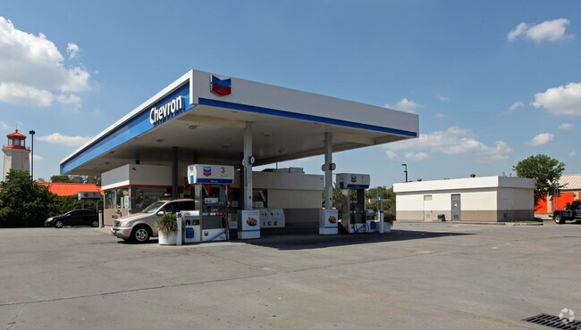
14647 Woodforest Blvd, Houston, TX 77015


NEARBY LISTINGS FOR SALE OR LEASE
Property Detail
14647 Woodforest Blvd
0450080000135
Abst 704 S Singleton
Servicestation
TR 9F-1 ABST 704 S SINGLETON
X
Harris
48201C0720M
Texas
2024
0.78 AC
2025
Pasadena/Galena Park
233003
Houston
1,552 SF
Houston-Pasadena-The Woodlands, TX
DEMOGRAPHICS near 14647 Woodforest Blvd
1 Mile
3 Mile
5 Mile
2024 Total Population
22,807
101,635
151,531
2029 Population
23,066
102,943
154,259
Pop Growth 2024-2029
+ 1.14%
+ 1.29%
+ 1.80%
Average Age
34
34
34
2024 Total Households
6,625
31,228
46,169
HH Growth 2024-2029
+ 1.06%
+ 1.22%
+ 1.74%
Median Household Inc
$57,536
$56,764
$54,868
Avg Household Size
3.30
3.20
3.20
2024 Avg HH Vehicles
2.00
2.00
2.00
Median Home Value
$147,897
$157,071
$152,039
Median Year Built
1980
1984
1984
Nearby Places
Map Layers
Map Styles
 Street
 Aerial
- Restaurants
- Banks
- Shops
- Fitness
- Groceries
PUBLIC TRANSPORTATION
AIRPORT
William P Hobby
DRIVE
WALK
Distance
William P Hobby
34 min
20.0 mi
George Bush Intcntl/Houston
DRIVE
WALK
Distance
George Bush Intcntl/Houston
26 min
21.4 mi
Freight Ports
Port of Houston
DRIVE
WALK
Distance
Port of Houston
21 min
11.8 mi
Nearby Properties
Address
Land Use
TOTAL SIZE
Lot Size
Zoning
Address
Land Use
TOTAL SIZE
Lot Size
Zoning
10,093,711 SF
30.83 AC
Address
Land Use
TOTAL SIZE
Lot Size
Zoning
1,403,952 SF
48.81 AC
Address
Land Use
TOTAL SIZE
Lot Size
Zoning
337,331 SF
56.09 AC
Address
Land Use
TOTAL SIZE
Lot Size
Zoning
699,448 SF
46.40 AC
Address
Land Use
TOTAL SIZE
Lot Size
Zoning
760,851 SF
41.87 AC
Address
Land Use
TOTAL SIZE
Lot Size
Zoning
671,363 SF
61.27 AC
Address
Land Use
TOTAL SIZE
Lot Size
Zoning
331,284 SF
15.15 AC
Address
Land Use
TOTAL SIZE
Lot Size
Zoning
30.84 AC
Address
Land Use
TOTAL SIZE
Lot Size
Zoning
398,995 SF
27.39 AC
Address
Land Use
TOTAL SIZE
Lot Size
Zoning
271,428 SF
10.57 AC
Address
Land Use
TOTAL SIZE
Lot Size
Zoning
225,124 SF
10.20 AC
Address
Land Use
TOTAL SIZE
Lot Size
Zoning
202,544 SF
4.06 AC
Address
Land Use
TOTAL SIZE
Lot Size
Zoning
485,662 SF
48.80 AC
Address
Land Use
TOTAL SIZE
Lot Size
Zoning
248,293 SF
13.20 AC
Address
Land Use
TOTAL SIZE
Lot Size
Zoning
187,726 SF
32.24 AC
Address
Land Use
TOTAL SIZE
Lot Size
Zoning
526,975 SF
21.08 AC
Address
Land Use
TOTAL SIZE
Lot Size
Zoning
195,732 SF
19.50 AC
Address
Land Use
TOTAL SIZE
Lot Size
Zoning
235,624 SF
10.06 AC
Address
Land Use
TOTAL SIZE
Lot Size
Zoning
205,001 SF
16.63 AC
Address
Land Use
TOTAL SIZE
Lot Size
Zoning
208,648 SF
8.99 AC
Address
Land Use
TOTAL SIZE
Lot Size
Zoning
537,768 SF
12.46 AC
Address
Land Use
TOTAL SIZE
Lot Size
Zoning
377,109 SF
17.36 AC
Address
Land Use
TOTAL SIZE
Lot Size
Zoning
197,953 SF
8.29 AC
Address
Land Use
TOTAL SIZE
Lot Size
Zoning
48.81 AC
Address
Land Use
TOTAL SIZE
Lot Size
Zoning
246,277 SF
10.91 AC
Address
Land Use
TOTAL SIZE
Lot Size
Zoning
104,829 SF
26.14 AC
Address
Land Use
TOTAL SIZE
Lot Size
Zoning
174,606 SF
55.34 AC
Address
Land Use
TOTAL SIZE
Lot Size
Zoning
202,747 SF
15.93 AC
Address
Land Use
TOTAL SIZE
Lot Size
Zoning
296,173 SF
16.33 AC
Address
Land Use
TOTAL SIZE
Lot Size
Zoning
90,413 SF
8.42 AC
The World's #1 Commercial Real Estate Marketplace
Connect with us
© 2026 CoStar Group
The information above has been obtained from sources believed reliable. While we do not doubt its accuracy we have not verified it and make no guarantee, warranty or representation about it. It is your responsibility to independently confirm its accuracy and completeness. Any projections, opinions, assumptions, or estimates used are for example only and do not represent the current or future performance of the property. The value of this transaction to you depends on tax and other factors which should be evaluated by your tax, financial, and legal advisors. You and your advisors should conduct a careful, independent investigation of the property to determine to your satisfaction the suitability of the property for your needs.