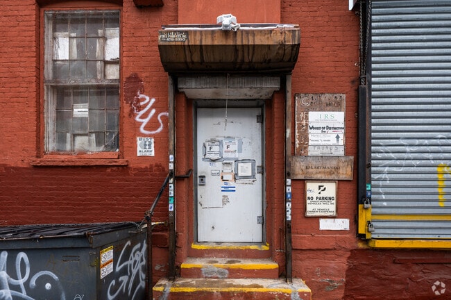
Property Record
301 Walton Ave, Bronx, NY 10451


Property Detail
301 Walton Ave
02344-0075
Bronx
Industrialgeneral
New York
X
75
3604970083F
0.30 AC
2024
Bronx
2025
Westchester/So Connecticut
006301
New York-Jersey City-White Plains, NY-NJ
27,425 SF
NEARBY LISTINGS FOR SALE OR LEASE
DEMOGRAPHICS near 301 Walton Ave
1 mile
3 mile
5 mile
2024 Total Population
170,931
1,204,734
2,632,725
2029 Population
158,798
1,119,363
2,458,232
Pop Growth 2024-2029
(7.10%)
(7.09%)
(6.63%)
Average Age
39
39
40
2024 Total Households
70,056
473,523
1,071,483
HH Growth 2024-2029
(7.55%)
(7.56%)
(6.98%)
Median Household Inc
$36,581
$48,232
$61,248
Avg Household Size
2.30
2.40
2.30
2024 Avg HH Vehicles
.00
.00
.00
Median Home Value
$516,215
$774,753
$754,750
Median Year Built
1961
1953
1953
Nearby Places
Map Layers
Map Styles
 Street
 Aerial
Transit
 Traffic
 Biking
Places
Listings with unknown addresses are not visible on the map
- Restaurants
- Banks
- Shops
- Fitness
- Groceries
PUBLIC TRANSPORTATION
TRANSIT/SUBWAY
138 Street (4 - New York MTA Subway (The Subway), 5 - New York MTA Subway (The Subway))
Drive
Walk
Distance
138 Street (4 - New York MTA Subway (The Subway), 5 - New York MTA Subway (The Subway))
2 min
3 min
0.2 mi
149 Street-Grand Concourse (2 - New York MTA Subway (The Subway), 4 - New York MTA Subway (The Subway), 5 - New York MTA Subway (The Subway))
Drive
Walk
Distance
149 Street-Grand Concourse (2 - New York MTA Subway (The Subway), 4 - New York MTA Subway (The Subway), 5 - New York MTA Subway (The Subway))
1 min
6 min
0.3 mi
3 Avenue-138 Street (6 - New York MTA Subway (The Subway))
Drive
Walk
Distance
3 Avenue-138 Street (6 - New York MTA Subway (The Subway))
3 min
8 min
0.4 mi
145 Street (3 Line) (3 - New York MTA Subway (The Subway))
Drive
Walk
Distance
145 Street (3 Line) (3 - New York MTA Subway (The Subway))
2 min
12 min
0.7 mi
135 Street (2,3 Line) (2 - New York MTA Subway (The Subway), 3 - New York MTA Subway (The Subway))
Drive
Walk
Distance
135 Street (2,3 Line) (2 - New York MTA Subway (The Subway), 3 - New York MTA Subway (The Subway))
2 min
14 min
0.8 mi
COMMUTER RAIL
Yankees-E 153Rd Street Station (Hudson Line - Metro-North Commuter Railroad Company (Metro-North))
Drive
Walk
Distance
Yankees-E 153Rd Street Station (Hudson Line - Metro-North Commuter Railroad Company (Metro-North))
1 min
18 min
0.9 mi
Harlem-125Th Street Station (Harlem Line - Metro-North Commuter Railroad Company (Metro-North), Hudson Line - Metro-North Commuter Railroad Company (Metro-North), New Haven Line - Metro-North Commuter Railroad Company (Metro-North))
Drive
Walk
Distance
Harlem-125Th Street Station (Harlem Line - Metro-North Commuter Railroad Company (Metro-North), Hudson Line - Metro-North Commuter Railroad Company (Metro-North), New Haven Line - Metro-North Commuter Railroad Company (Metro-North))
4 min
20 min
1.1 mi
AIRPORT
LaGuardia
Drive
Walk
Distance
LaGuardia
15 min
7.0 mi
John F Kennedy International
Drive
Walk
Distance
John F Kennedy International
28 min
18.2 mi
Newark Liberty International
Drive
Walk
Distance
Newark Liberty International
27 min
23.3 mi
Freight Ports
NY - Red Hook Container Terminal
Drive
Walk
Distance
NY - Red Hook Container Terminal
27 min
15.1 mi
SALE & LEASE HISTORY
LISTING DATE
SALE/LEASE

Sep 24, 2016
For Lease
Mar 31, 2021
For Sale
Jun 29, 2017
For Lease
Apr 25, 2017
For Sale
Apr 16, 2018
For Sale
Apr 09, 2019
For Lease
Nearby Properties
Address
Land Use
TOTAL SIZE
Lot Size
Zoning
Address
Land Use
TOTAL SIZE
Lot Size
Zoning
5,519,372 SF
409.21 AC
C8-2
Address
Land Use
TOTAL SIZE
Lot Size
Zoning
3,693,539 SF
8.37 AC
R8
Address
Land Use
TOTAL SIZE
Lot Size
Zoning
400,160 SF
10.96 AC
R7-2
Address
Land Use
TOTAL SIZE
Lot Size
Zoning
2,215,000 SF
6.43 AC
R9
Address
Land Use
TOTAL SIZE
Lot Size
Zoning
26.93 AC
R8
Address
Land Use
TOTAL SIZE
Lot Size
Zoning
1,368,870 SF
16.86 AC
R8
Address
Land Use
TOTAL SIZE
Lot Size
Zoning
2,278,432 SF
5.99 AC
R7-2
Address
Land Use
TOTAL SIZE
Lot Size
Zoning
755,000 SF
1.85 AC
R7-2
Address
Land Use
TOTAL SIZE
Lot Size
Zoning
11.92 AC
R7-2
Address
Land Use
TOTAL SIZE
Lot Size
Zoning
11.92 AC
R7-2
Address
Land Use
TOTAL SIZE
Lot Size
Zoning
11.92 AC
R7-2
Address
Land Use
TOTAL SIZE
Lot Size
Zoning
11.92 AC
R7-2
Address
Land Use
TOTAL SIZE
Lot Size
Zoning
11.92 AC
R7-2
Address
Land Use
TOTAL SIZE
Lot Size
Zoning
11.92 AC
R7-2
Address
Land Use
TOTAL SIZE
Lot Size
Zoning
11.92 AC
R7-2
Address
Land Use
TOTAL SIZE
Lot Size
Zoning
11.92 AC
R7-2
Address
Land Use
TOTAL SIZE
Lot Size
Zoning
11.92 AC
R7-2
Address
Land Use
TOTAL SIZE
Lot Size
Zoning
11.92 AC
R7-2
Address
Land Use
TOTAL SIZE
Lot Size
Zoning
11.92 AC
R7-2
Address
Land Use
TOTAL SIZE
Lot Size
Zoning
11.92 AC
R7-2
Address
Land Use
TOTAL SIZE
Lot Size
Zoning
11.92 AC
R7-2
Address
Land Use
TOTAL SIZE
Lot Size
Zoning
11.92 AC
R7-2
Address
Land Use
TOTAL SIZE
Lot Size
Zoning
11.92 AC
R7-2
Address
Land Use
TOTAL SIZE
Lot Size
Zoning
11.92 AC
R7-2
Address
Land Use
TOTAL SIZE
Lot Size
Zoning
11.92 AC
R7-2
Address
Land Use
TOTAL SIZE
Lot Size
Zoning
11.92 AC
R7-2
Address
Land Use
TOTAL SIZE
Lot Size
Zoning
11.92 AC
R7-2
Address
Land Use
TOTAL SIZE
Lot Size
Zoning
11.92 AC
R7-2
Address
Land Use
TOTAL SIZE
Lot Size
Zoning
11.92 AC
R7-2
Address
Land Use
TOTAL SIZE
Lot Size
Zoning
11.92 AC
R7-2
The World's #1 Commercial Real Estate Marketplace
Connect with us
© 2026 CoStar Group
The information above has been obtained from sources believed reliable. While we do not doubt its accuracy we have not verified it and make no guarantee, warranty or representation about it. It is your responsibility to independently confirm its accuracy and completeness. Any projections, opinions, assumptions, or estimates used are for example only and do not represent the current or future performance of the property. The value of this transaction to you depends on tax and other factors which should be evaluated by your tax, financial, and legal advisors. You and your advisors should conduct a careful, independent investigation of the property to determine to your satisfaction the suitability of the property for your needs.