Property Record
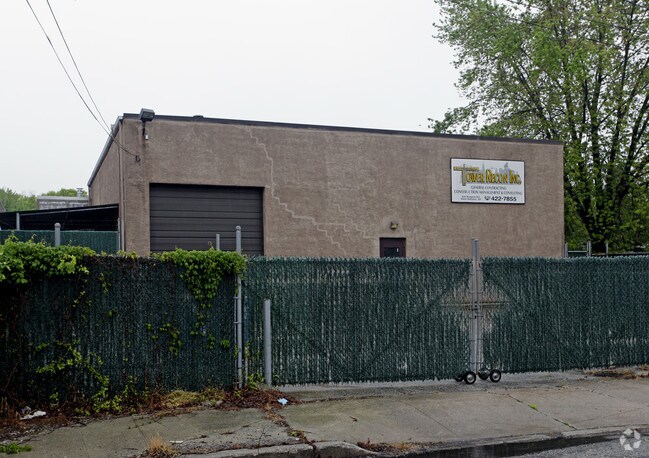
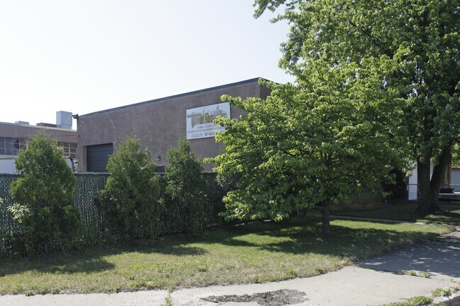
434 Rutgers Rd, West Babylon, NY 11704

Property Detail
434 Rutgers Rd
0100-145-00-05-00-076-001
FILED MAP 183 BLK.26 LTS P/O 6-10 INC
Industrialgeneral
Suffolk
GA
New York
B and X Area of moderate flood hazard, usually the area between the limits of the 100-year and 500-year floods.
76
2024
0.21 AC
2024
Southwest Suffolk
123002
Long Island (New York)
5,616 SF
Nassau County-Suffolk County, NY
NEARBY LISTINGS FOR SALE OR LEASE
DEMOGRAPHICS near 434 Rutgers Rd
1 mile
3 mile
5 mile
2025 Total Population
16,515
139,206
269,484
2030 Population
16,227
136,937
265,084
Pop Growth 2025-2030
(1.74%)
(1.63%)
(1.63%)
Average Age
42
41
41
2025 Total Households
5,584
45,338
86,044
HH Growth 2025-2030
(2.04%)
(1.93%)
(1.86%)
Median Household Inc
$125,568
$131,287
$126,578
Avg Household Size
2.80
2.90
3.00
2025 Avg HH Vehicles
2.00
2.00
2.00
Median Home Value
$581,694
$601,648
$588,238
Median Year Built
1963
1960
1962
Nearby Places
Map Layers
Map Styles
 Street
 Aerial
Transit
 Traffic
 Biking
Places
Listings with unknown addresses are not visible on the map
- Restaurants
- Banks
- Shops
- Fitness
- Groceries
PUBLIC TRANSPORTATION
COMMUTER RAIL
Babylon Station (Babylon Branch - Long Island Rail Road, Montauk Branch - Long Island Rail Road)
Drive
Walk
Distance
Babylon Station (Babylon Branch - Long Island Rail Road, Montauk Branch - Long Island Rail Road)
6 min
2.1 mi
Wyandanch Station (Ronkonkoma Branch - Long Island Rail Road)
Drive
Walk
Distance
Wyandanch Station (Ronkonkoma Branch - Long Island Rail Road)
9 min
4.2 mi
AIRPORT
Long Island MacArthur
Drive
Walk
Distance
Long Island MacArthur
25 min
16.3 mi
John F Kennedy International
Drive
Walk
Distance
John F Kennedy International
39 min
27.5 mi
LaGuardia
Drive
Walk
Distance
LaGuardia
49 min
34.4 mi
Freight Ports
NY - Red Hook Container Terminal
Drive
Walk
Distance
NY - Red Hook Container Terminal
59 min
38.9 mi
Nearby Properties
Address
Land Use
TOTAL SIZE
Lot Size
Zoning
Address
Land Use
TOTAL SIZE
Lot Size
Zoning
48.97 AC
GSC
Address
Land Use
TOTAL SIZE
Lot Size
Zoning
256 SF
24.20 AC
GSC
Address
Land Use
TOTAL SIZE
Lot Size
Zoning
20 AC
A
Address
Land Use
TOTAL SIZE
Lot Size
Zoning
10.07 AC
Address
Land Use
TOTAL SIZE
Lot Size
Zoning
1,400 SF
10.27 AC
BD
Address
Land Use
TOTAL SIZE
Lot Size
Zoning
20.50 AC
B
Address
Land Use
TOTAL SIZE
Lot Size
Zoning
15 AC
A
Address
Land Use
TOTAL SIZE
Lot Size
Zoning
4,290 SF
1.50 AC
VILLA
Address
Land Use
TOTAL SIZE
Lot Size
Zoning
18.70 AC
A
Address
Land Use
TOTAL SIZE
Lot Size
Zoning
6.66 AC
A
Address
Land Use
TOTAL SIZE
Lot Size
Zoning
10.22 AC
IBD
Address
Land Use
TOTAL SIZE
Lot Size
Zoning
14.60 AC
A
Address
Land Use
TOTAL SIZE
Lot Size
Zoning
13.30 AC
A
Address
Land Use
TOTAL SIZE
Lot Size
Zoning
9.70 AC
B
Address
Land Use
TOTAL SIZE
Lot Size
Zoning
19.40 AC
IND1
Address
Land Use
TOTAL SIZE
Lot Size
Zoning
11 AC
B
Address
Land Use
TOTAL SIZE
Lot Size
Zoning
7.50 AC
B
Address
Land Use
TOTAL SIZE
Lot Size
Zoning
5,821 SF
0.65 AC
CR60
Address
Land Use
TOTAL SIZE
Lot Size
Zoning
6.37 AC
BUS1
Address
Land Use
TOTAL SIZE
Lot Size
Zoning
6.37 AC
BUS3
Address
Land Use
TOTAL SIZE
Lot Size
Zoning
1.82 AC
Address
Land Use
TOTAL SIZE
Lot Size
Zoning
1.85 AC
BUS3
Address
Land Use
TOTAL SIZE
Lot Size
Zoning
3.60 AC
BUS1
Address
Land Use
TOTAL SIZE
Lot Size
Zoning
2.40 AC
A
Address
Land Use
TOTAL SIZE
Lot Size
Zoning
14.40 AC
NULL
Address
Land Use
TOTAL SIZE
Lot Size
Zoning
3.04 AC
BUS1
Address
Land Use
TOTAL SIZE
Lot Size
Zoning
3.91 AC
IND1
Address
Land Use
TOTAL SIZE
Lot Size
Zoning
4.06 AC
BUS1
Address
Land Use
TOTAL SIZE
Lot Size
Zoning
5,010 SF
0.30 AC
R10
Address
Land Use
TOTAL SIZE
Lot Size
Zoning
3.01 AC
BUS1
The World's #1 Commercial Real Estate Marketplace
Connect with us
© 2026 CoStar Group
The information above has been obtained from sources believed reliable. While we do not doubt its accuracy we have not verified it and make no guarantee, warranty or representation about it. It is your responsibility to independently confirm its accuracy and completeness. Any projections, opinions, assumptions, or estimates used are for example only and do not represent the current or future performance of the property. The value of this transaction to you depends on tax and other factors which should be evaluated by your tax, financial, and legal advisors. You and your advisors should conduct a careful, independent investigation of the property to determine to your satisfaction the suitability of the property for your needs.