Property Record
376 Dry Bridge Rd, North Kingstown, RI 02852


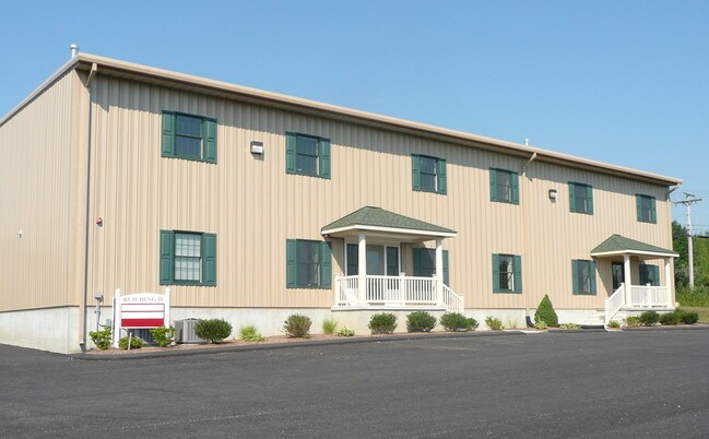
Property Detail
376 Dry Bridge Rd
Industrialcondominium
Washington
LI
Rhode Island
B and X Area of moderate flood hazard, usually the area between the limits of the 100-year and 500-year floods.
Washington County
2025
Providence
2025
Providence-Warwick, RI-MA
050401
NKIN-000079-000000-000165
4,862 SF
NEARBY LISTINGS FOR SALE OR LEASE
-
-
View all North Kingstown listings for lease on LoopNet.com
DEMOGRAPHICS near 376 Dry Bridge Rd
1 mile
3 mile
5 mile
2024 Total Population
743
10,946
32,785
2029 Population
714
10,586
32,102
Pop Growth 2024-2029
(3.90%)
(3.29%)
(2.08%)
Average Age
43
43
40
2024 Total Households
278
4,004
10,686
HH Growth 2024-2029
(4.32%)
(3.70%)
(2.71%)
Median Household Inc
$136,170
$123,955
$116,793
Avg Household Size
2.60
2.60
2.40
2024 Avg HH Vehicles
2.00
2.00
2.00
Median Home Value
$487,499
$614,143
$610,736
Median Year Built
1982
1979
1977
Nearby Places
Map Layers
Map Styles
 Street
 Aerial
Transit
 Traffic
 Biking
Places
Listings with unknown addresses are not visible on the map
- Restaurants
- Banks
- Shops
- Fitness
- Groceries
PUBLIC TRANSPORTATION
COMMUTER RAIL
Drive
Walk
Distance
7 min
3.5 mi
Drive
Walk
Distance
15 min
7.6 mi
AIRPORT
Rhode Island Tf Green International
Drive
Walk
Distance
Rhode Island Tf Green International
29 min
16.8 mi
SALE & LEASE HISTORY
LISTING DATE
SALE/LEASE

Sep 25, 2016
For Lease
Nearby Properties
Address
Land Use
TOTAL SIZE
Lot Size
Zoning
Address
Land Use
TOTAL SIZE
Lot Size
Zoning
141,701 SF
12 AC
WJ
Address
Land Use
TOTAL SIZE
Lot Size
Zoning
5,280 SF
469.40 AC
PD
Address
Land Use
TOTAL SIZE
Lot Size
Zoning
13.28 AC
GB
Address
Land Use
TOTAL SIZE
Lot Size
Zoning
125,393 SF
15.33 AC
GB
Address
Land Use
TOTAL SIZE
Lot Size
Zoning
237,726 SF
3.36 AC
WJ
Address
Land Use
TOTAL SIZE
Lot Size
Zoning
3.08 AC
GB
Address
Land Use
TOTAL SIZE
Lot Size
Zoning
120 AC
LI
Address
Land Use
TOTAL SIZE
Lot Size
Zoning
23,840 SF
7 AC
PD
Address
Land Use
TOTAL SIZE
Lot Size
Zoning
39,060 SF
8.71 AC
RR
Address
Land Use
TOTAL SIZE
Lot Size
Zoning
Address
Land Use
TOTAL SIZE
Lot Size
Zoning
26,766 SF
11.52 AC
B
Address
Land Use
TOTAL SIZE
Lot Size
Zoning
34.59 AC
GB
Address
Land Use
TOTAL SIZE
Lot Size
Zoning
57,570 SF
6.94 AC
B
Address
Land Use
TOTAL SIZE
Lot Size
Zoning
23,408 SF
2.30 AC
WJ
Address
Land Use
TOTAL SIZE
Lot Size
Zoning
5,040 SF
5.02 AC
RU-4
Address
Land Use
TOTAL SIZE
Lot Size
Zoning
13,203 SF
1.66 AC
GB
Address
Land Use
TOTAL SIZE
Lot Size
Zoning
50,559 SF
PBD
Address
Land Use
TOTAL SIZE
Lot Size
Zoning
44,706 SF
3.76 AC
GB
Address
Land Use
TOTAL SIZE
Lot Size
Zoning
4,162 SF
96.40 AC
RU-4
Address
Land Use
TOTAL SIZE
Lot Size
Zoning
3.76 AC
NR
Address
Land Use
TOTAL SIZE
Lot Size
Zoning
11,460 SF
1.91 AC
B
Address
Land Use
TOTAL SIZE
Lot Size
Zoning
43,168 SF
7.35 AC
LI
Address
Land Use
TOTAL SIZE
Lot Size
Zoning
9.56 AC
CVD
Address
Land Use
TOTAL SIZE
Lot Size
Zoning
3,409 SF
162.20 AC
RU-4
Address
Land Use
TOTAL SIZE
Lot Size
Zoning
24,602 SF
2.66 AC
WJ
Address
Land Use
TOTAL SIZE
Lot Size
Zoning
54.31 AC
OS
Address
Land Use
TOTAL SIZE
Lot Size
Zoning
728 SF
75.83 AC
LI
Address
Land Use
TOTAL SIZE
Lot Size
Zoning
2.01 AC
WJ
Address
Land Use
TOTAL SIZE
Lot Size
Zoning
11,520 SF
3 AC
RU-4
Address
Land Use
TOTAL SIZE
Lot Size
Zoning
14,752 SF
8.58 AC
GB
The World's #1 Commercial Real Estate Marketplace
Connect with us
© 2026 CoStar Group
The information above has been obtained from sources believed reliable. While we do not doubt its accuracy we have not verified it and make no guarantee, warranty or representation about it. It is your responsibility to independently confirm its accuracy and completeness. Any projections, opinions, assumptions, or estimates used are for example only and do not represent the current or future performance of the property. The value of this transaction to you depends on tax and other factors which should be evaluated by your tax, financial, and legal advisors. You and your advisors should conduct a careful, independent investigation of the property to determine to your satisfaction the suitability of the property for your needs.