Property Record
7004 Us Highway 301 N, Ellenton, FL 34222
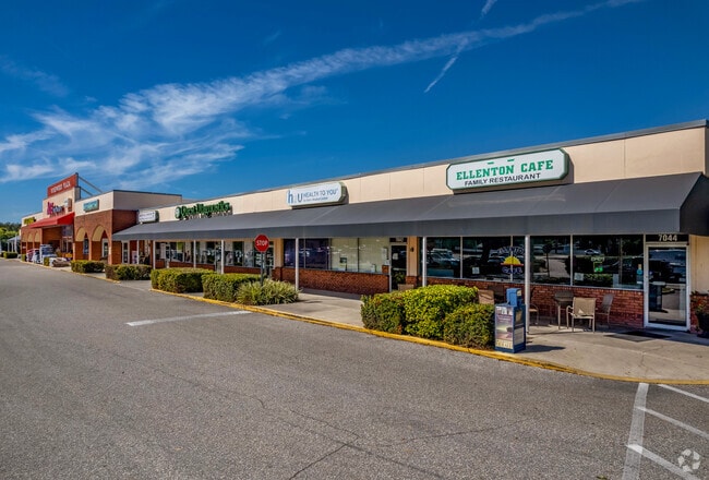

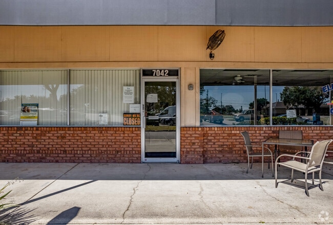

Property Detail
7004 Us Highway 301 N
8351-5000-4
FROM A CONC MON AT THE NW COR OF SEC 10; RUN S 00 DEG 17 MIN 42 SEC W, ALG THE W LN OF SD SEC, A DIST OF 3583.89 FT TO A IRON PIPE; TH N 60 DEG 02 MIN 20 SEC E, A DIST OF 1030.91 FT
Regionalshoppingcenterormallwithanchorstore
Manatee
GC GENERA
Florida
A Areas with a 1% annual chance of flooding and a 26% chance of flooding over the life of a 30-year mortgage.
2,4
2023
6.18 AC
2025
Manatee
001908
Tampa/St Petersburg
56,442 SF
North Port-Bradenton-Sarasota, FL
NEARBY LISTINGS FOR SALE OR LEASE
DEMOGRAPHICS near 7004 Us Highway 301 N
1 mile
3 mile
5 mile
2025 Total Population
7,655
49,850
129,850
2030 Population
8,671
55,908
146,528
Pop Growth 2025-2030
+ 13.27%
+ 12.15%
+ 12.84%
Average Age
59
47
45
2025 Total Households
3,970
21,389
52,308
HH Growth 2025-2030
+ 13.60%
+ 12.44%
+ 13.08%
Median Household Inc
$56,132
$89,860
$81,228
Avg Household Size
1.90
2.30
2.40
2025 Avg HH Vehicles
1.00
2.00
2.00
Median Home Value
$166,985
$398,417
$397,104
Median Year Built
1991
2004
2002
Nearby Places
Map Layers
Map Styles
 Street
 Aerial
Transit
 Traffic
 Biking
Places
Listings with unknown addresses are not visible on the map
- Restaurants
- Banks
- Shops
- Fitness
- Groceries
PUBLIC TRANSPORTATION
AIRPORT
Sarasota/Bradenton International
Drive
Walk
Distance
Sarasota/Bradenton International
28 min
14.6 mi
St Pete-Clearwater International
Drive
Walk
Distance
St Pete-Clearwater International
54 min
37.9 mi
Freight Ports
Port Manatee
Drive
Walk
Distance
Port Manatee
19 min
10.6 mi
SALE & LEASE HISTORY
LISTING DATE
SALE/LEASE

Sep 25, 2016
For Lease
Mar 13, 2018
For Sale
Nearby Properties
Address
Land Use
TOTAL SIZE
Lot Size
Zoning
Address
Land Use
TOTAL SIZE
Lot Size
Zoning
622,266 SF
68.76 AC
PD-MU
Address
Land Use
TOTAL SIZE
Lot Size
Zoning
881,490 SF
83.09 AC
BR_R-3
Address
Land Use
TOTAL SIZE
Lot Size
Zoning
513,465 SF
78.39 AC
PD-MU
Address
Land Use
TOTAL SIZE
Lot Size
Zoning
707,409 SF
27.98 AC
PD-MU
Address
Land Use
TOTAL SIZE
Lot Size
Zoning
359,241 SF
27.68 AC
PD-MU
Address
Land Use
TOTAL SIZE
Lot Size
Zoning
294,300 SF
10.33 AC
PD-MU
Address
Land Use
TOTAL SIZE
Lot Size
Zoning
319,679 SF
31.78 AC
BR_R-1
Address
Land Use
TOTAL SIZE
Lot Size
Zoning
311,669 SF
34.55 AC
BR_R-2
Address
Land Use
TOTAL SIZE
Lot Size
Zoning
225,768 SF
18.47 AC
BR_R-1
Address
Land Use
TOTAL SIZE
Lot Size
Zoning
313,422 SF
47.93 AC
PD-C
Address
Land Use
TOTAL SIZE
Lot Size
Zoning
456,375 SF
112.07 AC
PD-MU
Address
Land Use
TOTAL SIZE
Lot Size
Zoning
270,900 SF
44.35 AC
PD-MU
Address
Land Use
TOTAL SIZE
Lot Size
Zoning
456,317 SF
46.75 AC
PD-R
Address
Land Use
TOTAL SIZE
Lot Size
Zoning
312,546 SF
39.60 AC
A-1 SUBURB
Address
Land Use
TOTAL SIZE
Lot Size
Zoning
191,100 SF
30.35 AC
PD-C
Address
Land Use
TOTAL SIZE
Lot Size
Zoning
107,298 SF
12.91 AC
PD-MU
Address
Land Use
TOTAL SIZE
Lot Size
Zoning
220,706 SF
24.13 AC
PD-C, A-1
Address
Land Use
TOTAL SIZE
Lot Size
Zoning
201,982 SF
16.65 AC
BR_SCC
Address
Land Use
TOTAL SIZE
Lot Size
Zoning
64,800 SF
8.19 AC
Address
Land Use
TOTAL SIZE
Lot Size
Zoning
185,272 SF
18.11 AC
PD-R
Address
Land Use
TOTAL SIZE
Lot Size
Zoning
13,621 SF
61.72 AC
PD-RV,RSF-
Address
Land Use
TOTAL SIZE
Lot Size
Zoning
61,770 SF
79.85 AC
A,A-1
Address
Land Use
TOTAL SIZE
Lot Size
Zoning
59,222 SF
4.49 AC
PD-C
Address
Land Use
TOTAL SIZE
Lot Size
Zoning
65,761 SF
11.91 AC
BR_SCC
Address
Land Use
TOTAL SIZE
Lot Size
Zoning
33.49 AC
Address
Land Use
TOTAL SIZE
Lot Size
Zoning
56,246 SF
8.06 AC
BR_SCC
Address
Land Use
TOTAL SIZE
Lot Size
Zoning
35,784 SF
6.26 AC
PD-MU
Address
Land Use
TOTAL SIZE
Lot Size
Zoning
138,258 SF
9.59 AC
PD-MU
Address
Land Use
TOTAL SIZE
Lot Size
Zoning
61,721 SF
5.50 AC
PD-C
The World's #1 Commercial Real Estate Marketplace
Connect with us
© 2026 CoStar Group
The information above has been obtained from sources believed reliable. While we do not doubt its accuracy we have not verified it and make no guarantee, warranty or representation about it. It is your responsibility to independently confirm its accuracy and completeness. Any projections, opinions, assumptions, or estimates used are for example only and do not represent the current or future performance of the property. The value of this transaction to you depends on tax and other factors which should be evaluated by your tax, financial, and legal advisors. You and your advisors should conduct a careful, independent investigation of the property to determine to your satisfaction the suitability of the property for your needs.