Property Record
197 Western Ave, Essex, MA 01929
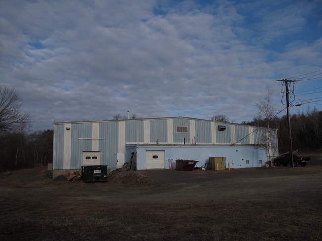

Property Detail
197 Western Ave
HAMI M:42 B:27
Essex
Manufacturinglight
Massachusetts
C00
58
B and X Area of moderate flood hazard, usually the area between the limits of the 100-year and 500-year floods.
2.85 AC
2025
Essex/Gloucester
2025
Boston
222100
Boston-Cambridge-Newton, MA-NH
29,752 SF
NEARBY LISTINGS FOR SALE OR LEASE
-
-
View all Essex listings for sale on LoopNet.com
DEMOGRAPHICS near 197 Western Ave
1 mile
3 mile
5 mile
2025 Total Population
1,570
10,180
45,454
2030 Population
1,609
10,439
46,896
Pop Growth 2025-2030
+ 2.48%
+ 2.54%
+ 3.17%
Average Age
43
41
43
2025 Total Households
588
3,587
16,691
HH Growth 2025-2030
+ 2.21%
+ 2.43%
+ 3.20%
Median Household Inc
$142,410
$135,597
$137,121
Avg Household Size
2.60
2.60
2.50
2025 Avg HH Vehicles
2.00
2.00
2.00
Median Home Value
$823,619
$852,672
$810,743
Median Year Built
1967
1965
1964
Nearby Places
Map Layers
Map Styles
 Street
 Aerial
Layers
 Traffic
 Biking
Places
Listings with unknown addresses are not visible on the map
- Restaurants
- Banks
- Shops
- Fitness
- Groceries
PUBLIC TRANSPORTATION
COMMUTER RAIL
Hamilton/Wenham (Newburyport/Rockport Line - Massachusetts Bay Transportation Authority Commuter Rail (Purple Line))
Drive
Walk
Distance
Hamilton/Wenham (Newburyport/Rockport Line - Massachusetts Bay Transportation Authority Commuter Rail (Purple Line))
9 min
4.3 mi
Ipswich (Newburyport/Rockport Line - Massachusetts Bay Transportation Authority Commuter Rail (Purple Line))
Drive
Walk
Distance
Ipswich (Newburyport/Rockport Line - Massachusetts Bay Transportation Authority Commuter Rail (Purple Line))
15 min
7.4 mi
AIRPORT
General Edward Lawrence Logan International
Drive
Walk
Distance
General Edward Lawrence Logan International
45 min
24.7 mi
Freight Ports
Port of Boston
Drive
Walk
Distance
Port of Boston
49 min
30.7 mi
Nearby Properties
Address
Land Use
TOTAL SIZE
Lot Size
Zoning
Address
Land Use
TOTAL SIZE
Lot Size
Zoning
126.58 AC
RRA
Address
Land Use
TOTAL SIZE
Lot Size
Zoning
64,451 SF
102.50 AC
R1A
Address
Land Use
TOTAL SIZE
Lot Size
Zoning
212,956 SF
44.90 AC
R1B
Address
Land Use
TOTAL SIZE
Lot Size
Zoning
10,464 SF
237.02 AC
Address
Land Use
TOTAL SIZE
Lot Size
Zoning
328.40 AC
R1A
Address
Land Use
TOTAL SIZE
Lot Size
Zoning
43.68 AC
Address
Land Use
TOTAL SIZE
Lot Size
Zoning
475 AC
RRA
Address
Land Use
TOTAL SIZE
Lot Size
Zoning
144 SF
179.50 AC
RA
Address
Land Use
TOTAL SIZE
Lot Size
Zoning
4.67 AC
C00
Address
Land Use
TOTAL SIZE
Lot Size
Zoning
13,992 SF
16 AC
R1A
Address
Land Use
TOTAL SIZE
Lot Size
Zoning
173.75 AC
RS2
Address
Land Use
TOTAL SIZE
Lot Size
Zoning
2.32 AC
R1A
Address
Land Use
TOTAL SIZE
Lot Size
Zoning
227.89 AC
RA
Address
Land Use
TOTAL SIZE
Lot Size
Zoning
52,259 SF
9.75 AC
Address
Land Use
TOTAL SIZE
Lot Size
Zoning
5.80 AC
IND
Address
Land Use
TOTAL SIZE
Lot Size
Zoning
2.68 AC
RRA
Address
Land Use
TOTAL SIZE
Lot Size
Zoning
1.68 AC
R1
Address
Land Use
TOTAL SIZE
Lot Size
Zoning
5.86 AC
C00
Address
Land Use
TOTAL SIZE
Lot Size
Zoning
79.56 AC
Address
Land Use
TOTAL SIZE
Lot Size
Zoning
3.04 AC
R1B
Address
Land Use
TOTAL SIZE
Lot Size
Zoning
1.40 AC
C00
Address
Land Use
TOTAL SIZE
Lot Size
Zoning
0.87 AC
C00
Address
Land Use
TOTAL SIZE
Lot Size
Zoning
20.32 AC
R1B
Address
Land Use
TOTAL SIZE
Lot Size
Zoning
Address
Land Use
TOTAL SIZE
Lot Size
Zoning
9,910 SF
0.71 AC
C00
Address
Land Use
TOTAL SIZE
Lot Size
Zoning
5.49 AC
R1B
Address
Land Use
TOTAL SIZE
Lot Size
Zoning
25.25 AC
RS2
Address
Land Use
TOTAL SIZE
Lot Size
Zoning
5,054 SF
119.33 AC
IRA
Address
Land Use
TOTAL SIZE
Lot Size
Zoning
7.55 AC
R1A
Address
Land Use
TOTAL SIZE
Lot Size
Zoning
14,494 SF
4.46 AC
R1A
The World's #1 Commercial Real Estate Marketplace
Connect with us
© 2026 CoStar Group
The information above has been obtained from sources believed reliable. While we do not doubt its accuracy we have not verified it and make no guarantee, warranty or representation about it. It is your responsibility to independently confirm its accuracy and completeness. Any projections, opinions, assumptions, or estimates used are for example only and do not represent the current or future performance of the property. The value of this transaction to you depends on tax and other factors which should be evaluated by your tax, financial, and legal advisors. You and your advisors should conduct a careful, independent investigation of the property to determine to your satisfaction the suitability of the property for your needs.