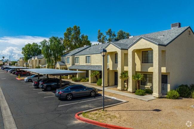
Property Record
7801 N 44Th Dr, Glendale, AZ 85301

NEARBY LISTINGS FOR SALE OR LEASE
Property Detail
7801 N 44Th Dr
Phoenix-Mesa-Chandler, AZ
Trends 84
147-01-148
TRENDS 84 MCR 269-40
Townhouserowhouse
Maricopa
X
Arizona
04013C1720L
b
0
0.02 AC
2025
Westside
092402
Phoenix
960 SF
DEMOGRAPHICS near 7801 N 44Th Dr
1 Mile
3 Mile
5 Mile
2024 Total Population
23,363
194,577
517,443
2029 Population
25,123
209,299
557,379
Pop Growth 2024-2029
+ 7.53%
+ 7.57%
+ 7.72%
Average Age
37
36
35
2024 Total Households
8,061
66,268
173,084
HH Growth 2024-2029
+ 7.64%
+ 7.69%
+ 7.98%
Median Household Inc
$53,379
$49,559
$53,732
Avg Household Size
2.80
2.80
2.80
2024 Avg HH Vehicles
2.00
2.00
2.00
Median Home Value
$272,348
$253,352
$271,375
Median Year Built
1973
1974
1975
Nearby Places
Map Layers
Map Styles
 Street
 Aerial
- Restaurants
- Banks
- Shops
- Fitness
- Groceries
PUBLIC TRANSPORTATION
AIRPORT
Phoenix Sky Harbor International
DRIVE
WALK
Distance
Phoenix Sky Harbor International
27 min
15.2 mi
Phoenix-Mesa Gateway
DRIVE
WALK
Distance
Phoenix-Mesa Gateway
61 min
42.4 mi
Nearby Properties
Address
Land Use
TOTAL SIZE
Lot Size
Zoning
Address
Land Use
TOTAL SIZE
Lot Size
Zoning
19,474 SF
8.43 AC
C-3
Address
Land Use
TOTAL SIZE
Lot Size
Zoning
611,971 SF
36.16 AC
A1
Address
Land Use
TOTAL SIZE
Lot Size
Zoning
337,487 SF
39 AC
R-6
Address
Land Use
TOTAL SIZE
Lot Size
Zoning
3,241 SF
2.13 AC
C-N
Address
Land Use
TOTAL SIZE
Lot Size
Zoning
629,928 SF
41.37 AC
Address
Land Use
TOTAL SIZE
Lot Size
Zoning
74,376 SF
2.12 AC
C-N
Address
Land Use
TOTAL SIZE
Lot Size
Zoning
276,102 SF
39.72 AC
AG
Address
Land Use
TOTAL SIZE
Lot Size
Zoning
25.91 AC
A1
Address
Land Use
TOTAL SIZE
Lot Size
Zoning
4.43 AC
Address
Land Use
TOTAL SIZE
Lot Size
Zoning
211,015 SF
9.59 AC
R-6
Address
Land Use
TOTAL SIZE
Lot Size
Zoning
194,523 SF
37.27 AC
R-6
Address
Land Use
TOTAL SIZE
Lot Size
Zoning
212,227 SF
27.71 AC
R-6
Address
Land Use
TOTAL SIZE
Lot Size
Zoning
262,609 SF
18.96 AC
I-1
Address
Land Use
TOTAL SIZE
Lot Size
Zoning
200,998 SF
0.06 AC
C-C
Address
Land Use
TOTAL SIZE
Lot Size
Zoning
187,309 SF
19.99 AC
R-6
Address
Land Use
TOTAL SIZE
Lot Size
Zoning
88,059 SF
78.03 AC
AG
Address
Land Use
TOTAL SIZE
Lot Size
Zoning
217,214 SF
27.12 AC
R-6
Address
Land Use
TOTAL SIZE
Lot Size
Zoning
2.23 AC
Address
Land Use
TOTAL SIZE
Lot Size
Zoning
139,343 SF
10.13 AC
R-6
Address
Land Use
TOTAL SIZE
Lot Size
Zoning
114,671 SF
13.28 AC
R-6
Address
Land Use
TOTAL SIZE
Lot Size
Zoning
287,199 SF
15.11 AC
M-H
Address
Land Use
TOTAL SIZE
Lot Size
Zoning
228,072 SF
14.72 AC
C-C
Address
Land Use
TOTAL SIZE
Lot Size
Zoning
320,093 SF
14.56 AC
M-H
Address
Land Use
TOTAL SIZE
Lot Size
Zoning
206,428 SF
18.02 AC
C-C
Address
Land Use
TOTAL SIZE
Lot Size
Zoning
96,328 SF
15.58 AC
M-H
Address
Land Use
TOTAL SIZE
Lot Size
Zoning
113,313 SF
9.49 AC
R-6
Address
Land Use
TOTAL SIZE
Lot Size
Zoning
212,109 SF
20.14 AC
C-C
Address
Land Use
TOTAL SIZE
Lot Size
Zoning
114,424 SF
10.88 AC
R-6
Address
Land Use
TOTAL SIZE
Lot Size
Zoning
143,422 SF
14.16 AC
C-C
Address
Land Use
TOTAL SIZE
Lot Size
Zoning
89,773 SF
17.78 AC
R-6
The World's #1 Commercial Real Estate Marketplace
Connect with us
© 2026 CoStar Group
The information above has been obtained from sources believed reliable. While we do not doubt its accuracy we have not verified it and make no guarantee, warranty or representation about it. It is your responsibility to independently confirm its accuracy and completeness. Any projections, opinions, assumptions, or estimates used are for example only and do not represent the current or future performance of the property. The value of this transaction to you depends on tax and other factors which should be evaluated by your tax, financial, and legal advisors. You and your advisors should conduct a careful, independent investigation of the property to determine to your satisfaction the suitability of the property for your needs.