Property Record
2400 Sutherland Ave, Knoxville, TN 37919


Property Detail
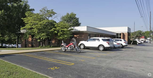
2400 Sutherland Ave
Knoxville, TN
SUBDIVISIONNAME DOLL MYNDERSE & BROWNLEE 5TH ADDN RESUB MAPPLATB 11 MAPPLATP 99 DIMENSIONS 350 X 135
108BA-006
Knox
Casino
Tennessee
B and X Area of moderate flood hazard, usually the area between the limits of the 100-year and 500-year floods.
5r
2025
1.09 AC
2025
Bearden/Papermill/W Town
002600
Knoxville
4,750 SF
NEARBY LISTINGS FOR SALE OR LEASE
DEMOGRAPHICS near 2400 Sutherland Ave
1 mile
3 mile
5 mile
2024 Total Population
7,337
76,406
167,996
2029 Population
7,668
80,262
175,623
Pop Growth 2024-2029
+ 4.51%
+ 5.05%
+ 4.54%
Average Age
28
34
37
2024 Total Households
2,451
30,849
71,705
HH Growth 2024-2029
+ 5.92%
+ 5.64%
+ 4.75%
Median Household Inc
$31,344
$41,766
$49,718
Avg Household Size
2.20
2.10
2.10
2024 Avg HH Vehicles
2.00
2.00
2.00
Median Home Value
$182,010
$338,619
$279,977
Median Year Built
1988
1974
1974
Nearby Places
Map Layers
Map Styles
 Street
 Aerial
Transit
 Traffic
 Biking
Places
Listings with unknown addresses are not visible on the map
- Restaurants
- Banks
- Shops
- Fitness
- Groceries
PUBLIC TRANSPORTATION
AIRPORT
McGhee Tyson
Drive
Walk
Distance
McGhee Tyson
30 min
16.1 mi
SALE & LEASE HISTORY
LISTING DATE
SALE/LEASE

Aug 15, 2024
For Lease
Nearby Properties
Address
Land Use
TOTAL SIZE
Lot Size
Zoning
Address
Land Use
TOTAL SIZE
Lot Size
Zoning
285,481 SF
1.77 AC
Address
Land Use
TOTAL SIZE
Lot Size
Zoning
254,407 SF
1.08 AC
Address
Land Use
TOTAL SIZE
Lot Size
Zoning
453,998 SF
1.03 AC
Address
Land Use
TOTAL SIZE
Lot Size
Zoning
311,042 SF
1.36 AC
Address
Land Use
TOTAL SIZE
Lot Size
Zoning
320,324 SF
2.83 AC
Address
Land Use
TOTAL SIZE
Lot Size
Zoning
404,996 SF
Address
Land Use
TOTAL SIZE
Lot Size
Zoning
154,163 SF
3.48 AC
Address
Land Use
TOTAL SIZE
Lot Size
Zoning
210,640 SF
1.90 AC
Address
Land Use
TOTAL SIZE
Lot Size
Zoning
38,438 SF
2.04 AC
Address
Land Use
TOTAL SIZE
Lot Size
Zoning
742,968 SF
2.95 AC
Address
Land Use
TOTAL SIZE
Lot Size
Zoning
207,067 SF
11.79 AC
Address
Land Use
TOTAL SIZE
Lot Size
Zoning
117,375 SF
1.82 AC
Address
Land Use
TOTAL SIZE
Lot Size
Zoning
120,331 SF
5.62 AC
Address
Land Use
TOTAL SIZE
Lot Size
Zoning
177,685 SF
4.20 AC
Address
Land Use
TOTAL SIZE
Lot Size
Zoning
359,624 SF
60.94 AC
Address
Land Use
TOTAL SIZE
Lot Size
Zoning
210,052 SF
Address
Land Use
TOTAL SIZE
Lot Size
Zoning
173,567 SF
1.10 AC
Address
Land Use
TOTAL SIZE
Lot Size
Zoning
45,702 SF
6.07 AC
Address
Land Use
TOTAL SIZE
Lot Size
Zoning
158,993 SF
Address
Land Use
TOTAL SIZE
Lot Size
Zoning
131,702 SF
0.68 AC
Address
Land Use
TOTAL SIZE
Lot Size
Zoning
395,134 SF
1.35 AC
Address
Land Use
TOTAL SIZE
Lot Size
Zoning
325,704 SF
1.30 AC
Address
Land Use
TOTAL SIZE
Lot Size
Zoning
52,072 SF
18.05 AC
Address
Land Use
TOTAL SIZE
Lot Size
Zoning
60,782 SF
6.12 AC
Address
Land Use
TOTAL SIZE
Lot Size
Zoning
76,620 SF
0.64 AC
Address
Land Use
TOTAL SIZE
Lot Size
Zoning
5,260 SF
33.45 AC
Address
Land Use
TOTAL SIZE
Lot Size
Zoning
291,550 SF
2.47 AC
Address
Land Use
TOTAL SIZE
Lot Size
Zoning
325,704 SF
1.30 AC
Address
Land Use
TOTAL SIZE
Lot Size
Zoning
62,114 SF
3.60 AC
Address
Land Use
TOTAL SIZE
Lot Size
Zoning
223,763 SF
2.28 AC
The World's #1 Commercial Real Estate Marketplace
Connect with us
© 2026 CoStar Group
The information above has been obtained from sources believed reliable. While we do not doubt its accuracy we have not verified it and make no guarantee, warranty or representation about it. It is your responsibility to independently confirm its accuracy and completeness. Any projections, opinions, assumptions, or estimates used are for example only and do not represent the current or future performance of the property. The value of this transaction to you depends on tax and other factors which should be evaluated by your tax, financial, and legal advisors. You and your advisors should conduct a careful, independent investigation of the property to determine to your satisfaction the suitability of the property for your needs.