Property Record
245 S 41St St, Louisville, KY 40212
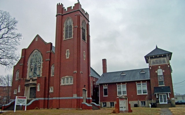


Property Detail
245 S 41St St
Louisville/Jefferson County, KY-IN
LOT 49 RITTERS WEST MKT ST ADD PB 2 PG 247 0.1253 AC
008E00140000
Jefferson
Privateschool
Kentucky
R5-RESIDEN
49
2025
0.13 AC
2025
W Outlying Jefferson Cnty
000700
Louisville
7,682 SF
NEARBY LISTINGS FOR SALE OR LEASE
DEMOGRAPHICS near 245 S 41St St
1 mile
3 mile
5 mile
2024 Total Population
15,995
80,368
205,426
2029 Population
16,570
84,018
213,081
Pop Growth 2024-2029
+ 3.59%
+ 4.54%
+ 3.73%
Average Age
40
39
39
2024 Total Households
6,491
32,681
88,351
HH Growth 2024-2029
+ 3.56%
+ 4.62%
+ 3.90%
Median Household Inc
$34,222
$36,290
$42,271
Avg Household Size
2.40
2.30
2.10
2024 Avg HH Vehicles
1.00
1.00
1.00
Median Home Value
$92,652
$103,562
$151,739
Median Year Built
1946
1947
1953
Nearby Places
Map Layers
Map Styles
 Street
 Aerial
Transit
 Traffic
 Biking
Places
Listings with unknown addresses are not visible on the map
- Restaurants
- Banks
- Shops
- Fitness
- Groceries
Nearby Properties
Address
Land Use
TOTAL SIZE
Lot Size
Zoning
Address
Land Use
TOTAL SIZE
Lot Size
Zoning
119,395 SF
0.54 AC
C3-CENTRAL
Address
Land Use
TOTAL SIZE
Lot Size
Zoning
3,162 SF
23.76 AC
EZ1-ENTERP
Address
Land Use
TOTAL SIZE
Lot Size
Zoning
95,508 SF
3.67 AC
EZ1-ENTERP
Address
Land Use
TOTAL SIZE
Lot Size
Zoning
12,270 SF
13.50 AC
Address
Land Use
TOTAL SIZE
Lot Size
Zoning
0.80 AC
Address
Land Use
TOTAL SIZE
Lot Size
Zoning
17,548 SF
0.60 AC
C3-CENTRAL
Address
Land Use
TOTAL SIZE
Lot Size
Zoning
8.74 AC
R7-RESIDEN
Address
Land Use
TOTAL SIZE
Lot Size
Zoning
143,700 SF
0.29 AC
Address
Land Use
TOTAL SIZE
Lot Size
Zoning
135,832 SF
5.06 AC
EZ1-ENTERP
Address
Land Use
TOTAL SIZE
Lot Size
Zoning
16,920 SF
0.18 AC
C3-CENTRAL
Address
Land Use
TOTAL SIZE
Lot Size
Zoning
2.21 AC
C3-CENTRAL
Address
Land Use
TOTAL SIZE
Lot Size
Zoning
7.11 AC
R7-RESIDEN
Address
Land Use
TOTAL SIZE
Lot Size
Zoning
40,080 SF
1.89 AC
C2-COMMERC
Address
Land Use
TOTAL SIZE
Lot Size
Zoning
17,920 SF
0.98 AC
C2-COMMERC
Address
Land Use
TOTAL SIZE
Lot Size
Zoning
141,370 SF
0.72 AC
Address
Land Use
TOTAL SIZE
Lot Size
Zoning
265,835 SF
15.39 AC
EZ1-ENTERP
Address
Land Use
TOTAL SIZE
Lot Size
Zoning
1.75 AC
OR3-OFFICE
Address
Land Use
TOTAL SIZE
Lot Size
Zoning
266,400 SF
16.40 AC
EZ1-ENTERP
Address
Land Use
TOTAL SIZE
Lot Size
Zoning
133,829 SF
10.03 AC
EZ1-ENTERP
Address
Land Use
TOTAL SIZE
Lot Size
Zoning
8,100 SF
8.59 AC
EZ1-ENTERP
Address
Land Use
TOTAL SIZE
Lot Size
Zoning
14,355 SF
1.50 AC
C2-COMMERC
Address
Land Use
TOTAL SIZE
Lot Size
Zoning
3,350 SF
8.28 AC
M3-INDUSTR
Address
Land Use
TOTAL SIZE
Lot Size
Zoning
125,842 SF
2.16 AC
EZ1-ENTERP
Address
Land Use
TOTAL SIZE
Lot Size
Zoning
304,575 SF
13.10 AC
M3-INDUSTR
Address
Land Use
TOTAL SIZE
Lot Size
Zoning
44,820 SF
35.72 AC
C3-CENTRAL
Address
Land Use
TOTAL SIZE
Lot Size
Zoning
84,626 SF
0.61 AC
C3-CENTRAL
Address
Land Use
TOTAL SIZE
Lot Size
Zoning
10.76 AC
R7-RESIDEN
Address
Land Use
TOTAL SIZE
Lot Size
Zoning
Address
Land Use
TOTAL SIZE
Lot Size
Zoning
49,088 SF
0.34 AC
EZ1-ENTERP
Address
Land Use
TOTAL SIZE
Lot Size
Zoning
2.98 AC
C3-CENTRAL
The World's #1 Commercial Real Estate Marketplace
Connect with us
© 2026 CoStar Group
The information above has been obtained from sources believed reliable. While we do not doubt its accuracy we have not verified it and make no guarantee, warranty or representation about it. It is your responsibility to independently confirm its accuracy and completeness. Any projections, opinions, assumptions, or estimates used are for example only and do not represent the current or future performance of the property. The value of this transaction to you depends on tax and other factors which should be evaluated by your tax, financial, and legal advisors. You and your advisors should conduct a careful, independent investigation of the property to determine to your satisfaction the suitability of the property for your needs.