Property Record
19 Fuller Rd, Albany, NY 12205


Property Detail
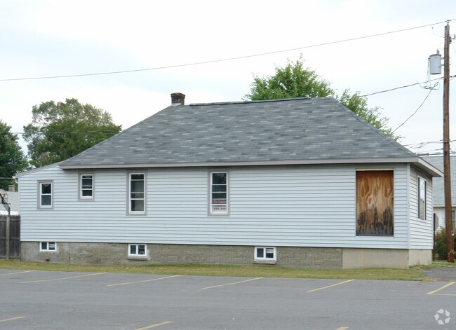
19 Fuller Rd
012689-042-017-0003-055-000-0000
N-PINEHURST AVE E-FULLER S-50-60
Servicestationmarket
Albany
12
New York
B and X Area of moderate flood hazard, usually the area between the limits of the 100-year and 500-year floods.
55.000
2025
1.20 AC
2025
Central Avenue Corridor
014001
Albany/Schenectady/Troy
3,889 SF
Albany-Schenectady-Troy, NY
NEARBY LISTINGS FOR SALE OR LEASE
DEMOGRAPHICS near 19 Fuller Rd
1 mile
3 mile
5 mile
2024 Total Population
6,912
69,512
184,236
2029 Population
7,040
70,367
186,642
Pop Growth 2024-2029
+ 1.85%
+ 1.23%
+ 1.31%
Average Age
42
40
40
2024 Total Households
3,191
27,493
76,519
HH Growth 2024-2029
+ 2.19%
+ 1.39%
+ 1.45%
Median Household Inc
$85,954
$86,124
$77,669
Avg Household Size
2.10
2.10
2.10
2024 Avg HH Vehicles
1.00
2.00
1.00
Median Home Value
$247,874
$282,009
$284,936
Median Year Built
1967
1963
1962
Nearby Places
Map Layers
Map Styles
 Street
 Aerial
Transit
 Traffic
 Biking
Places
Listings with unknown addresses are not visible on the map
- Restaurants
- Banks
- Shops
- Fitness
- Groceries
PUBLIC TRANSPORTATION
COMMUTER RAIL
Drive
Walk
Distance
17 min
9.0 mi
AIRPORT
Albany International
Drive
Walk
Distance
Albany International
12 min
5.8 mi
Nearby Properties
Address
Land Use
TOTAL SIZE
Lot Size
Zoning
Address
Land Use
TOTAL SIZE
Lot Size
Zoning
111,628 SF
303.87 AC
CO
Address
Land Use
TOTAL SIZE
Lot Size
Zoning
72,000 SF
279.23 AC
CO
Address
Land Use
TOTAL SIZE
Lot Size
Zoning
5.04 AC
CM
Address
Land Use
TOTAL SIZE
Lot Size
Zoning
Address
Land Use
TOTAL SIZE
Lot Size
Zoning
151,305 SF
9.60 AC
R4
Address
Land Use
TOTAL SIZE
Lot Size
Zoning
812,458 SF
38.74 AC
F
Address
Land Use
TOTAL SIZE
Lot Size
Zoning
190 AC
LC
Address
Land Use
TOTAL SIZE
Lot Size
Zoning
561,128 SF
33.58 AC
GB
Address
Land Use
TOTAL SIZE
Lot Size
Zoning
10,216 SF
48.37 AC
16
Address
Land Use
TOTAL SIZE
Lot Size
Zoning
595,472 SF
6.06 AC
CO
Address
Land Use
TOTAL SIZE
Lot Size
Zoning
12,096 SF
73.12 AC
CM
Address
Land Use
TOTAL SIZE
Lot Size
Zoning
242,658 SF
29 AC
19
Address
Land Use
TOTAL SIZE
Lot Size
Zoning
373,296 SF
11.70 AC
46
Address
Land Use
TOTAL SIZE
Lot Size
Zoning
175,587 SF
20.14 AC
LB
Address
Land Use
TOTAL SIZE
Lot Size
Zoning
3,760 SF
28.30 AC
MR
Address
Land Use
TOTAL SIZE
Lot Size
Zoning
12,984 SF
19.42 AC
BNRP
Address
Land Use
TOTAL SIZE
Lot Size
Zoning
213,860 SF
28.20 AC
C2
Address
Land Use
TOTAL SIZE
Lot Size
Zoning
135,000 SF
14.64 AC
R1B
Address
Land Use
TOTAL SIZE
Lot Size
Zoning
301,834 SF
9 AC
26
Address
Land Use
TOTAL SIZE
Lot Size
Zoning
80.10 AC
LC
Address
Land Use
TOTAL SIZE
Lot Size
Zoning
279,150 SF
21.10 AC
CO
Address
Land Use
TOTAL SIZE
Lot Size
Zoning
266,600 SF
22.60 AC
47
Address
Land Use
TOTAL SIZE
Lot Size
Zoning
64,685 SF
6.79 AC
R2A
Address
Land Use
TOTAL SIZE
Lot Size
Zoning
8,084 SF
36.30 AC
25
Address
Land Use
TOTAL SIZE
Lot Size
Zoning
31,080 SF
13.60 AC
LB
Address
Land Use
TOTAL SIZE
Lot Size
Zoning
167,222 SF
15.65 AC
14
Address
Land Use
TOTAL SIZE
Lot Size
Zoning
0.06 AC
Address
Land Use
TOTAL SIZE
Lot Size
Zoning
66,419 SF
2 AC
CPB
Address
Land Use
TOTAL SIZE
Lot Size
Zoning
87.50 AC
CO
Address
Land Use
TOTAL SIZE
Lot Size
Zoning
10,500 SF
40.10 AC
CO
The World's #1 Commercial Real Estate Marketplace
Connect with us
© 2026 CoStar Group
The information above has been obtained from sources believed reliable. While we do not doubt its accuracy we have not verified it and make no guarantee, warranty or representation about it. It is your responsibility to independently confirm its accuracy and completeness. Any projections, opinions, assumptions, or estimates used are for example only and do not represent the current or future performance of the property. The value of this transaction to you depends on tax and other factors which should be evaluated by your tax, financial, and legal advisors. You and your advisors should conduct a careful, independent investigation of the property to determine to your satisfaction the suitability of the property for your needs.