Property Record
4061 State Route 104, Williamson, NY 14589
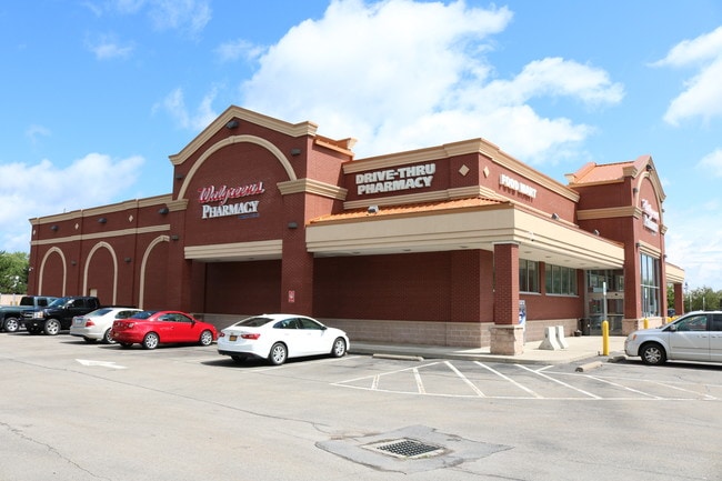


Property Detail
4061 State Route 104
Rochester, NY
33117-08-883863
544600-065-117-0008-910-873-0000
Wayne
Communitycenter
New York
C1
910.873
2025
2.36 AC
2024
Wayne County
020402
Rochester
14,690 SF
NEARBY LISTINGS FOR SALE OR LEASE
DEMOGRAPHICS near 4061 State Route 104
1 mile
3 mile
5 mile
2025 Total Population
2,246
5,380
12,695
2030 Population
2,194
5,273
12,590
Pop Growth 2025-2030
(2.32%)
(1.99%)
(0.83%)
Average Age
43
43
44
2025 Total Households
950
2,224
5,189
HH Growth 2025-2030
(2.42%)
(2.11%)
(0.89%)
Median Household Inc
$75,507
$83,488
$83,670
Avg Household Size
2.30
2.40
2.40
2025 Avg HH Vehicles
2.00
2.00
2.00
Median Home Value
$165,730
$188,556
$198,434
Median Year Built
1961
1962
1967
Nearby Places
Map Layers
Map Styles
 Street
 Aerial
Transit
 Traffic
 Biking
Places
Listings with unknown addresses are not visible on the map
- Restaurants
- Banks
- Shops
- Fitness
- Groceries
PUBLIC TRANSPORTATION
AIRPORT
Frederick Douglass/Greater Rochester International
Drive
Walk
Distance
Frederick Douglass/Greater Rochester International
43 min
29.0 mi
SALE & LEASE HISTORY
LISTING DATE
SALE/LEASE

May 08, 2019
For Sale
Jun 26, 2022
For Sale
Jul 23, 2019
For Sale
Jul 18, 2024
For Sale
Nearby Properties
Address
Land Use
TOTAL SIZE
Lot Size
Zoning
Address
Land Use
TOTAL SIZE
Lot Size
Zoning
65,762 SF
51.16 AC
I1
Address
Land Use
TOTAL SIZE
Lot Size
Zoning
952 SF
91.60 AC
MU1
Address
Land Use
TOTAL SIZE
Lot Size
Zoning
201.60 AC
I1
Address
Land Use
TOTAL SIZE
Lot Size
Zoning
12.25 AC
R1
Address
Land Use
TOTAL SIZE
Lot Size
Zoning
97,515 SF
38.19 AC
R1
Address
Land Use
TOTAL SIZE
Lot Size
Zoning
11,482 SF
7.69 AC
C1
Address
Land Use
TOTAL SIZE
Lot Size
Zoning
19.15 AC
R1
Address
Land Use
TOTAL SIZE
Lot Size
Zoning
25,700 SF
13.55 AC
MU1
Address
Land Use
TOTAL SIZE
Lot Size
Zoning
Address
Land Use
TOTAL SIZE
Lot Size
Zoning
160,000 SF
15.72 AC
I1
Address
Land Use
TOTAL SIZE
Lot Size
Zoning
19,000 SF
8.60 AC
C1
Address
Land Use
TOTAL SIZE
Lot Size
Zoning
Address
Land Use
TOTAL SIZE
Lot Size
Zoning
1,152 SF
15.60 AC
C2
Address
Land Use
TOTAL SIZE
Lot Size
Zoning
9.60 AC
Address
Land Use
TOTAL SIZE
Lot Size
Zoning
31.30 AC
A1
Address
Land Use
TOTAL SIZE
Lot Size
Zoning
12.58 AC
C1
Address
Land Use
TOTAL SIZE
Lot Size
Zoning
1.94 AC
MU1
Address
Land Use
TOTAL SIZE
Lot Size
Zoning
13,263 SF
3.81 AC
C2
Address
Land Use
TOTAL SIZE
Lot Size
Zoning
19,020 SF
3.43 AC
MU1
Address
Land Use
TOTAL SIZE
Lot Size
Zoning
16,420 SF
6.75 AC
C1
Address
Land Use
TOTAL SIZE
Lot Size
Zoning
6,064 SF
0.46 AC
C1
Address
Land Use
TOTAL SIZE
Lot Size
Zoning
27.03 AC
I1
Address
Land Use
TOTAL SIZE
Lot Size
Zoning
13,400 SF
4.20 AC
C2
Address
Land Use
TOTAL SIZE
Lot Size
Zoning
14,063 SF
3.24 AC
C1
Address
Land Use
TOTAL SIZE
Lot Size
Zoning
1.52 AC
R1
Address
Land Use
TOTAL SIZE
Lot Size
Zoning
3,544 SF
14.53 AC
MU1
Address
Land Use
TOTAL SIZE
Lot Size
Zoning
30,420 SF
4.02 AC
C1
Address
Land Use
TOTAL SIZE
Lot Size
Zoning
37.98 AC
A1
Address
Land Use
TOTAL SIZE
Lot Size
Zoning
12,320 SF
36.88 AC
C2
The World's #1 Commercial Real Estate Marketplace
Connect with us
© 2026 CoStar Group
The information above has been obtained from sources believed reliable. While we do not doubt its accuracy we have not verified it and make no guarantee, warranty or representation about it. It is your responsibility to independently confirm its accuracy and completeness. Any projections, opinions, assumptions, or estimates used are for example only and do not represent the current or future performance of the property. The value of this transaction to you depends on tax and other factors which should be evaluated by your tax, financial, and legal advisors. You and your advisors should conduct a careful, independent investigation of the property to determine to your satisfaction the suitability of the property for your needs.