Property Record
1771 Bellamah Ave Nw, Albuquerque, NM 87104
NEARBY LISTINGS FOR SALE OR LEASE
Property Detail
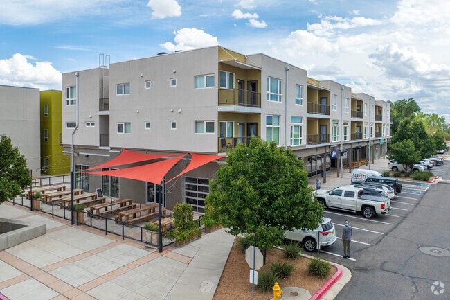
1771 Bellamah Ave Nw
Albuquerque, NM
Arbolera De Vida
1-013-058-281494-1-27-33
LT 5 CORR PLAT OF SAWMILL VILLAGE (BEING A REPL OF LT B-2-A DUKE CITY LUMBER COMPANY ADDN) CONT .0624 AC
Apartment
Bernalillo
X
New Mexico
35001C0331H
5
2024
0.65 AC
2025
Sawmill Area
004800
Albuquerque
20,150 SF
DEMOGRAPHICS near 1771 Bellamah Ave Nw
1 Mile
3 Mile
5 Mile
2024 Total Population
12,172
92,759
244,347
2029 Population
12,126
92,774
243,478
Pop Growth 2024-2029
(0.38%)
+ 0.02%
(0.36%)
Average Age
43
41
40
2024 Total Households
5,737
41,029
103,242
HH Growth 2024-2029
(0.47%)
+ 0.10%
(0.30%)
Median Household Inc
$54,014
$47,407
$53,983
Avg Household Size
2.00
2.10
2.30
2024 Avg HH Vehicles
2.00
2.00
2.00
Median Home Value
$314,926
$262,152
$244,893
Median Year Built
1961
1971
1977
Nearby Places
Map Layers
Map Styles
 Street
 Aerial
- Restaurants
- Banks
- Shops
- Fitness
- Groceries
PUBLIC TRANSPORTATION
COMMUTER RAIL
Downtown Albuquerque (NMRX - Rio Metro Regional Transit District, Rail Runner Express - Rio Metro Regional Transit District)
DRIVE
WALK
Distance
Downtown Albuquerque (NMRX - Rio Metro Regional Transit District, Rail Runner Express - Rio Metro Regional Transit District)
6 min
2.2 mi
Montaño Station (NMRX - Rio Metro Regional Transit District)
DRIVE
WALK
Distance
Montaño Station (NMRX - Rio Metro Regional Transit District)
10 min
4.8 mi
AIRPORT
Albuquerque International Sunport
DRIVE
WALK
Distance
Albuquerque International Sunport
26 min
12.9 mi
Freight Ports
Tulsa Port Of Catoosa
DRIVE
WALK
Distance
Tulsa Port Of Catoosa
690 min
664.2 mi
Nearby Properties
Address
Land Use
TOTAL SIZE
Lot Size
Zoning
Address
Land Use
TOTAL SIZE
Lot Size
Zoning
607,287 SF
8.26 AC
Address
Land Use
TOTAL SIZE
Lot Size
Zoning
18,420 SF
18.94 AC
Address
Land Use
TOTAL SIZE
Lot Size
Zoning
Address
Land Use
TOTAL SIZE
Lot Size
Zoning
4,284 SF
47.29 AC
Address
Land Use
TOTAL SIZE
Lot Size
Zoning
472,156 SF
1.78 AC
Address
Land Use
TOTAL SIZE
Lot Size
Zoning
Address
Land Use
TOTAL SIZE
Lot Size
Zoning
37,700 SF
4.43 AC
Address
Land Use
TOTAL SIZE
Lot Size
Zoning
312,090 SF
35 AC
Address
Land Use
TOTAL SIZE
Lot Size
Zoning
Address
Land Use
TOTAL SIZE
Lot Size
Zoning
355,645 SF
11.98 AC
Address
Land Use
TOTAL SIZE
Lot Size
Zoning
381,985 SF
1.84 AC
Address
Land Use
TOTAL SIZE
Lot Size
Zoning
380,018 SF
0.13 AC
Address
Land Use
TOTAL SIZE
Lot Size
Zoning
Address
Land Use
TOTAL SIZE
Lot Size
Zoning
338,398 SF
23.72 AC
Address
Land Use
TOTAL SIZE
Lot Size
Zoning
27.32 AC
Address
Land Use
TOTAL SIZE
Lot Size
Zoning
370,665 SF
1.66 AC
Address
Land Use
TOTAL SIZE
Lot Size
Zoning
22,368 SF
13.64 AC
Address
Land Use
TOTAL SIZE
Lot Size
Zoning
Address
Land Use
TOTAL SIZE
Lot Size
Zoning
Address
Land Use
TOTAL SIZE
Lot Size
Zoning
313,812 SF
0.77 AC
Address
Land Use
TOTAL SIZE
Lot Size
Zoning
267,101 SF
3.40 AC
Address
Land Use
TOTAL SIZE
Lot Size
Zoning
41.40 AC
Address
Land Use
TOTAL SIZE
Lot Size
Zoning
32.17 AC
Address
Land Use
TOTAL SIZE
Lot Size
Zoning
Address
Land Use
TOTAL SIZE
Lot Size
Zoning
269,596 SF
9.33 AC
Address
Land Use
TOTAL SIZE
Lot Size
Zoning
378,973 SF
19.84 AC
Address
Land Use
TOTAL SIZE
Lot Size
Zoning
19,468 SF
60.34 AC
Address
Land Use
TOTAL SIZE
Lot Size
Zoning
89,661 SF
6.12 AC
Address
Land Use
TOTAL SIZE
Lot Size
Zoning
Address
Land Use
TOTAL SIZE
Lot Size
Zoning
202,182 SF
5 AC
The World's #1 Commercial Real Estate Marketplace
Connect with us
© 2025 CoStar Group
The information above has been obtained from sources believed reliable. While we do not doubt its accuracy we have not verified it and make no guarantee, warranty or representation about it. It is your responsibility to independently confirm its accuracy and completeness. Any projections, opinions, assumptions, or estimates used are for example only and do not represent the current or future performance of the property. The value of this transaction to you depends on tax and other factors which should be evaluated by your tax, financial, and legal advisors. You and your advisors should conduct a careful, independent investigation of the property to determine to your satisfaction the suitability of the property for your needs.