Property Record
S Andrews Ave, Pompano Beach, FL 33069

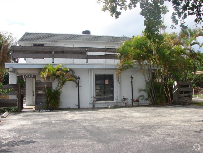
Property Detail
S Andrews Ave
Fort Lauderdale-Pompano Beach-Sunrise, FL
2-49-42 S 100 OF N 2635 OF W1/2 OF W1/2 OF W1/2 OF SAID SEC,LYING S OF GOV LOT 5 & LYING E OF ANDREWS AVE R/W
49-42-02-00-0630
BROWARD
Industrialacreage
Florida
I-1
5
AE The base floodplain where base flood elevations are provided. AE Zones are now used on new format FIRMs instead of A1-A30 Zones.
0.62 AC
2025
Central Broward
2026
South Florida
030806
NEARBY LISTINGS FOR SALE OR LEASE
DEMOGRAPHICS near S Andrews Ave
1 mile
3 mile
5 mile
2024 Total Population
29,225
177,020
371,353
2029 Population
31,435
189,721
399,076
Pop Growth 2024-2029
+ 7.56%
+ 7.17%
+ 7.47%
Average Age
41
43
43
2024 Total Households
14,324
80,769
159,449
HH Growth 2024-2029
+ 8.06%
+ 7.19%
+ 7.53%
Median Household Inc
$68,812
$79,988
$73,119
Avg Household Size
1.90
2.10
2.20
2024 Avg HH Vehicles
1.00
1.00
2.00
Median Home Value
$379,952
$610,679
$489,754
Median Year Built
1981
1973
1972
Nearby Places
Map Layers
Map Styles
 Street
 Aerial
Transit
 Traffic
 Biking
Places
Listings with unknown addresses are not visible on the map
- Restaurants
- Banks
- Shops
- Fitness
- Groceries
PUBLIC TRANSPORTATION
COMMUTER RAIL
Cypress Creek (Tri-County Commuter - South Florida Regional Transportation Authority (Tri-Rail))
Drive
Walk
Distance
Cypress Creek (Tri-County Commuter - South Florida Regional Transportation Authority (Tri-Rail))
3 min
1.3 mi
Pompano Beach (Tri-County Commuter - South Florida Regional Transportation Authority (Tri-Rail))
Drive
Walk
Distance
Pompano Beach (Tri-County Commuter - South Florida Regional Transportation Authority (Tri-Rail))
10 min
4.2 mi
AIRPORT
Fort Lauderdale/Hollywood International
Drive
Walk
Distance
Fort Lauderdale/Hollywood International
19 min
12.7 mi
Freight Ports
Port Everglades
Drive
Walk
Distance
Port Everglades
18 min
11.4 mi
Nearby Properties
Address
Land Use
TOTAL SIZE
Lot Size
Zoning
Address
Land Use
TOTAL SIZE
Lot Size
Zoning
202,260 SF
443 AC
GAA
Address
Land Use
TOTAL SIZE
Lot Size
Zoning
1,030,211 SF
7.57 AC
RMH-60
Address
Land Use
TOTAL SIZE
Lot Size
Zoning
1,724,503 SF
64.97 AC
LAC
Address
Land Use
TOTAL SIZE
Lot Size
Zoning
1,080,487 SF
27.58 AC
CF
Address
Land Use
TOTAL SIZE
Lot Size
Zoning
425,379 SF
26.84 AC
RPUD
Address
Land Use
TOTAL SIZE
Lot Size
Zoning
489,065 SF
3.92 AC
PD-I
Address
Land Use
TOTAL SIZE
Lot Size
Zoning
513,748 SF
2.99 AC
TO-EOD
Address
Land Use
TOTAL SIZE
Lot Size
Zoning
302,696 SF
42.40 AC
Address
Land Use
TOTAL SIZE
Lot Size
Zoning
561,250 SF
137.82 AC
T
Address
Land Use
TOTAL SIZE
Lot Size
Zoning
467,722 SF
36.71 AC
I-1
Address
Land Use
TOTAL SIZE
Lot Size
Zoning
667,120 SF
12.75 AC
PCD
Address
Land Use
TOTAL SIZE
Lot Size
Zoning
297,289 SF
2.45 AC
UUV-NE
Address
Land Use
TOTAL SIZE
Lot Size
Zoning
553,007 SF
72.23 AC
CF
Address
Land Use
TOTAL SIZE
Lot Size
Zoning
591,110 SF
62.54 AC
CF
Address
Land Use
TOTAL SIZE
Lot Size
Zoning
470,786 SF
1.58 AC
B-1
Address
Land Use
TOTAL SIZE
Lot Size
Zoning
396,092 SF
1.81 AC
TO-DPOD
Address
Land Use
TOTAL SIZE
Lot Size
Zoning
457,033 SF
1.96 AC
TO-EOD
Address
Land Use
TOTAL SIZE
Lot Size
Zoning
380,866 SF
26.23 AC
O-IP/PCD
Address
Land Use
TOTAL SIZE
Lot Size
Zoning
256,158 SF
13.06 AC
RMH-60
Address
Land Use
TOTAL SIZE
Lot Size
Zoning
406,839 SF
1.61 AC
RPUD
Address
Land Use
TOTAL SIZE
Lot Size
Zoning
434,859 SF
38.72 AC
CF
Address
Land Use
TOTAL SIZE
Lot Size
Zoning
548,682 SF
21.63 AC
CF
Address
Land Use
TOTAL SIZE
Lot Size
Zoning
399,854 SF
1.60 AC
TO-EOD
Address
Land Use
TOTAL SIZE
Lot Size
Zoning
769,391 SF
51.52 AC
I-1
Address
Land Use
TOTAL SIZE
Lot Size
Zoning
411,173 SF
4.21 AC
B-3
Address
Land Use
TOTAL SIZE
Lot Size
Zoning
216,533 SF
9.99 AC
RPUD
Address
Land Use
TOTAL SIZE
Lot Size
Zoning
213,768 SF
10.23 AC
RM-25
Address
Land Use
TOTAL SIZE
Lot Size
Zoning
223,809 SF
18.56 AC
B-2
Address
Land Use
TOTAL SIZE
Lot Size
Zoning
345,035 SF
49.57 AC
CF
Address
Land Use
TOTAL SIZE
Lot Size
Zoning
158,703 SF
9 AC
AIP
The World's #1 Commercial Real Estate Marketplace
Connect with us
© 2026 CoStar Group
The information above has been obtained from sources believed reliable. While we do not doubt its accuracy we have not verified it and make no guarantee, warranty or representation about it. It is your responsibility to independently confirm its accuracy and completeness. Any projections, opinions, assumptions, or estimates used are for example only and do not represent the current or future performance of the property. The value of this transaction to you depends on tax and other factors which should be evaluated by your tax, financial, and legal advisors. You and your advisors should conduct a careful, independent investigation of the property to determine to your satisfaction the suitability of the property for your needs.