Property Record
3450 Veterans Memorial Hwy, Bohemia, NY 11716


Property Detail
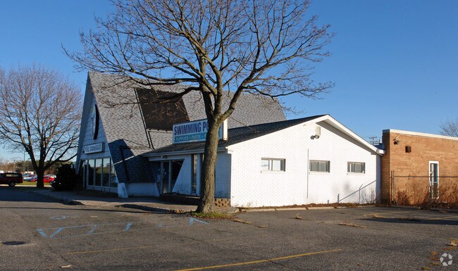
3450 Veterans Memorial Hwy
Nassau County-Suffolk County, NY
X2242215Y205558 N028N00000000
0500-147-00-02-00-060-003
Suffolk
Restaurantdrivein
New York
ICD
200
B and X Area of moderate flood hazard, usually the area between the limits of the 100-year and 500-year floods.
1 AC
0
Central Suffolk
2024
Long Island (New York)
146616
NEARBY LISTINGS FOR SALE OR LEASE
DEMOGRAPHICS near 3450 Veterans Memorial Hwy
1 mile
3 mile
5 mile
2024 Total Population
4,835
62,798
225,542
2029 Population
4,823
62,647
224,303
Pop Growth 2024-2029
(0.25%)
(0.24%)
(0.55%)
Average Age
41
42
42
2024 Total Households
1,779
21,528
76,206
HH Growth 2024-2029
(0.17%)
(0.29%)
(0.61%)
Median Household Inc
$124,511
$122,668
$125,565
Avg Household Size
2.70
2.80
2.80
2024 Avg HH Vehicles
2.00
2.00
2.00
Median Home Value
$601,492
$556,593
$597,136
Median Year Built
1969
1971
1970
Nearby Places
Map Layers
Map Styles
 Street
 Aerial
Transit
 Traffic
 Biking
Places
Listings with unknown addresses are not visible on the map
- Restaurants
- Banks
- Shops
- Fitness
- Groceries
PUBLIC TRANSPORTATION
COMMUTER RAIL
Ronkonkoma Station (Greenport Branch - Long Island Rail Road, Ronkonkoma Branch - Long Island Rail Road)
Drive
Walk
Distance
Ronkonkoma Station (Greenport Branch - Long Island Rail Road, Ronkonkoma Branch - Long Island Rail Road)
6 min
2.5 mi
Oakdale Station (Montauk Branch - Long Island Rail Road)
Drive
Walk
Distance
Oakdale Station (Montauk Branch - Long Island Rail Road)
9 min
3.3 mi
AIRPORT
Long Island MacArthur
Drive
Walk
Distance
Long Island MacArthur
6 min
1.9 mi
John F Kennedy International
Drive
Walk
Distance
John F Kennedy International
58 min
42.9 mi
Freight Ports
NY - Red Hook Container Terminal
Drive
Walk
Distance
NY - Red Hook Container Terminal
75 min
51.9 mi
SALE & LEASE HISTORY
LISTING DATE
SALE/LEASE

Sep 25, 2016
For Lease
Nearby Properties
Address
Land Use
TOTAL SIZE
Lot Size
Zoning
Address
Land Use
TOTAL SIZE
Lot Size
Zoning
1,207.60 AC
Address
Land Use
TOTAL SIZE
Lot Size
Zoning
2,057.30 AC
AAA
Address
Land Use
TOTAL SIZE
Lot Size
Zoning
69.90 AC
AA
Address
Land Use
TOTAL SIZE
Lot Size
Zoning
49.54 AC
CA
Address
Land Use
TOTAL SIZE
Lot Size
Zoning
27.90 AC
AA
Address
Land Use
TOTAL SIZE
Lot Size
Zoning
8.05 AC
NULL
Address
Land Use
TOTAL SIZE
Lot Size
Zoning
465.70 AC
AAA
Address
Land Use
TOTAL SIZE
Lot Size
Zoning
170.87 AC
AAA
Address
Land Use
TOTAL SIZE
Lot Size
Zoning
95.19 AC
Address
Land Use
TOTAL SIZE
Lot Size
Zoning
27.63 AC
C
Address
Land Use
TOTAL SIZE
Lot Size
Zoning
51.59 AC
AA
Address
Land Use
TOTAL SIZE
Lot Size
Zoning
360.60 AC
AAA
Address
Land Use
TOTAL SIZE
Lot Size
Zoning
26,811 SF
43.20 AC
CA
Address
Land Use
TOTAL SIZE
Lot Size
Zoning
339.70 AC
AAA
Address
Land Use
TOTAL SIZE
Lot Size
Zoning
31.30 AC
IND1
Address
Land Use
TOTAL SIZE
Lot Size
Zoning
18.68 AC
IND1
Address
Land Use
TOTAL SIZE
Lot Size
Zoning
23.80 AC
AAA
Address
Land Use
TOTAL SIZE
Lot Size
Zoning
3.16 AC
A
Address
Land Use
TOTAL SIZE
Lot Size
Zoning
97.24 AC
AAA
Address
Land Use
TOTAL SIZE
Lot Size
Zoning
20.29 AC
CA
Address
Land Use
TOTAL SIZE
Lot Size
Zoning
722 SF
24.39 AC
BUS3
Address
Land Use
TOTAL SIZE
Lot Size
Zoning
25 AC
AA
Address
Land Use
TOTAL SIZE
Lot Size
Zoning
23.08 AC
AA
Address
Land Use
TOTAL SIZE
Lot Size
Zoning
200.70 AC
AAA
Address
Land Use
TOTAL SIZE
Lot Size
Zoning
5.53 AC
ICD
Address
Land Use
TOTAL SIZE
Lot Size
Zoning
152.10 AC
AA
Address
Land Use
TOTAL SIZE
Lot Size
Zoning
11.19 AC
Address
Land Use
TOTAL SIZE
Lot Size
Zoning
14 AC
AAA
Address
Land Use
TOTAL SIZE
Lot Size
Zoning
9.38 AC
B
Address
Land Use
TOTAL SIZE
Lot Size
Zoning
16.90 AC
AA
The World's #1 Commercial Real Estate Marketplace
Connect with us
© 2026 CoStar Group
The information above has been obtained from sources believed reliable. While we do not doubt its accuracy we have not verified it and make no guarantee, warranty or representation about it. It is your responsibility to independently confirm its accuracy and completeness. Any projections, opinions, assumptions, or estimates used are for example only and do not represent the current or future performance of the property. The value of this transaction to you depends on tax and other factors which should be evaluated by your tax, financial, and legal advisors. You and your advisors should conduct a careful, independent investigation of the property to determine to your satisfaction the suitability of the property for your needs.