Property Record
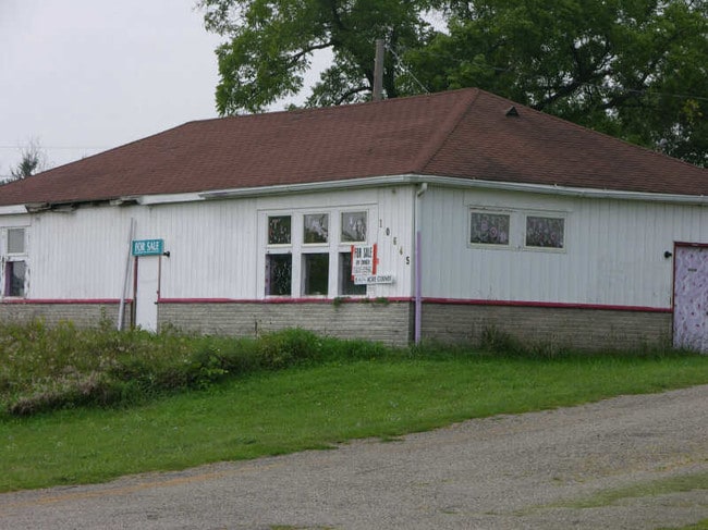
10655 Dixie Hwy, Davisburg, MI 48350


Property Detail
10655 Dixie Hwy
07-03-177-007
T4N, R8E, SEC 3 PART OF NW FRC 1/4 BEG AT PT DIST N 88-45-00 W 379.13 FT & N 27-34-40 E 55.78 FT FROM CEN OF SEC, TH N 88-45-00 W 216.04 FT, TH ALG CURVE TO LEFT, RAD 24195.40 FT, CHORD BEARS N 36-57-05 W 346.04 FT, DIST OF 346.04 FT, TH N 37-21-40 W
Storebuilding
Oakland
X
Michigan
26049C0475D
8.30 AC
2024
St Clair & Lapeer Counties
2025
Detroit
126300
Detroit-Warren-Dearborn, MI
5,503 SF
NEARBY LISTINGS FOR SALE OR LEASE
DEMOGRAPHICS near 10655 Dixie Hwy
1 mile
3 mile
5 mile
2024 Total Population
3,167
10,525
27,605
2029 Population
3,186
10,466
27,497
Pop Growth 2024-2029
+ 0.60%
(0.56%)
(0.39%)
Average Age
39
42
43
2024 Total Households
1,209
3,901
10,128
HH Growth 2024-2029
+ 0.58%
(0.62%)
(0.39%)
Median Household Inc
$80,862
$105,715
$107,737
Avg Household Size
2.50
2.70
2.70
2024 Avg HH Vehicles
2.00
2.00
2.00
Median Home Value
$311,574
$351,259
$348,588
Median Year Built
1995
1989
1986
Nearby Places
Map Layers
Map Styles
 Street
 Aerial
Transit
 Traffic
 Biking
Places
Listings with unknown addresses are not visible on the map
- Restaurants
- Banks
- Shops
- Fitness
- Groceries
PUBLIC TRANSPORTATION
AIRPORT
Bishop International
Drive
Walk
Distance
Bishop International
36 min
22.0 mi
Nearby Properties
Address
Land Use
TOTAL SIZE
Lot Size
Zoning
Address
Land Use
TOTAL SIZE
Lot Size
Zoning
8,617 SF
71.35 AC
MM
Address
Land Use
TOTAL SIZE
Lot Size
Zoning
6,981 SF
88.04 AC
Address
Land Use
TOTAL SIZE
Lot Size
Zoning
26,221 SF
15.76 AC
C2
Address
Land Use
TOTAL SIZE
Lot Size
Zoning
5,088 SF
18.48 AC
Address
Land Use
TOTAL SIZE
Lot Size
Zoning
44,258 SF
8.86 AC
C2GEN
Address
Land Use
TOTAL SIZE
Lot Size
Zoning
6,981 SF
10.78 AC
R1
Address
Land Use
TOTAL SIZE
Lot Size
Zoning
8,388 SF
17.09 AC
Address
Land Use
TOTAL SIZE
Lot Size
Zoning
59,491 SF
6.94 AC
C2GEN
Address
Land Use
TOTAL SIZE
Lot Size
Zoning
26,331 SF
6 AC
C2GEN
Address
Land Use
TOTAL SIZE
Lot Size
Zoning
57,600 SF
15.72 AC
M1LITE
Address
Land Use
TOTAL SIZE
Lot Size
Zoning
7,700 SF
26.61 AC
R1
Address
Land Use
TOTAL SIZE
Lot Size
Zoning
77,403 SF
4.58 AC
M1LITE
Address
Land Use
TOTAL SIZE
Lot Size
Zoning
6,651 SF
50.55 AC
Address
Land Use
TOTAL SIZE
Lot Size
Zoning
64,195 SF
5.01 AC
M1LITE
Address
Land Use
TOTAL SIZE
Lot Size
Zoning
14,218 SF
16.94 AC
Address
Land Use
TOTAL SIZE
Lot Size
Zoning
5,594 SF
10 AC
R1R
Address
Land Use
TOTAL SIZE
Lot Size
Zoning
4,706 SF
10.17 AC
R1R
Address
Land Use
TOTAL SIZE
Lot Size
Zoning
24.97 AC
Address
Land Use
TOTAL SIZE
Lot Size
Zoning
6,401 SF
20 AC
R1A
Address
Land Use
TOTAL SIZE
Lot Size
Zoning
3,470 SF
0.58 AC
R3
Address
Land Use
TOTAL SIZE
Lot Size
Zoning
16,585 SF
4 AC
R1
Address
Land Use
TOTAL SIZE
Lot Size
Zoning
5,127 SF
0.88 AC
PUD
Address
Land Use
TOTAL SIZE
Lot Size
Zoning
3,881 SF
21.14 AC
R1A
Address
Land Use
TOTAL SIZE
Lot Size
Zoning
3,781 SF
1.17 AC
PUD
Address
Land Use
TOTAL SIZE
Lot Size
Zoning
4,068 SF
1.44 AC
C2
Address
Land Use
TOTAL SIZE
Lot Size
Zoning
12,710 SF
18.88 AC
ME
Address
Land Use
TOTAL SIZE
Lot Size
Zoning
5,183 SF
1.01 AC
R2
Address
Land Use
TOTAL SIZE
Lot Size
Zoning
4,134 SF
0.81 AC
PUD
Address
Land Use
TOTAL SIZE
Lot Size
Zoning
4,361 SF
22.09 AC
R1
Address
Land Use
TOTAL SIZE
Lot Size
Zoning
1,524 SF
0.48 AC
R3
The World's #1 Commercial Real Estate Marketplace
Connect with us
© 2026 CoStar Group
The information above has been obtained from sources believed reliable. While we do not doubt its accuracy we have not verified it and make no guarantee, warranty or representation about it. It is your responsibility to independently confirm its accuracy and completeness. Any projections, opinions, assumptions, or estimates used are for example only and do not represent the current or future performance of the property. The value of this transaction to you depends on tax and other factors which should be evaluated by your tax, financial, and legal advisors. You and your advisors should conduct a careful, independent investigation of the property to determine to your satisfaction the suitability of the property for your needs.