Property Record
3295 Haggerty Rd, Commerce Township, MI 48390
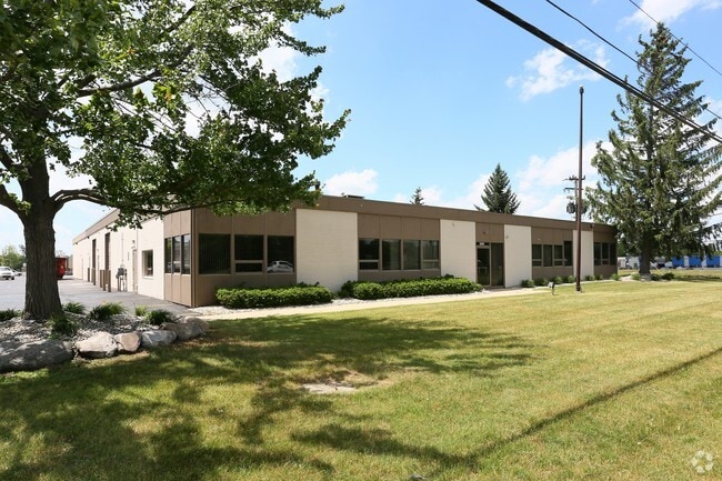


Property Detail
3295 Haggerty Rd
17-24-228-028
T2N, R8E, SEC 24 PART OF NE 1/4 BEG AT PT DIST S 02-05-35 E 380.11 FT & S 01-59-25 E 57.05 FT FROM NE SEC COR, TH S 01-59-25 E 170 FT, TH S 87-20-25 W 833.36 FT, TH N 02-01-50 W 170 FT, TH N 87-20-25 E 833.48 FT TO BEG, EXC BEG AT PT DIST S 02-05-35
Manufacturinglight
Oakland
II
Michigan
B and X Area of moderate flood hazard, usually the area between the limits of the 100-year and 500-year floods.
1.40 AC
2024
Central I-96 Corridor
2025
Detroit
134500
Detroit-Warren-Dearborn, MI
18,050 SF
NEARBY LISTINGS FOR SALE OR LEASE
DEMOGRAPHICS near 3295 Haggerty Rd
1 mile
3 mile
5 mile
2025 Total Population
4,053
51,597
159,068
2030 Population
4,156
52,726
162,288
Pop Growth 2025-2030
+ 2.54%
+ 2.19%
+ 2.02%
Average Age
42
44
44
2025 Total Households
1,401
20,566
64,629
HH Growth 2025-2030
+ 2.57%
+ 2.30%
+ 2.16%
Median Household Inc
$114,916
$106,894
$103,492
Avg Household Size
2.80
2.50
2.40
2025 Avg HH Vehicles
2.00
2.00
2.00
Median Home Value
$451,953
$379,804
$374,556
Median Year Built
1989
1984
1985
Nearby Places
Map Layers
Map Styles
 Street
 Aerial
Transit
 Traffic
 Biking
Places
Listings with unknown addresses are not visible on the map
- Restaurants
- Banks
- Shops
- Fitness
- Groceries
PUBLIC TRANSPORTATION
AIRPORT
Detroit Metro Wayne County
Drive
Walk
Distance
Detroit Metro Wayne County
44 min
32.9 mi
Windsor International
Drive
Walk
Distance
Windsor International
66 min
38.9 mi
Bishop International
Drive
Walk
Distance
Bishop International
63 min
39.0 mi
Nearby Properties
Address
Land Use
TOTAL SIZE
Lot Size
Zoning
Address
Land Use
TOTAL SIZE
Lot Size
Zoning
308,794 SF
76.30 AC
RI
Address
Land Use
TOTAL SIZE
Lot Size
Zoning
614,079 SF
57.44 AC
Address
Land Use
TOTAL SIZE
Lot Size
Zoning
659,897 SF
53.96 AC
AI
Address
Land Use
TOTAL SIZE
Lot Size
Zoning
400,505 SF
26.50 AC
Address
Land Use
TOTAL SIZE
Lot Size
Zoning
427,062 SF
31.20 AC
AI
Address
Land Use
TOTAL SIZE
Lot Size
Zoning
411,118 SF
43.95 AC
AI
Address
Land Use
TOTAL SIZE
Lot Size
Zoning
204,652 SF
9.62 AC
BI
Address
Land Use
TOTAL SIZE
Lot Size
Zoning
367,354 SF
62.73 AC
AI
Address
Land Use
TOTAL SIZE
Lot Size
Zoning
188,643 SF
12.81 AC
IV
Address
Land Use
TOTAL SIZE
Lot Size
Zoning
269,975 SF
23.88 AC
AI
Address
Land Use
TOTAL SIZE
Lot Size
Zoning
115,400 SF
9.38 AC
BI
Address
Land Use
TOTAL SIZE
Lot Size
Zoning
260,330 SF
21.04 AC
AI
Address
Land Use
TOTAL SIZE
Lot Size
Zoning
244,500 SF
7.80 AC
AI
Address
Land Use
TOTAL SIZE
Lot Size
Zoning
222,664 SF
21.10 AC
BI
Address
Land Use
TOTAL SIZE
Lot Size
Zoning
196,222 SF
Address
Land Use
TOTAL SIZE
Lot Size
Zoning
105,179 SF
14.55 AC
BI
Address
Land Use
TOTAL SIZE
Lot Size
Zoning
Address
Land Use
TOTAL SIZE
Lot Size
Zoning
66,230 SF
6 AC
BI
Address
Land Use
TOTAL SIZE
Lot Size
Zoning
118,592 SF
Address
Land Use
TOTAL SIZE
Lot Size
Zoning
93,440 SF
17.23 AC
BI
Address
Land Use
TOTAL SIZE
Lot Size
Zoning
169,638 SF
16.39 AC
Address
Land Use
TOTAL SIZE
Lot Size
Zoning
227,399 SF
14.73 AC
II
Address
Land Use
TOTAL SIZE
Lot Size
Zoning
206,191 SF
23.73 AC
Address
Land Use
TOTAL SIZE
Lot Size
Zoning
206,191 SF
Address
Land Use
TOTAL SIZE
Lot Size
Zoning
236,315 SF
35.86 AC
AI
Address
Land Use
TOTAL SIZE
Lot Size
Zoning
15,332 SF
10 AC
RI
Address
Land Use
TOTAL SIZE
Lot Size
Zoning
236,821 SF
15.45 AC
AI
Address
Land Use
TOTAL SIZE
Lot Size
Zoning
206,191 SF
24.88 AC
BI
Address
Land Use
TOTAL SIZE
Lot Size
Zoning
94,264 SF
4.24 AC
BI
Address
Land Use
TOTAL SIZE
Lot Size
Zoning
128,868 SF
13.25 AC
BI
The World's #1 Commercial Real Estate Marketplace
Connect with us
© 2026 CoStar Group
The information above has been obtained from sources believed reliable. While we do not doubt its accuracy we have not verified it and make no guarantee, warranty or representation about it. It is your responsibility to independently confirm its accuracy and completeness. Any projections, opinions, assumptions, or estimates used are for example only and do not represent the current or future performance of the property. The value of this transaction to you depends on tax and other factors which should be evaluated by your tax, financial, and legal advisors. You and your advisors should conduct a careful, independent investigation of the property to determine to your satisfaction the suitability of the property for your needs.