Property Record
8500 Cook Rd, Houston, TX 77072


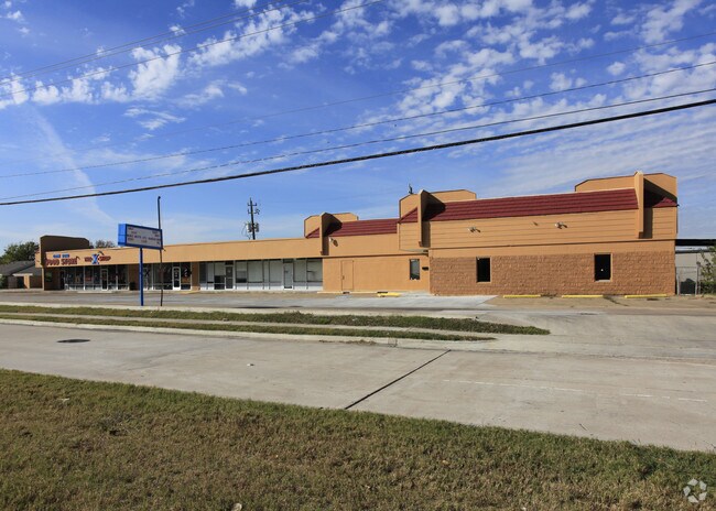

Property Detail
8500 Cook Rd
1054610660002
Wellington Park Patio Homes
Stripcommercialcenter
RES V1 WELLINGTON PARK PATIO HOMES
AE
Harris
48157C0165L
Texas
2024
0.76 AC
2025
Sugar Land
453702
Houston
8,558 SF
Houston-Pasadena-The Woodlands, TX
NEARBY LISTINGS FOR SALE OR LEASE
DEMOGRAPHICS near 8500 Cook Rd
1 mile
3 mile
5 mile
2024 Total Population
23,864
199,585
487,523
2029 Population
24,184
207,649
513,955
Pop Growth 2024-2029
+ 1.34%
+ 4.04%
+ 5.42%
Average Age
36
36
37
2024 Total Households
7,211
66,123
176,117
HH Growth 2024-2029
+ 1.37%
+ 4.10%
+ 5.26%
Median Household Inc
$46,046
$43,539
$49,137
Avg Household Size
3.20
2.90
2.70
2024 Avg HH Vehicles
2.00
2.00
2.00
Median Home Value
$147,348
$173,727
$208,761
Median Year Built
1978
1983
1984
Nearby Places
Map Layers
Map Styles
 Street
 Aerial
Transit
 Traffic
 Biking
Places
Listings with unknown addresses are not visible on the map
- Restaurants
- Banks
- Shops
- Fitness
- Groceries
PUBLIC TRANSPORTATION
AIRPORT
William P Hobby
Drive
Walk
Distance
William P Hobby
40 min
25.1 mi
George Bush Intcntl/Houston
Drive
Walk
Distance
George Bush Intcntl/Houston
45 min
36.3 mi
Freight Ports
Port of Houston
Drive
Walk
Distance
Port of Houston
41 min
26.1 mi
Nearby Properties
Address
Land Use
TOTAL SIZE
Lot Size
Zoning
Address
Land Use
TOTAL SIZE
Lot Size
Zoning
627,632 SF
24.12 AC
Address
Land Use
TOTAL SIZE
Lot Size
Zoning
771,720 SF
19.28 AC
Address
Land Use
TOTAL SIZE
Lot Size
Zoning
126,308 SF
16.95 AC
Address
Land Use
TOTAL SIZE
Lot Size
Zoning
76,385 SF
17.48 AC
Address
Land Use
TOTAL SIZE
Lot Size
Zoning
526,945 SF
23.05 AC
Address
Land Use
TOTAL SIZE
Lot Size
Zoning
61,006 SF
13.16 AC
X
Address
Land Use
TOTAL SIZE
Lot Size
Zoning
283,782 SF
11.57 AC
Address
Land Use
TOTAL SIZE
Lot Size
Zoning
183,015 SF
9.91 AC
Address
Land Use
TOTAL SIZE
Lot Size
Zoning
286,285 SF
11.78 AC
Address
Land Use
TOTAL SIZE
Lot Size
Zoning
291,196 SF
30.06 AC
SXY
Address
Land Use
TOTAL SIZE
Lot Size
Zoning
322,894 SF
17.51 AC
Address
Land Use
TOTAL SIZE
Lot Size
Zoning
725,466 SF
9.69 AC
Address
Land Use
TOTAL SIZE
Lot Size
Zoning
574,191 SF
8.32 AC
Address
Land Use
TOTAL SIZE
Lot Size
Zoning
355,887 SF
13.89 AC
Address
Land Use
TOTAL SIZE
Lot Size
Zoning
269,067 SF
17.98 AC
Address
Land Use
TOTAL SIZE
Lot Size
Zoning
329,954 SF
15.55 AC
SH
Address
Land Use
TOTAL SIZE
Lot Size
Zoning
364,674 SF
13.79 AC
Address
Land Use
TOTAL SIZE
Lot Size
Zoning
396,100 SF
18.02 AC
Address
Land Use
TOTAL SIZE
Lot Size
Zoning
459,199 SF
15.74 AC
Address
Land Use
TOTAL SIZE
Lot Size
Zoning
314,657 SF
17.77 AC
S
Address
Land Use
TOTAL SIZE
Lot Size
Zoning
45,216 SF
11.92 AC
SY
Address
Land Use
TOTAL SIZE
Lot Size
Zoning
307,488 SF
11 AC
Address
Land Use
TOTAL SIZE
Lot Size
Zoning
274,158 SF
10.51 AC
Address
Land Use
TOTAL SIZE
Lot Size
Zoning
299,622 SF
17.66 AC
MSY
Address
Land Use
TOTAL SIZE
Lot Size
Zoning
280,309 SF
9.98 AC
Address
Land Use
TOTAL SIZE
Lot Size
Zoning
282,636 SF
4.18 AC
Address
Land Use
TOTAL SIZE
Lot Size
Zoning
20.82 AC
Address
Land Use
TOTAL SIZE
Lot Size
Zoning
185,541 SF
10.51 AC
Address
Land Use
TOTAL SIZE
Lot Size
Zoning
280,253 SF
12.54 AC
Address
Land Use
TOTAL SIZE
Lot Size
Zoning
365,218 SF
25.48 AC
The World's #1 Commercial Real Estate Marketplace
Connect with us
© 2026 CoStar Group
The information above has been obtained from sources believed reliable. While we do not doubt its accuracy we have not verified it and make no guarantee, warranty or representation about it. It is your responsibility to independently confirm its accuracy and completeness. Any projections, opinions, assumptions, or estimates used are for example only and do not represent the current or future performance of the property. The value of this transaction to you depends on tax and other factors which should be evaluated by your tax, financial, and legal advisors. You and your advisors should conduct a careful, independent investigation of the property to determine to your satisfaction the suitability of the property for your needs.