Property Record
3852 Highway 17, Murrells Inlet, SC 29576
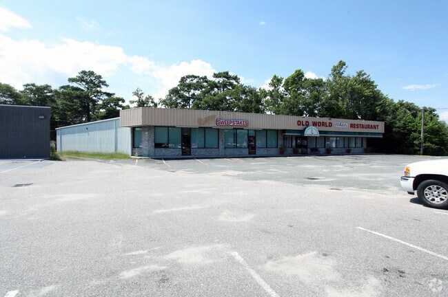
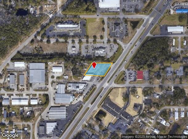
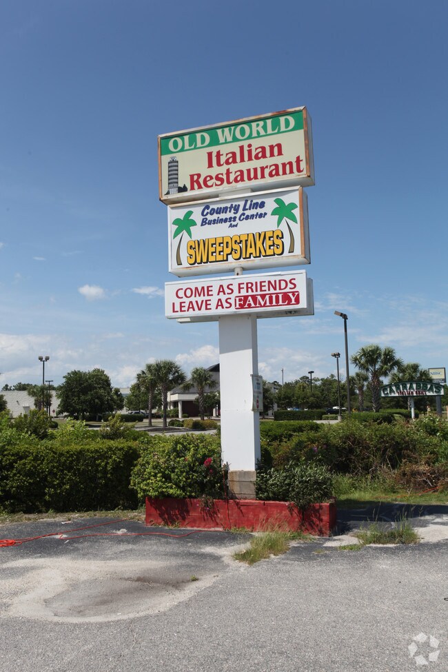

Property Detail
3852 Highway 17
41-0108-002-01-01
Bp17
Commercialnec
U S HWY 17
X
Georgetown
45043C0250G
South Carolina
2025
1 AC
2025
Myrtle Beach South
920510
Other Market Areas
7,488 SF
Murrells Inlet, SC
NEARBY LISTINGS FOR SALE OR LEASE
DEMOGRAPHICS near 3852 Highway 17
1 mile
3 mile
5 mile
2024 Total Population
3,468
29,293
52,847
2029 Population
3,702
33,888
62,821
Pop Growth 2024-2029
+ 6.75%
+ 15.69%
+ 18.87%
Average Age
52
53
52
2024 Total Households
1,637
13,936
24,693
HH Growth 2024-2029
+ 6.41%
+ 14.71%
+ 17.79%
Median Household Inc
$66,796
$60,290
$62,409
Avg Household Size
2.10
2.00
2.10
2024 Avg HH Vehicles
2.00
2.00
2.00
Median Home Value
$329,700
$265,045
$258,074
Median Year Built
2000
1999
1997
Nearby Places
Map Layers
Map Styles
 Street
 Aerial
Transit
 Traffic
 Biking
Places
Listings with unknown addresses are not visible on the map
- Restaurants
- Banks
- Shops
- Fitness
- Groceries
PUBLIC TRANSPORTATION
AIRPORT
Myrtle Beach International
Drive
Walk
Distance
Myrtle Beach International
21 min
14.1 mi
Nearby Properties
Address
Land Use
TOTAL SIZE
Lot Size
Zoning
Address
Land Use
TOTAL SIZE
Lot Size
Zoning
20.55 AC
Address
Land Use
TOTAL SIZE
Lot Size
Zoning
7,144 SF
188.69 AC
Address
Land Use
TOTAL SIZE
Lot Size
Zoning
151,727 SF
20.92 AC
Address
Land Use
TOTAL SIZE
Lot Size
Zoning
3,696 SF
55.20 AC
Address
Land Use
TOTAL SIZE
Lot Size
Zoning
2,510 SF
43.14 AC
Address
Land Use
TOTAL SIZE
Lot Size
Zoning
25,722 SF
13.73 AC
Address
Land Use
TOTAL SIZE
Lot Size
Zoning
8,640 SF
5.47 AC
Address
Land Use
TOTAL SIZE
Lot Size
Zoning
4,800 SF
75.54 AC
Address
Land Use
TOTAL SIZE
Lot Size
Zoning
65,578 SF
11.76 AC
Address
Land Use
TOTAL SIZE
Lot Size
Zoning
64,620 SF
7.90 AC
Address
Land Use
TOTAL SIZE
Lot Size
Zoning
69,048 SF
12.72 AC
Address
Land Use
TOTAL SIZE
Lot Size
Zoning
93,048 SF
2.24 AC
Address
Land Use
TOTAL SIZE
Lot Size
Zoning
38,829 SF
6.52 AC
Address
Land Use
TOTAL SIZE
Lot Size
Zoning
22,536 SF
3 AC
Address
Land Use
TOTAL SIZE
Lot Size
Zoning
231,700 SF
33.77 AC
Address
Land Use
TOTAL SIZE
Lot Size
Zoning
108,250 SF
13.52 AC
Address
Land Use
TOTAL SIZE
Lot Size
Zoning
56,259 SF
8.06 AC
Address
Land Use
TOTAL SIZE
Lot Size
Zoning
8,340 SF
5.26 AC
Address
Land Use
TOTAL SIZE
Lot Size
Zoning
148 SF
77.18 AC
Address
Land Use
TOTAL SIZE
Lot Size
Zoning
4,861 SF
1.05 AC
Address
Land Use
TOTAL SIZE
Lot Size
Zoning
4,576 SF
40.70 AC
Address
Land Use
TOTAL SIZE
Lot Size
Zoning
44,242 SF
6.27 AC
Address
Land Use
TOTAL SIZE
Lot Size
Zoning
39.14 AC
Address
Land Use
TOTAL SIZE
Lot Size
Zoning
50,630 SF
5.40 AC
Address
Land Use
TOTAL SIZE
Lot Size
Zoning
45,356 SF
7.99 AC
Address
Land Use
TOTAL SIZE
Lot Size
Zoning
37,976 SF
3.76 AC
Address
Land Use
TOTAL SIZE
Lot Size
Zoning
41,715 SF
5.28 AC
Address
Land Use
TOTAL SIZE
Lot Size
Zoning
46,806 SF
1.14 AC
Address
Land Use
TOTAL SIZE
Lot Size
Zoning
30,002 SF
1.99 AC
The World's #1 Commercial Real Estate Marketplace
Connect with us
© 2026 CoStar Group
The information above has been obtained from sources believed reliable. While we do not doubt its accuracy we have not verified it and make no guarantee, warranty or representation about it. It is your responsibility to independently confirm its accuracy and completeness. Any projections, opinions, assumptions, or estimates used are for example only and do not represent the current or future performance of the property. The value of this transaction to you depends on tax and other factors which should be evaluated by your tax, financial, and legal advisors. You and your advisors should conduct a careful, independent investigation of the property to determine to your satisfaction the suitability of the property for your needs.