Property Record
13705 Veterans Memorial Dr, Houston, TX 77014
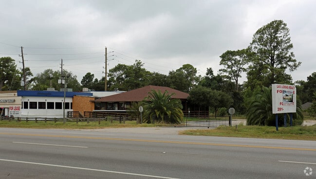


Property Detail
13705 Veterans Memorial Dr
1066150000037
RES C BLK 11 FOUNTAINHEAD SEC 1
Restaurantbuilding
HARRIS
B and X Area of moderate flood hazard, usually the area between the limits of the 100-year and 500-year floods.
Texas
2024
2.19 AC
2025
Willowbrook
551201
Houston
3,897 SF
Houston-Pasadena-The Woodlands, TX
NEARBY LISTINGS FOR SALE OR LEASE
DEMOGRAPHICS near 13705 Veterans Memorial Dr
1 mile
3 mile
5 mile
2024 Total Population
21,404
118,857
339,812
2029 Population
22,793
126,120
360,899
Pop Growth 2024-2029
+ 6.49%
+ 6.11%
+ 6.21%
Average Age
37
38
37
2024 Total Households
7,823
40,966
118,647
HH Growth 2024-2029
+ 6.72%
+ 6.38%
+ 6.49%
Median Household Inc
$57,907
$74,686
$67,129
Avg Household Size
2.70
2.80
2.80
2024 Avg HH Vehicles
2.00
2.00
2.00
Median Home Value
$266,115
$278,592
$274,546
Median Year Built
1985
1988
1990
Nearby Places
Map Layers
Map Styles
 Street
 Aerial
Transit
 Traffic
 Biking
Places
Listings with unknown addresses are not visible on the map
- Restaurants
- Banks
- Shops
- Fitness
- Groceries
PUBLIC TRANSPORTATION
AIRPORT
George Bush Intcntl/Houston
Drive
Walk
Distance
George Bush Intcntl/Houston
21 min
14.8 mi
William P Hobby
Drive
Walk
Distance
William P Hobby
50 min
30.3 mi
Freight Ports
Port of Houston
Drive
Walk
Distance
Port of Houston
41 min
25.9 mi
Nearby Properties
Address
Land Use
TOTAL SIZE
Lot Size
Zoning
Address
Land Use
TOTAL SIZE
Lot Size
Zoning
180,249 SF
13.35 AC
Address
Land Use
TOTAL SIZE
Lot Size
Zoning
402,504 SF
31.93 AC
Address
Land Use
TOTAL SIZE
Lot Size
Zoning
339,477 SF
13.54 AC
Address
Land Use
TOTAL SIZE
Lot Size
Zoning
286,090 SF
13.25 AC
Address
Land Use
TOTAL SIZE
Lot Size
Zoning
423,472 SF
28.91 AC
Address
Land Use
TOTAL SIZE
Lot Size
Zoning
351,235 SF
20.73 AC
Address
Land Use
TOTAL SIZE
Lot Size
Zoning
348,658 SF
16.72 AC
Address
Land Use
TOTAL SIZE
Lot Size
Zoning
335,106 SF
13.27 AC
Address
Land Use
TOTAL SIZE
Lot Size
Zoning
304,518 SF
15 AC
Address
Land Use
TOTAL SIZE
Lot Size
Zoning
329,812 SF
19.14 AC
Address
Land Use
TOTAL SIZE
Lot Size
Zoning
293,280 SF
16.24 AC
Address
Land Use
TOTAL SIZE
Lot Size
Zoning
222,479 SF
4.82 AC
Address
Land Use
TOTAL SIZE
Lot Size
Zoning
130,470 SF
9.22 AC
Address
Land Use
TOTAL SIZE
Lot Size
Zoning
241,946 SF
14.02 AC
Address
Land Use
TOTAL SIZE
Lot Size
Zoning
237,292 SF
11.91 AC
Address
Land Use
TOTAL SIZE
Lot Size
Zoning
247,670 SF
13.38 AC
Address
Land Use
TOTAL SIZE
Lot Size
Zoning
218,967 SF
14.11 AC
Address
Land Use
TOTAL SIZE
Lot Size
Zoning
217,594 SF
8.26 AC
Address
Land Use
TOTAL SIZE
Lot Size
Zoning
246,999 SF
9.27 AC
Address
Land Use
TOTAL SIZE
Lot Size
Zoning
211,200 SF
8.10 AC
Address
Land Use
TOTAL SIZE
Lot Size
Zoning
268,232 SF
12.33 AC
Address
Land Use
TOTAL SIZE
Lot Size
Zoning
221,352 SF
17.35 AC
Address
Land Use
TOTAL SIZE
Lot Size
Zoning
205,054 SF
10.05 AC
Address
Land Use
TOTAL SIZE
Lot Size
Zoning
204,633 SF
10.44 AC
Address
Land Use
TOTAL SIZE
Lot Size
Zoning
194,808 SF
11.09 AC
Address
Land Use
TOTAL SIZE
Lot Size
Zoning
286,341 SF
10.35 AC
Address
Land Use
TOTAL SIZE
Lot Size
Zoning
223,662 SF
10.79 AC
Address
Land Use
TOTAL SIZE
Lot Size
Zoning
215,133 SF
9.26 AC
Address
Land Use
TOTAL SIZE
Lot Size
Zoning
263,990 SF
10.98 AC
Address
Land Use
TOTAL SIZE
Lot Size
Zoning
194,816 SF
8 AC
The World's #1 Commercial Real Estate Marketplace
Connect with us
© 2026 CoStar Group
The information above has been obtained from sources believed reliable. While we do not doubt its accuracy we have not verified it and make no guarantee, warranty or representation about it. It is your responsibility to independently confirm its accuracy and completeness. Any projections, opinions, assumptions, or estimates used are for example only and do not represent the current or future performance of the property. The value of this transaction to you depends on tax and other factors which should be evaluated by your tax, financial, and legal advisors. You and your advisors should conduct a careful, independent investigation of the property to determine to your satisfaction the suitability of the property for your needs.