Property Record
351 W Main St, Westville, IN 46391

Property Detail
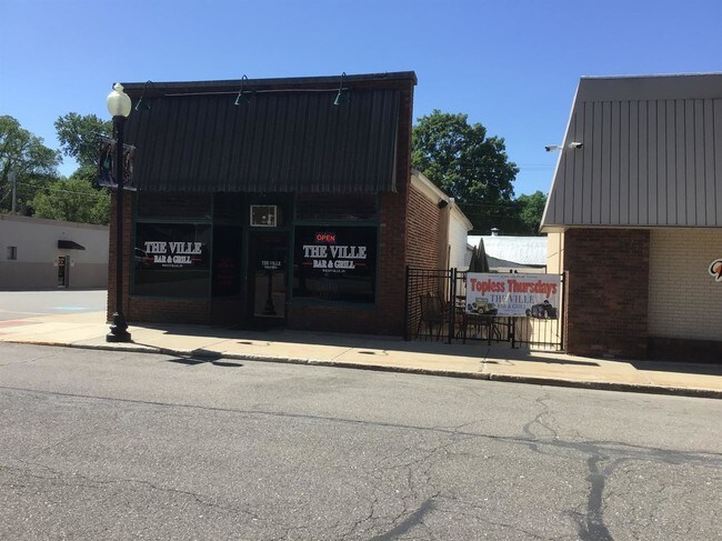
351 W Main St
Michigan City-La Porte, IN
49-09-29-288-011 28 FT E SD EX 45 FT S END CLYBURNS LT 1 BLK 6.
46-09-29-288-011.000-028
La Porte
Restaurantbuilding
Indiana
B and X Area of moderate flood hazard, usually the area between the limits of the 100-year and 500-year floods.
1
2024
0.04 AC
2025
South Bend/Elkhart
042601
Other Market Areas
682 SF
NEARBY LISTINGS FOR SALE OR LEASE
DEMOGRAPHICS near 351 W Main St
1 mile
3 mile
5 mile
2025 Total Population
4,606
8,089
12,072
2030 Population
4,543
8,000
11,916
Pop Growth 2025-2030
(1.37%)
(1.10%)
(1.29%)
Average Age
41
42
43
2025 Total Households
739
2,058
3,563
HH Growth 2025-2030
(2.57%)
(1.51%)
(1.63%)
Median Household Inc
$70,327
$81,493
$88,442
Avg Household Size
2.50
2.50
2.50
2025 Avg HH Vehicles
2.00
2.00
2.00
Median Home Value
$216,084
$244,796
$276,291
Median Year Built
1999
1995
1992
Nearby Places
Map Layers
Map Styles
 Street
 Aerial
Transit
 Traffic
 Biking
Places
Listings with unknown addresses are not visible on the map
- Restaurants
- Banks
- Shops
- Fitness
- Groceries
PUBLIC TRANSPORTATION
AIRPORT
South Bend International
Drive
Walk
Distance
South Bend International
61 min
43.0 mi
SALE & LEASE HISTORY
LISTING DATE
SALE/LEASE

Sep 26, 2017
For Sale
Aug 22, 2022
For Sale
Aug 20, 2019
For Sale
Nearby Properties
Address
Land Use
TOTAL SIZE
Lot Size
Zoning
Address
Land Use
TOTAL SIZE
Lot Size
Zoning
3,025 SF
51.01 AC
Address
Land Use
TOTAL SIZE
Lot Size
Zoning
120,218 SF
91.18 AC
Address
Land Use
TOTAL SIZE
Lot Size
Zoning
52,908 SF
6.14 AC
Address
Land Use
TOTAL SIZE
Lot Size
Zoning
323 SF
1.96 AC
Address
Land Use
TOTAL SIZE
Lot Size
Zoning
37,880 SF
3.24 AC
Address
Land Use
TOTAL SIZE
Lot Size
Zoning
29,121 SF
2.90 AC
Address
Land Use
TOTAL SIZE
Lot Size
Zoning
90.83 AC
Address
Land Use
TOTAL SIZE
Lot Size
Zoning
10,526 SF
54.56 AC
Address
Land Use
TOTAL SIZE
Lot Size
Zoning
28,222 SF
27.64 AC
Address
Land Use
TOTAL SIZE
Lot Size
Zoning
4,248 SF
12.95 AC
Address
Land Use
TOTAL SIZE
Lot Size
Zoning
57,000 SF
10 AC
Address
Land Use
TOTAL SIZE
Lot Size
Zoning
5,816 SF
12.92 AC
Address
Land Use
TOTAL SIZE
Lot Size
Zoning
480 SF
19.43 AC
Address
Land Use
TOTAL SIZE
Lot Size
Zoning
5,320 SF
4.20 AC
Address
Land Use
TOTAL SIZE
Lot Size
Zoning
5,547 SF
10 AC
Address
Land Use
TOTAL SIZE
Lot Size
Zoning
6,444 SF
11.43 AC
Address
Land Use
TOTAL SIZE
Lot Size
Zoning
5,570 SF
1.37 AC
Address
Land Use
TOTAL SIZE
Lot Size
Zoning
1,966 SF
Address
Land Use
TOTAL SIZE
Lot Size
Zoning
6,808 SF
10.03 AC
Address
Land Use
TOTAL SIZE
Lot Size
Zoning
9,070 SF
1.09 AC
Address
Land Use
TOTAL SIZE
Lot Size
Zoning
3,480 SF
12.78 AC
Address
Land Use
TOTAL SIZE
Lot Size
Zoning
29,580 SF
3.32 AC
Address
Land Use
TOTAL SIZE
Lot Size
Zoning
14,120 SF
21.80 AC
Address
Land Use
TOTAL SIZE
Lot Size
Zoning
4,612 SF
12.40 AC
Address
Land Use
TOTAL SIZE
Lot Size
Zoning
33.86 AC
Address
Land Use
TOTAL SIZE
Lot Size
Zoning
200 SF
0.82 AC
Address
Land Use
TOTAL SIZE
Lot Size
Zoning
4,626 SF
1.06 AC
Address
Land Use
TOTAL SIZE
Lot Size
Zoning
6,364 SF
83.77 AC
Address
Land Use
TOTAL SIZE
Lot Size
Zoning
6,242 SF
34.58 AC
Address
Land Use
TOTAL SIZE
Lot Size
Zoning
12,780 SF
8.34 AC
The World's #1 Commercial Real Estate Marketplace
Connect with us
© 2026 CoStar Group
The information above has been obtained from sources believed reliable. While we do not doubt its accuracy we have not verified it and make no guarantee, warranty or representation about it. It is your responsibility to independently confirm its accuracy and completeness. Any projections, opinions, assumptions, or estimates used are for example only and do not represent the current or future performance of the property. The value of this transaction to you depends on tax and other factors which should be evaluated by your tax, financial, and legal advisors. You and your advisors should conduct a careful, independent investigation of the property to determine to your satisfaction the suitability of the property for your needs.