Property Record
Hayward St Parking, Schoolcraft, MI 49087

Property Detail
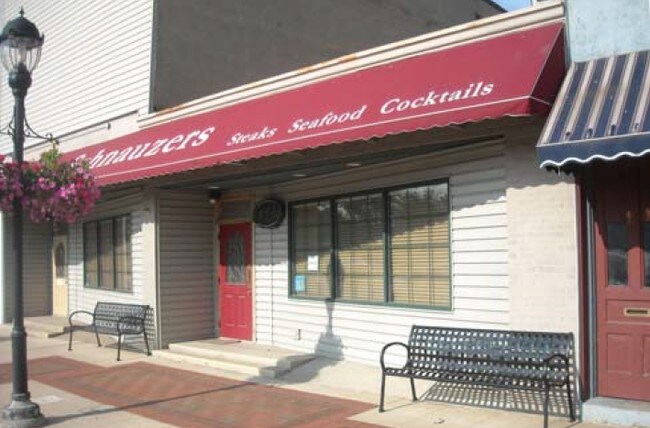
Hayward St Parking
Kalamazoo-Portage, MI
S 1-61-2 VILLAGE OF SCHOOLCRAFT ORIGINAL PLAT E1/2 S1/2 S 1/2 ALSO E 29 FT W1/2 S1/2 S1/2 LOT 121
14-18-382-090
KALAMAZOO
Commercialnec
Michigan
PH679-4304
121
B and X Area of moderate flood hazard, usually the area between the limits of the 100-year and 500-year floods.
0.04 AC
2025
Southern Kalamazoo County
2025
West Michigan
006102
NEARBY LISTINGS FOR SALE OR LEASE
DEMOGRAPHICS near Hayward St Parking
1 mile
3 mile
5 mile
2024 Total Population
1,556
3,672
14,614
2029 Population
1,533
3,625
14,603
Pop Growth 2024-2029
(1.48%)
(1.28%)
(0.08%)
Average Age
41
42
41
2024 Total Households
631
1,433
5,632
HH Growth 2024-2029
(1.74%)
(1.47%)
(0.27%)
Median Household Inc
$75,641
$82,935
$89,923
Avg Household Size
2.40
2.50
2.60
2024 Avg HH Vehicles
2.00
2.00
2.00
Median Home Value
$244,623
$289,266
$293,939
Median Year Built
1968
1978
1979
Nearby Places
Map Layers
Map Styles
 Street
 Aerial
Transit
 Traffic
 Biking
Places
Listings with unknown addresses are not visible on the map
- Restaurants
- Banks
- Shops
- Fitness
- Groceries
PUBLIC TRANSPORTATION
AIRPORT
Kalamazoo/Battle Creek International
Drive
Walk
Distance
Kalamazoo/Battle Creek International
22 min
14.1 mi
Freight Ports
Port of Toledo
Drive
Walk
Distance
Port of Toledo
180 min
151.9 mi
SALE & LEASE HISTORY
LISTING DATE
SALE/LEASE

Sep 24, 2016
For Sale
Nearby Properties
Address
Land Use
TOTAL SIZE
Lot Size
Zoning
Address
Land Use
TOTAL SIZE
Lot Size
Zoning
165,750 SF
60 AC
Address
Land Use
TOTAL SIZE
Lot Size
Zoning
Address
Land Use
TOTAL SIZE
Lot Size
Zoning
Address
Land Use
TOTAL SIZE
Lot Size
Zoning
19,497 SF
6.38 AC
SCHTWP.ORG
Address
Land Use
TOTAL SIZE
Lot Size
Zoning
137,342 SF
20.98 AC
Address
Land Use
TOTAL SIZE
Lot Size
Zoning
Address
Land Use
TOTAL SIZE
Lot Size
Zoning
49,980 SF
15.73 AC
Address
Land Use
TOTAL SIZE
Lot Size
Zoning
53,450 SF
6 AC
Address
Land Use
TOTAL SIZE
Lot Size
Zoning
2,062 SF
142.41 AC
AG
Address
Land Use
TOTAL SIZE
Lot Size
Zoning
6.10 AC
Address
Land Use
TOTAL SIZE
Lot Size
Zoning
152,546 SF
10.68 AC
Address
Land Use
TOTAL SIZE
Lot Size
Zoning
62,520 SF
5.95 AC
Address
Land Use
TOTAL SIZE
Lot Size
Zoning
51.47 AC
SCHTWP.ORG
Address
Land Use
TOTAL SIZE
Lot Size
Zoning
7,972 SF
26.05 AC
AG
Address
Land Use
TOTAL SIZE
Lot Size
Zoning
1,562 SF
127.04 AC
AG
Address
Land Use
TOTAL SIZE
Lot Size
Zoning
29,750 SF
8.01 AC
Address
Land Use
TOTAL SIZE
Lot Size
Zoning
2,150 SF
135.77 AC
AG
Address
Land Use
TOTAL SIZE
Lot Size
Zoning
4.80 AC
Address
Land Use
TOTAL SIZE
Lot Size
Zoning
41,618 SF
7.30 AC
Address
Land Use
TOTAL SIZE
Lot Size
Zoning
49,196 SF
4.02 AC
Address
Land Use
TOTAL SIZE
Lot Size
Zoning
Address
Land Use
TOTAL SIZE
Lot Size
Zoning
5,760 SF
2.36 AC
Address
Land Use
TOTAL SIZE
Lot Size
Zoning
1,872 SF
160.88 AC
AG
Address
Land Use
TOTAL SIZE
Lot Size
Zoning
205.43 AC
AG
Address
Land Use
TOTAL SIZE
Lot Size
Zoning
1,456 SF
135.97 AC
AG
Address
Land Use
TOTAL SIZE
Lot Size
Zoning
19,528 SF
4.68 AC
Address
Land Use
TOTAL SIZE
Lot Size
Zoning
6,247 SF
4.03 AC
Address
Land Use
TOTAL SIZE
Lot Size
Zoning
2,222 SF
101.66 AC
AG
Address
Land Use
TOTAL SIZE
Lot Size
Zoning
6,144 SF
1 AC
Address
Land Use
TOTAL SIZE
Lot Size
Zoning
160 AC
SCHTWP.ORG
The World's #1 Commercial Real Estate Marketplace
Connect with us
© 2026 CoStar Group
The information above has been obtained from sources believed reliable. While we do not doubt its accuracy we have not verified it and make no guarantee, warranty or representation about it. It is your responsibility to independently confirm its accuracy and completeness. Any projections, opinions, assumptions, or estimates used are for example only and do not represent the current or future performance of the property. The value of this transaction to you depends on tax and other factors which should be evaluated by your tax, financial, and legal advisors. You and your advisors should conduct a careful, independent investigation of the property to determine to your satisfaction the suitability of the property for your needs.