Property Record
35831 Highway 58, Pleasant Hill, OR 97455


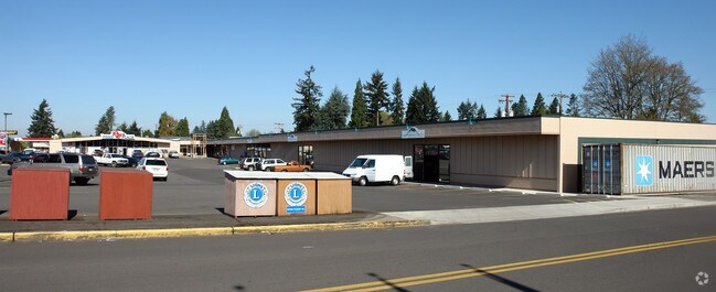
Property Detail
35831 Highway 58
Eugene-Springfield, OR
TL 01300
1001781
Lane
Commercialbuilding
Oregon
X
1300
41039C1655F
0.55 AC
2025
Lane County
2025
Portland
001700
NEARBY LISTINGS FOR SALE OR LEASE
-
-
View all Pleasant Hill listings for lease on LoopNet.com
DEMOGRAPHICS near 35831 Highway 58
1 mile
3 mile
5 mile
2024 Total Population
665
3,466
16,151
2029 Population
656
3,416
16,071
Pop Growth 2024-2029
(1.35%)
(1.44%)
(0.50%)
Average Age
46
46
43
2024 Total Households
256
1,297
6,106
HH Growth 2024-2029
(1.17%)
(1.46%)
(0.61%)
Median Household Inc
$84,821
$95,364
$75,624
Avg Household Size
2.50
2.50
2.60
2024 Avg HH Vehicles
2.00
2.00
2.00
Median Home Value
$471,428
$492,150
$377,179
Median Year Built
1968
1970
1989
Nearby Places
Map Layers
Map Styles
 Street
 Aerial
Transit
 Traffic
 Biking
Places
Listings with unknown addresses are not visible on the map
- Restaurants
- Banks
- Shops
- Fitness
- Groceries
PUBLIC TRANSPORTATION
AIRPORT
Mahlon Sweet Field
Drive
Walk
Distance
Mahlon Sweet Field
32 min
21.0 mi
SALE & LEASE HISTORY
LISTING DATE
SALE/LEASE

Sep 25, 2016
For Lease
Mar 04, 2020
For Lease
Nearby Properties
Address
Land Use
TOTAL SIZE
Lot Size
Zoning
Address
Land Use
TOTAL SIZE
Lot Size
Zoning
16.29 AC
E40
Address
Land Use
TOTAL SIZE
Lot Size
Zoning
20.50 AC
E40
Address
Land Use
TOTAL SIZE
Lot Size
Zoning
840 SF
13.37 AC
E25
Address
Land Use
TOTAL SIZE
Lot Size
Zoning
6.78 AC
RR5
Address
Land Use
TOTAL SIZE
Lot Size
Zoning
7,546 SF
4.85 AC
F1
Address
Land Use
TOTAL SIZE
Lot Size
Zoning
2.63 AC
RC
Address
Land Use
TOTAL SIZE
Lot Size
Zoning
5,232 SF
14.92 AC
E25
Address
Land Use
TOTAL SIZE
Lot Size
Zoning
7,433 SF
2 AC
RR2
Address
Land Use
TOTAL SIZE
Lot Size
Zoning
4.33 AC
RR5
Address
Land Use
TOTAL SIZE
Lot Size
Zoning
7,928 SF
131.18 AC
E40
Address
Land Use
TOTAL SIZE
Lot Size
Zoning
5,086 SF
30 AC
E30
Address
Land Use
TOTAL SIZE
Lot Size
Zoning
9,348 SF
4.21 AC
RR2
Address
Land Use
TOTAL SIZE
Lot Size
Zoning
561.24 AC
E25
Address
Land Use
TOTAL SIZE
Lot Size
Zoning
8,411 SF
3.93 AC
RPF
Address
Land Use
TOTAL SIZE
Lot Size
Zoning
5 AC
RI
Address
Land Use
TOTAL SIZE
Lot Size
Zoning
7,701 SF
14.88 AC
E25
Address
Land Use
TOTAL SIZE
Lot Size
Zoning
5,672 SF
4.45 AC
F2
Address
Land Use
TOTAL SIZE
Lot Size
Zoning
4,777 SF
3.41 AC
E40
Address
Land Use
TOTAL SIZE
Lot Size
Zoning
8,085 SF
5.17 AC
F2
Address
Land Use
TOTAL SIZE
Lot Size
Zoning
4,884 SF
59.02 AC
E40
Address
Land Use
TOTAL SIZE
Lot Size
Zoning
5,175 SF
6.85 AC
E25
Address
Land Use
TOTAL SIZE
Lot Size
Zoning
6,437 SF
2.87 AC
E25
Address
Land Use
TOTAL SIZE
Lot Size
Zoning
6,878 SF
17.41 AC
E25
Address
Land Use
TOTAL SIZE
Lot Size
Zoning
6,625 SF
5 AC
F2
Address
Land Use
TOTAL SIZE
Lot Size
Zoning
4,006 SF
56.76 AC
E40
Address
Land Use
TOTAL SIZE
Lot Size
Zoning
5,872 SF
5 AC
F2
Address
Land Use
TOTAL SIZE
Lot Size
Zoning
5,617 SF
51.93 AC
E40
Address
Land Use
TOTAL SIZE
Lot Size
Zoning
6,625 SF
5 AC
F2
Address
Land Use
TOTAL SIZE
Lot Size
Zoning
6,043 SF
2.07 AC
RR2
Address
Land Use
TOTAL SIZE
Lot Size
Zoning
5,294 SF
4.86 AC
RR5
The World's #1 Commercial Real Estate Marketplace
Connect with us
© 2026 CoStar Group
The information above has been obtained from sources believed reliable. While we do not doubt its accuracy we have not verified it and make no guarantee, warranty or representation about it. It is your responsibility to independently confirm its accuracy and completeness. Any projections, opinions, assumptions, or estimates used are for example only and do not represent the current or future performance of the property. The value of this transaction to you depends on tax and other factors which should be evaluated by your tax, financial, and legal advisors. You and your advisors should conduct a careful, independent investigation of the property to determine to your satisfaction the suitability of the property for your needs.