Property Record
183 Route 206, Hillsborough, NJ 08844

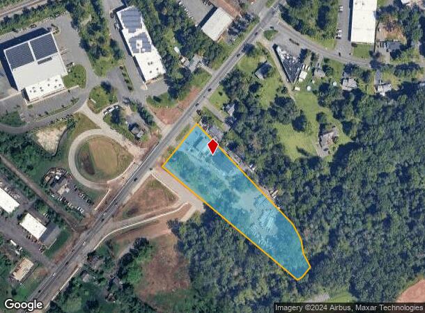

Property Detail
183 Route 206
10-00141-0000-00034-02
Somerset
Vacantlandnec
New Jersey
AE
34.2
34035C0161E
3.32 AC
2024
Princeton North
2025
Northern New Jersey
053805
Lakewood-New Brunswick, NJ
4,600 SF
NEARBY LISTINGS FOR SALE OR LEASE
DEMOGRAPHICS near 183 Route 206
1 mile
3 mile
5 mile
2024 Total Population
4,719
55,790
126,689
2029 Population
4,758
56,036
127,009
Pop Growth 2024-2029
+ 0.83%
+ 0.44%
+ 0.25%
Average Age
42
41
42
2024 Total Households
1,845
21,676
47,059
HH Growth 2024-2029
+ 0.81%
+ 0.49%
+ 0.29%
Median Household Inc
$112,933
$104,443
$118,603
Avg Household Size
2.40
2.50
2.60
2024 Avg HH Vehicles
2.00
2.00
2.00
Median Home Value
$488,059
$370,983
$431,932
Median Year Built
2010
1977
1981
Nearby Places
Map Layers
Map Styles
 Street
 Aerial
Transit
 Traffic
 Biking
Places
Listings with unknown addresses are not visible on the map
- Restaurants
- Banks
- Shops
- Fitness
- Groceries
PUBLIC TRANSPORTATION
COMMUTER RAIL
Somerville (Raritan Valley Line - NJ Transit Commuter Rail (NJ Transit))
Drive
Walk
Distance
Somerville (Raritan Valley Line - NJ Transit Commuter Rail (NJ Transit))
5 min
2.6 mi
Raritan (Raritan Valley Line - NJ Transit Commuter Rail (NJ Transit))
Drive
Walk
Distance
Raritan (Raritan Valley Line - NJ Transit Commuter Rail (NJ Transit))
6 min
3.7 mi
AIRPORT
Trenton Mercer
Drive
Walk
Distance
Trenton Mercer
43 min
26.9 mi
Newark Liberty International
Drive
Walk
Distance
Newark Liberty International
45 min
37.3 mi
Freight Ports
New York Container Terminal
Drive
Walk
Distance
New York Container Terminal
46 min
33.9 mi
Nearby Properties
Address
Land Use
TOTAL SIZE
Lot Size
Zoning
Address
Land Use
TOTAL SIZE
Lot Size
Zoning
13.59 AC
H
Address
Land Use
TOTAL SIZE
Lot Size
Zoning
22.36 AC
PAC
Address
Land Use
TOTAL SIZE
Lot Size
Zoning
153 AC
Address
Land Use
TOTAL SIZE
Lot Size
Zoning
25.70 AC
PACD
Address
Land Use
TOTAL SIZE
Lot Size
Zoning
Address
Land Use
TOTAL SIZE
Lot Size
Zoning
82.79 AC
M2
Address
Land Use
TOTAL SIZE
Lot Size
Zoning
10.31 AC
PDRD
Address
Land Use
TOTAL SIZE
Lot Size
Zoning
5.60 AC
CG
Address
Land Use
TOTAL SIZE
Lot Size
Zoning
1,056 SF
0.07 AC
Address
Land Use
TOTAL SIZE
Lot Size
Zoning
25 SF
10.43 AC
M2
Address
Land Use
TOTAL SIZE
Lot Size
Zoning
268,441 SF
52.97 AC
02
Address
Land Use
TOTAL SIZE
Lot Size
Zoning
289,939 SF
27.31 AC
MUID
Address
Land Use
TOTAL SIZE
Lot Size
Zoning
14.06 AC
GV
Address
Land Use
TOTAL SIZE
Lot Size
Zoning
61,757 SF
8.75 AC
TC
Address
Land Use
TOTAL SIZE
Lot Size
Zoning
27.06 AC
GV
Address
Land Use
TOTAL SIZE
Lot Size
Zoning
Address
Land Use
TOTAL SIZE
Lot Size
Zoning
114.10 AC
M2
Address
Land Use
TOTAL SIZE
Lot Size
Zoning
111,204 SF
26.68 AC
PD
Address
Land Use
TOTAL SIZE
Lot Size
Zoning
1,383 SF
259.46 AC
ED
Address
Land Use
TOTAL SIZE
Lot Size
Zoning
43.66 AC
ARPD
Address
Land Use
TOTAL SIZE
Lot Size
Zoning
780 SF
9.89 AC
GA
Address
Land Use
TOTAL SIZE
Lot Size
Zoning
Address
Land Use
TOTAL SIZE
Lot Size
Zoning
121,478 SF
19.33 AC
TC
Address
Land Use
TOTAL SIZE
Lot Size
Zoning
31.27 AC
Address
Land Use
TOTAL SIZE
Lot Size
Zoning
1,096 SF
17.75 AC
TC
Address
Land Use
TOTAL SIZE
Lot Size
Zoning
22.95 AC
ARPD
Address
Land Use
TOTAL SIZE
Lot Size
Zoning
1.81 AC
B-3
Address
Land Use
TOTAL SIZE
Lot Size
Zoning
27.10 AC
Address
Land Use
TOTAL SIZE
Lot Size
Zoning
8.61 AC
R10
Address
Land Use
TOTAL SIZE
Lot Size
Zoning
20.04 AC
R10
The World's #1 Commercial Real Estate Marketplace
Connect with us
© 2026 CoStar Group
The information above has been obtained from sources believed reliable. While we do not doubt its accuracy we have not verified it and make no guarantee, warranty or representation about it. It is your responsibility to independently confirm its accuracy and completeness. Any projections, opinions, assumptions, or estimates used are for example only and do not represent the current or future performance of the property. The value of this transaction to you depends on tax and other factors which should be evaluated by your tax, financial, and legal advisors. You and your advisors should conduct a careful, independent investigation of the property to determine to your satisfaction the suitability of the property for your needs.