Property Record
157 Kimbles Rd, Hawley, PA 18428
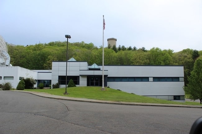

Property Detail
157 Kimbles Rd
010508
15.50 AC INELIG 191.18 ACT319 2 HSES 4 OBS SATELLITE STATION
Agriculturalland
Pike
A Areas with a 1% annual chance of flooding and a 26% chance of flooding over the life of a 30-year mortgage.
Pennsylvania
2024
206.68 AC
2025
Pike County
950303
Northern New Jersey
11,287 SF
Hemlock Farms, PA
NEARBY LISTINGS FOR SALE OR LEASE
DEMOGRAPHICS near 157 Kimbles Rd
1 mile
3 mile
5 mile
2025 Total Population
137
3,330
8,045
2030 Population
139
3,404
8,399
Pop Growth 2025-2030
+ 1.46%
+ 2.22%
+ 4.40%
Average Age
46
46
47
2025 Total Households
55
1,474
3,513
HH Growth 2025-2030
+ 1.82%
+ 2.17%
+ 4.38%
Median Household Inc
$74,999
$69,626
$69,194
Avg Household Size
2.30
2.20
2.20
2025 Avg HH Vehicles
2.00
2.00
2.00
Median Home Value
$268,420
$271,293
$285,328
Median Year Built
1984
1980
1983
Nearby Places
Map Layers
Map Styles
 Street
 Aerial
Transit
 Traffic
 Biking
Places
Listings with unknown addresses are not visible on the map
- Restaurants
- Banks
- Shops
- Fitness
- Groceries
PUBLIC TRANSPORTATION
AIRPORT
Wilkes-Barre/Scranton International
Drive
Walk
Distance
Wilkes-Barre/Scranton International
70 min
49.1 mi
Nearby Properties
Address
Land Use
TOTAL SIZE
Lot Size
Zoning
Address
Land Use
TOTAL SIZE
Lot Size
Zoning
Address
Land Use
TOTAL SIZE
Lot Size
Zoning
5.93 AC
B2
Address
Land Use
TOTAL SIZE
Lot Size
Zoning
6.70 AC
Address
Land Use
TOTAL SIZE
Lot Size
Zoning
3.67 AC
Address
Land Use
TOTAL SIZE
Lot Size
Zoning
0.79 AC
Address
Land Use
TOTAL SIZE
Lot Size
Zoning
3,575 SF
0.56 AC
R-1
Address
Land Use
TOTAL SIZE
Lot Size
Zoning
235,718 SF
30.55 AC
Address
Land Use
TOTAL SIZE
Lot Size
Zoning
6,927 SF
0.17 AC
B2
Address
Land Use
TOTAL SIZE
Lot Size
Zoning
755 SF
0.81 AC
B2
Address
Land Use
TOTAL SIZE
Lot Size
Zoning
0.17 AC
B-2
Address
Land Use
TOTAL SIZE
Lot Size
Zoning
1.20 AC
I1
Address
Land Use
TOTAL SIZE
Lot Size
Zoning
1.20 AC
Address
Land Use
TOTAL SIZE
Lot Size
Zoning
7,840 SF
3,084.93 AC
Address
Land Use
TOTAL SIZE
Lot Size
Zoning
1.03 AC
B-2
Address
Land Use
TOTAL SIZE
Lot Size
Zoning
0.27 AC
Address
Land Use
TOTAL SIZE
Lot Size
Zoning
3,360 SF
1.39 AC
Address
Land Use
TOTAL SIZE
Lot Size
Zoning
0.83 AC
R1
Address
Land Use
TOTAL SIZE
Lot Size
Zoning
15,840 SF
0.34 AC
B2
Address
Land Use
TOTAL SIZE
Lot Size
Zoning
1.15 AC
Address
Land Use
TOTAL SIZE
Lot Size
Zoning
6,626 SF
0.12 AC
B-2
Address
Land Use
TOTAL SIZE
Lot Size
Zoning
33,609 SF
376.99 AC
Address
Land Use
TOTAL SIZE
Lot Size
Zoning
1.07 AC
Address
Land Use
TOTAL SIZE
Lot Size
Zoning
0.08 AC
B2
Address
Land Use
TOTAL SIZE
Lot Size
Zoning
2,730 SF
0.54 AC
B-2
Address
Land Use
TOTAL SIZE
Lot Size
Zoning
0.17 AC
B-2
Address
Land Use
TOTAL SIZE
Lot Size
Zoning
6,049 SF
0.42 AC
B2
Address
Land Use
TOTAL SIZE
Lot Size
Zoning
0.27 AC
B2
Address
Land Use
TOTAL SIZE
Lot Size
Zoning
1.80 AC
The World's #1 Commercial Real Estate Marketplace
Connect with us
© 2026 CoStar Group
The information above has been obtained from sources believed reliable. While we do not doubt its accuracy we have not verified it and make no guarantee, warranty or representation about it. It is your responsibility to independently confirm its accuracy and completeness. Any projections, opinions, assumptions, or estimates used are for example only and do not represent the current or future performance of the property. The value of this transaction to you depends on tax and other factors which should be evaluated by your tax, financial, and legal advisors. You and your advisors should conduct a careful, independent investigation of the property to determine to your satisfaction the suitability of the property for your needs.