Property Record
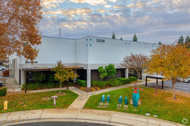
2029 Opportunity Dr, Roseville, CA 95678


Property Detail
2029 Opportunity Dr
Sacramento-Roseville-Folsom, CA
1.9 AC LOT 8 & POR LOT 7 VINEYARD POINTE BUS PARK
473-150-023
Placer
Lightindustrial
California
B and X Area of moderate flood hazard, usually the area between the limits of the 100-year and 500-year floods.
8,7
2024
1.90 AC
2025
Roseville/Rocklin
020908
Sacramento
28,400 SF
NEARBY LISTINGS FOR SALE OR LEASE
DEMOGRAPHICS near 2029 Opportunity Dr
1 mile
3 mile
5 mile
2025 Total Population
9,960
115,797
351,922
2030 Population
10,313
119,193
361,978
Pop Growth 2025-2030
+ 3.54%
+ 2.93%
+ 2.86%
Average Age
38
40
40
2025 Total Households
3,737
42,385
128,896
HH Growth 2025-2030
+ 3.51%
+ 3.01%
+ 2.91%
Median Household Inc
$93,354
$97,903
$96,367
Avg Household Size
2.60
2.70
2.70
2025 Avg HH Vehicles
2.00
2.00
2.00
Median Home Value
$478,779
$566,980
$573,770
Median Year Built
1981
1985
1987
Nearby Places
Map Layers
Map Styles
 Street
 Aerial
Transit
 Traffic
 Biking
Places
Listings with unknown addresses are not visible on the map
- Restaurants
- Banks
- Shops
- Fitness
- Groceries
PUBLIC TRANSPORTATION
COMMUTER RAIL
Drive
Walk
Distance
4 min
1.7 mi
Drive
Walk
Distance
14 min
6.4 mi
AIRPORT
Sacramento International
Drive
Walk
Distance
Sacramento International
36 min
23.6 mi
Nearby Properties
Address
Land Use
TOTAL SIZE
Lot Size
Zoning
Address
Land Use
TOTAL SIZE
Lot Size
Zoning
210,380 SF
14.26 AC
Address
Land Use
TOTAL SIZE
Lot Size
Zoning
325,462 SF
29.50 AC
Address
Land Use
TOTAL SIZE
Lot Size
Zoning
144,760 SF
26.70 AC
Address
Land Use
TOTAL SIZE
Lot Size
Zoning
222,702 SF
10.57 AC
Address
Land Use
TOTAL SIZE
Lot Size
Zoning
401,175 SF
19.80 AC
Address
Land Use
TOTAL SIZE
Lot Size
Zoning
233,228 SF
12.10 AC
Address
Land Use
TOTAL SIZE
Lot Size
Zoning
263,682 SF
14.40 AC
Address
Land Use
TOTAL SIZE
Lot Size
Zoning
718,131 SF
42 AC
Address
Land Use
TOTAL SIZE
Lot Size
Zoning
310,720 SF
16.90 AC
Address
Land Use
TOTAL SIZE
Lot Size
Zoning
345,370 SF
12.80 AC
Address
Land Use
TOTAL SIZE
Lot Size
Zoning
78,730 SF
8.03 AC
RD20 BP
Address
Land Use
TOTAL SIZE
Lot Size
Zoning
128,480 SF
7.95 AC
RD30 BP
Address
Land Use
TOTAL SIZE
Lot Size
Zoning
217,550 SF
21.31 AC
SPA
Address
Land Use
TOTAL SIZE
Lot Size
Zoning
2,080 SF
136.17 AC
FDR
Address
Land Use
TOTAL SIZE
Lot Size
Zoning
126,521 SF
11 AC
Address
Land Use
TOTAL SIZE
Lot Size
Zoning
110,744 SF
6.70 AC
Address
Land Use
TOTAL SIZE
Lot Size
Zoning
98,508 SF
5.33 AC
RD20
Address
Land Use
TOTAL SIZE
Lot Size
Zoning
153,746 SF
15.20 AC
Address
Land Use
TOTAL SIZE
Lot Size
Zoning
166,398 SF
13.80 AC
Address
Land Use
TOTAL SIZE
Lot Size
Zoning
111,185 SF
8.10 AC
Address
Land Use
TOTAL SIZE
Lot Size
Zoning
162,401 SF
5.29 AC
Address
Land Use
TOTAL SIZE
Lot Size
Zoning
140,237 SF
8.60 AC
Address
Land Use
TOTAL SIZE
Lot Size
Zoning
268,502 SF
12.38 AC
RD30
Address
Land Use
TOTAL SIZE
Lot Size
Zoning
185,640 SF
17.80 AC
Address
Land Use
TOTAL SIZE
Lot Size
Zoning
95,321 SF
4.10 AC
Address
Land Use
TOTAL SIZE
Lot Size
Zoning
147,606 SF
11.80 AC
Address
Land Use
TOTAL SIZE
Lot Size
Zoning
213,664 SF
22.10 AC
Address
Land Use
TOTAL SIZE
Lot Size
Zoning
109,538 SF
5.10 AC
Address
Land Use
TOTAL SIZE
Lot Size
Zoning
100,099 SF
10.80 AC
Address
Land Use
TOTAL SIZE
Lot Size
Zoning
145,922 SF
11.90 AC
The World's #1 Commercial Real Estate Marketplace
Connect with us
© 2026 CoStar Group
The information above has been obtained from sources believed reliable. While we do not doubt its accuracy we have not verified it and make no guarantee, warranty or representation about it. It is your responsibility to independently confirm its accuracy and completeness. Any projections, opinions, assumptions, or estimates used are for example only and do not represent the current or future performance of the property. The value of this transaction to you depends on tax and other factors which should be evaluated by your tax, financial, and legal advisors. You and your advisors should conduct a careful, independent investigation of the property to determine to your satisfaction the suitability of the property for your needs.