Property Record
1237 Haddonfield Berlin Rd, Voorhees, NJ 08043
NEARBY LISTINGS FOR SALE OR LEASE
Property Detail
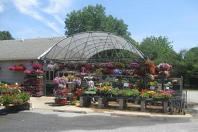
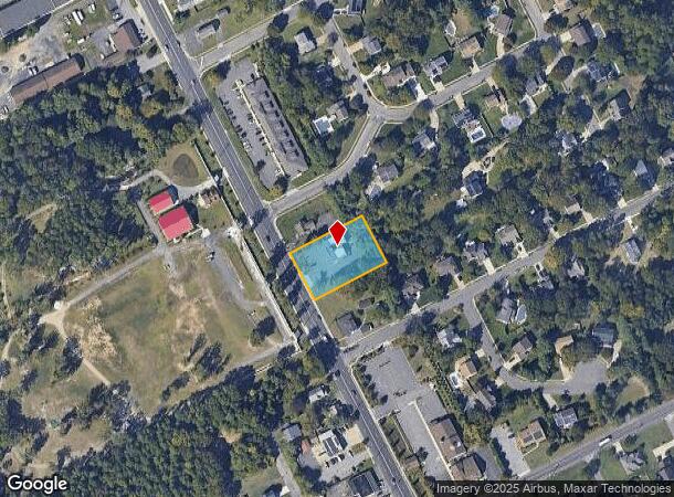
1237 Haddonfield Berlin Rd
34-00270-0000-00026
Camden
Commercialnec
New Jersey
X
26
34007C0129E
0.67 AC
2024
South Camden County
2025
Philadelphia
607505
Philadelphia-Camden-Wilmington, PA-NJ-DE-MD
2,250 SF
DEMOGRAPHICS near 1237 Haddonfield Berlin Rd
1 Mile
3 Mile
5 Mile
2024 Total Population
5,015
54,130
168,235
2029 Population
4,993
53,988
168,186
Pop Growth 2024-2029
(0.44%)
(0.26%)
(0.03%)
Average Age
42
41
41
2024 Total Households
1,828
20,521
65,384
HH Growth 2024-2029
(0.44%)
(0.27%)
0.00%
Median Household Inc
$107,742
$82,349
$90,047
Avg Household Size
2.70
2.60
2.50
2024 Avg HH Vehicles
2.00
2.00
2.00
Median Home Value
$307,055
$297,102
$274,986
Median Year Built
1969
1974
1976
Nearby Places
Map Layers
Map Styles
 Street
 Aerial
- Restaurants
- Banks
- Shops
- Fitness
- Groceries
PUBLIC TRANSPORTATION
COMMUTER RAIL
Atco (Atlantic City Line - NJ Transit Commuter Rail (NJ Transit))
DRIVE
WALK
Distance
Atco (Atlantic City Line - NJ Transit Commuter Rail (NJ Transit))
7 min
4.4 mi
Lindenwold (NJT) (Atlantic City Line - NJ Transit Commuter Rail (NJ Transit))
DRIVE
WALK
Distance
Lindenwold (NJT) (Atlantic City Line - NJ Transit Commuter Rail (NJ Transit))
8 min
5.0 mi
AIRPORT
Philadelphia International
DRIVE
WALK
Distance
Philadelphia International
38 min
23.0 mi
Atlantic City International
DRIVE
WALK
Distance
Atlantic City International
66 min
36.0 mi
Trenton Mercer
DRIVE
WALK
Distance
Trenton Mercer
61 min
43.3 mi
Freight Ports
South Jersey Port
DRIVE
WALK
Distance
South Jersey Port
24 min
13.7 mi
Nearby Properties
Address
Land Use
TOTAL SIZE
Lot Size
Zoning
Address
Land Use
TOTAL SIZE
Lot Size
Zoning
58.91 AC
MB
Address
Land Use
TOTAL SIZE
Lot Size
Zoning
256,152 SF
58.91 AC
MB
Address
Land Use
TOTAL SIZE
Lot Size
Zoning
79.35 AC
CP
Address
Land Use
TOTAL SIZE
Lot Size
Zoning
16.61 AC
SH
Address
Land Use
TOTAL SIZE
Lot Size
Zoning
4,177 SF
32.42 AC
SH
Address
Land Use
TOTAL SIZE
Lot Size
Zoning
186,464 SF
19.93 AC
MB
Address
Land Use
TOTAL SIZE
Lot Size
Zoning
44.34 AC
C1
Address
Land Use
TOTAL SIZE
Lot Size
Zoning
36.17 AC
Address
Land Use
TOTAL SIZE
Lot Size
Zoning
58,330 SF
5.08 AC
MB
Address
Land Use
TOTAL SIZE
Lot Size
Zoning
28.40 AC
Address
Land Use
TOTAL SIZE
Lot Size
Zoning
90,080 SF
5.22 AC
MB
Address
Land Use
TOTAL SIZE
Lot Size
Zoning
31.80 AC
Address
Land Use
TOTAL SIZE
Lot Size
Zoning
128,662 SF
15.87 AC
TC-1
Address
Land Use
TOTAL SIZE
Lot Size
Zoning
3.43 AC
O3
Address
Land Use
TOTAL SIZE
Lot Size
Zoning
222,056 SF
25.98 AC
O3
Address
Land Use
TOTAL SIZE
Lot Size
Zoning
1.82 AC
MB
Address
Land Use
TOTAL SIZE
Lot Size
Zoning
126,080 SF
TC-1
Address
Land Use
TOTAL SIZE
Lot Size
Zoning
42,648 SF
4.36 AC
RR
Address
Land Use
TOTAL SIZE
Lot Size
Zoning
171,540 SF
0.02 AC
MB
Address
Land Use
TOTAL SIZE
Lot Size
Zoning
850,368 SF
8.52 AC
GB2
Address
Land Use
TOTAL SIZE
Lot Size
Zoning
24.84 AC
Address
Land Use
TOTAL SIZE
Lot Size
Zoning
5.76 AC
O3
Address
Land Use
TOTAL SIZE
Lot Size
Zoning
118,180 SF
2.71 AC
MB
Address
Land Use
TOTAL SIZE
Lot Size
Zoning
54,658 SF
7.97 AC
O3
Address
Land Use
TOTAL SIZE
Lot Size
Zoning
16.71 AC
MF
Address
Land Use
TOTAL SIZE
Lot Size
Zoning
14.53 AC
C2
Address
Land Use
TOTAL SIZE
Lot Size
Zoning
4.67 AC
INST
Address
Land Use
TOTAL SIZE
Lot Size
Zoning
18.72 AC
CP
Address
Land Use
TOTAL SIZE
Lot Size
Zoning
47,738 SF
8.03 AC
O3
Address
Land Use
TOTAL SIZE
Lot Size
Zoning
55,920 SF
5.65 AC
RR
The World's #1 Commercial Real Estate Marketplace
Connect with us
© 2026 CoStar Group
The information above has been obtained from sources believed reliable. While we do not doubt its accuracy we have not verified it and make no guarantee, warranty or representation about it. It is your responsibility to independently confirm its accuracy and completeness. Any projections, opinions, assumptions, or estimates used are for example only and do not represent the current or future performance of the property. The value of this transaction to you depends on tax and other factors which should be evaluated by your tax, financial, and legal advisors. You and your advisors should conduct a careful, independent investigation of the property to determine to your satisfaction the suitability of the property for your needs.