Property Record
21028 Mack Ave, Grosse Pointe Woods, MI 48236
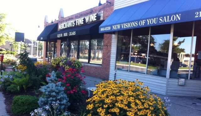

Property Detail
21028 Mack Ave
40-004-02-0010-001
WDG10A N 20 FT OF LOT 10 MEYERING LAND COS HAMPTON ROSLYN ROADS SUB PC 576 L55 P52 WCR K 20.00
Barberhairsalon
Wayne
C
Michigan
B and X Area of moderate flood hazard, usually the area between the limits of the 100-year and 500-year floods.
10
2025
0.05 AC
2025
The Pointes/Harper Woods
551800
Detroit
1,251 SF
Detroit-Warren-Dearborn, MI
NEARBY LISTINGS FOR SALE OR LEASE
DEMOGRAPHICS near 21028 Mack Ave
1 mile
3 mile
5 mile
2025 Total Population
16,821
120,075
274,706
2030 Population
16,560
119,659
277,306
Pop Growth 2025-2030
(1.55%)
(0.35%)
+ 0.95%
Average Age
42
40
40
2025 Total Households
7,139
47,911
107,331
HH Growth 2025-2030
(1.55%)
(0.40%)
+ 0.82%
Median Household Inc
$85,575
$67,649
$62,075
Avg Household Size
2.30
2.40
2.50
2025 Avg HH Vehicles
2.00
2.00
2.00
Median Home Value
$224,591
$184,818
$163,454
Median Year Built
1953
1954
1953
Nearby Places
Map Layers
Map Styles
 Street
 Aerial
Transit
 Traffic
 Biking
Places
Listings with unknown addresses are not visible on the map
- Restaurants
- Banks
- Shops
- Fitness
- Groceries
PUBLIC TRANSPORTATION
AIRPORT
Windsor International
Drive
Walk
Distance
Windsor International
44 min
23.0 mi
Detroit Metro Wayne County
Drive
Walk
Distance
Detroit Metro Wayne County
48 min
32.5 mi
Nearby Properties
Address
Land Use
TOTAL SIZE
Lot Size
Zoning
Address
Land Use
TOTAL SIZE
Lot Size
Zoning
1,034,990 SF
28.60 AC
Address
Land Use
TOTAL SIZE
Lot Size
Zoning
9,937 SF
35.42 AC
CLD
Address
Land Use
TOTAL SIZE
Lot Size
Zoning
211,065 SF
8.84 AC
C.F
Address
Land Use
TOTAL SIZE
Lot Size
Zoning
575,081 SF
8.53 AC
R6
Address
Land Use
TOTAL SIZE
Lot Size
Zoning
89,970 SF
2.86 AC
RM-1
Address
Land Use
TOTAL SIZE
Lot Size
Zoning
192,387 SF
11.26 AC
CLD
Address
Land Use
TOTAL SIZE
Lot Size
Zoning
101,733 SF
1.10 AC
C-2
Address
Land Use
TOTAL SIZE
Lot Size
Zoning
129,502 SF
3.17 AC
RM-1
Address
Land Use
TOTAL SIZE
Lot Size
Zoning
103,069 SF
11.41 AC
B-3
Address
Land Use
TOTAL SIZE
Lot Size
Zoning
105,354 SF
2.33 AC
B-3
Address
Land Use
TOTAL SIZE
Lot Size
Zoning
115,307 SF
7.01 AC
RM-1
Address
Land Use
TOTAL SIZE
Lot Size
Zoning
75,284 SF
0.87 AC
C
Address
Land Use
TOTAL SIZE
Lot Size
Zoning
202,788 SF
27.98 AC
CLD
Address
Land Use
TOTAL SIZE
Lot Size
Zoning
5,511 SF
1.52 AC
Address
Land Use
TOTAL SIZE
Lot Size
Zoning
41,235 SF
8.81 AC
Address
Land Use
TOTAL SIZE
Lot Size
Zoning
136,270 SF
3.42 AC
LI
Address
Land Use
TOTAL SIZE
Lot Size
Zoning
30,244 SF
2.06 AC
B-1
Address
Land Use
TOTAL SIZE
Lot Size
Zoning
28,300 SF
11.49 AC
I-1
Address
Land Use
TOTAL SIZE
Lot Size
Zoning
11,315 SF
41.52 AC
RA
Address
Land Use
TOTAL SIZE
Lot Size
Zoning
7,797 SF
24.23 AC
CLD
Address
Land Use
TOTAL SIZE
Lot Size
Zoning
26,068 SF
5.57 AC
B-2
Address
Land Use
TOTAL SIZE
Lot Size
Zoning
46,246 SF
3.19 AC
B-3
Address
Land Use
TOTAL SIZE
Lot Size
Zoning
71,025 SF
4.03 AC
RM-1
Address
Land Use
TOTAL SIZE
Lot Size
Zoning
30,919 SF
0.86 AC
C
Address
Land Use
TOTAL SIZE
Lot Size
Zoning
92,903 SF
1.70 AC
LI
Address
Land Use
TOTAL SIZE
Lot Size
Zoning
80,320 SF
4.73 AC
RM-1
Address
Land Use
TOTAL SIZE
Lot Size
Zoning
102,205 SF
214.30 AC
Address
Land Use
TOTAL SIZE
Lot Size
Zoning
36,191 SF
3.87 AC
B-2
Address
Land Use
TOTAL SIZE
Lot Size
Zoning
60,694 SF
3.05 AC
B-2
Address
Land Use
TOTAL SIZE
Lot Size
Zoning
56,170 SF
3.19 AC
RM-1
The World's #1 Commercial Real Estate Marketplace
Connect with us
© 2026 CoStar Group
The information above has been obtained from sources believed reliable. While we do not doubt its accuracy we have not verified it and make no guarantee, warranty or representation about it. It is your responsibility to independently confirm its accuracy and completeness. Any projections, opinions, assumptions, or estimates used are for example only and do not represent the current or future performance of the property. The value of this transaction to you depends on tax and other factors which should be evaluated by your tax, financial, and legal advisors. You and your advisors should conduct a careful, independent investigation of the property to determine to your satisfaction the suitability of the property for your needs.