Property Record
349 W 4Th Ave, Escondido, CA 92025


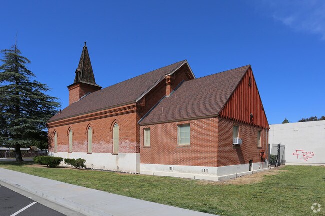

Property Detail
349 W 4Th Ave
233-150-23
BLK 104 LOTS 12 THRU 16 LOTS 3&4& TR 000336
Religious
SAN DIEGO
S-P
California
B and X Area of moderate flood hazard, usually the area between the limits of the 100-year and 500-year floods.
3-4
2024
1.12 AC
2025
Escondido
020601
San Diego
16,042 SF
San Diego-Chula Vista-Carlsbad, CA
NEARBY LISTINGS FOR SALE OR LEASE
DEMOGRAPHICS near 349 W 4Th Ave
1 mile
3 mile
5 mile
2025 Total Population
25,371
136,467
203,927
2030 Population
25,236
136,133
203,648
Pop Growth 2025-2030
(0.53%)
(0.24%)
(0.14%)
Average Age
36
38
39
2025 Total Households
7,787
43,289
65,876
HH Growth 2025-2030
(0.72%)
(0.38%)
(0.26%)
Median Household Inc
$66,446
$85,379
$98,078
Avg Household Size
3.00
3.00
3.00
2025 Avg HH Vehicles
2.00
2.00
2.00
Median Home Value
$728,419
$733,510
$771,883
Median Year Built
1977
1978
1981
Nearby Places
Map Layers
Map Styles
 Street
 Aerial
Transit
 Traffic
 Biking
Places
Listings with unknown addresses are not visible on the map
- Restaurants
- Banks
- Shops
- Fitness
- Groceries
PUBLIC TRANSPORTATION
TRANSIT/SUBWAY
Escondido Transit Center (Sprinter - San Diego North County Transit District (Coaster/Sprinter/Breeze))
Drive
Walk
Distance
Escondido Transit Center (Sprinter - San Diego North County Transit District (Coaster/Sprinter/Breeze))
2 min
13 min
0.7 mi
AIRPORT
San Diego International
Drive
Walk
Distance
San Diego International
38 min
29.8 mi
Freight Ports
Port of San Diego
Drive
Walk
Distance
Port of San Diego
41 min
32.0 mi
SALE & LEASE HISTORY
LISTING DATE
SALE/LEASE

Sep 23, 2016
For Sale
Nearby Properties
Address
Land Use
TOTAL SIZE
Lot Size
Zoning
Address
Land Use
TOTAL SIZE
Lot Size
Zoning
Address
Land Use
TOTAL SIZE
Lot Size
Zoning
14.98 AC
R-1-10
Address
Land Use
TOTAL SIZE
Lot Size
Zoning
9.77 AC
PD-R-18
Address
Land Use
TOTAL SIZE
Lot Size
Zoning
Address
Land Use
TOTAL SIZE
Lot Size
Zoning
71,656 SF
S-P
Address
Land Use
TOTAL SIZE
Lot Size
Zoning
Address
Land Use
TOTAL SIZE
Lot Size
Zoning
75,138 SF
C
Address
Land Use
TOTAL SIZE
Lot Size
Zoning
80,064 SF
1.53 AC
S-P
Address
Land Use
TOTAL SIZE
Lot Size
Zoning
7.90 AC
PD-C
Address
Land Use
TOTAL SIZE
Lot Size
Zoning
7.60 AC
R-3-18
Address
Land Use
TOTAL SIZE
Lot Size
Zoning
Address
Land Use
TOTAL SIZE
Lot Size
Zoning
5.94 AC
PD-R-24
Address
Land Use
TOTAL SIZE
Lot Size
Zoning
99,461 SF
4.89 AC
SPA
Address
Land Use
TOTAL SIZE
Lot Size
Zoning
8.30 AC
R-2-12
Address
Land Use
TOTAL SIZE
Lot Size
Zoning
Address
Land Use
TOTAL SIZE
Lot Size
Zoning
97,874 SF
8.47 AC
R-2-12
Address
Land Use
TOTAL SIZE
Lot Size
Zoning
2.98 AC
S-P
Address
Land Use
TOTAL SIZE
Lot Size
Zoning
13.99 AC
PD-C
Address
Land Use
TOTAL SIZE
Lot Size
Zoning
5.85 AC
R-3-18
Address
Land Use
TOTAL SIZE
Lot Size
Zoning
83,832 SF
7.85 AC
C-G
Address
Land Use
TOTAL SIZE
Lot Size
Zoning
6.24 AC
R-3-18
Address
Land Use
TOTAL SIZE
Lot Size
Zoning
5.82 AC
RE-20
Address
Land Use
TOTAL SIZE
Lot Size
Zoning
97,090 SF
5.38 AC
R-3-18
Address
Land Use
TOTAL SIZE
Lot Size
Zoning
3.06 AC
S-P
Address
Land Use
TOTAL SIZE
Lot Size
Zoning
16.12 AC
SPA
Address
Land Use
TOTAL SIZE
Lot Size
Zoning
10.83 AC
SPA
Address
Land Use
TOTAL SIZE
Lot Size
Zoning
91,354 SF
2.66 AC
SPA
Address
Land Use
TOTAL SIZE
Lot Size
Zoning
8.23 AC
PD-C
Address
Land Use
TOTAL SIZE
Lot Size
Zoning
5.49 AC
R-3-18
Address
Land Use
TOTAL SIZE
Lot Size
Zoning
4.42 AC
S-P
The World's #1 Commercial Real Estate Marketplace
Connect with us
© 2026 CoStar Group
The information above has been obtained from sources believed reliable. While we do not doubt its accuracy we have not verified it and make no guarantee, warranty or representation about it. It is your responsibility to independently confirm its accuracy and completeness. Any projections, opinions, assumptions, or estimates used are for example only and do not represent the current or future performance of the property. The value of this transaction to you depends on tax and other factors which should be evaluated by your tax, financial, and legal advisors. You and your advisors should conduct a careful, independent investigation of the property to determine to your satisfaction the suitability of the property for your needs.