Property Record
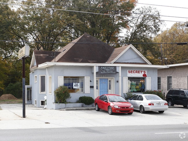
1140 Ralph David Abernathy Blvd Sw, Atlanta, GA 30310


NEARBY LISTINGS FOR SALE OR LEASE
Property Detail
1140 Ralph David Abernathy Blvd Sw
14-0118-0001-059-5
KA MELVINS HAIR CARE SYSTEM ID MR. WHITE OWNER FC 4/14/20
Storebuilding
Fulton
X
Georgia
13121C0356F
0.19 AC
2024
College Park/SW Atl
2025
Atlanta
006200
Atlanta-Sandy Springs-Roswell, GA
3,788 SF
DEMOGRAPHICS near 1140 Ralph David Abernathy Blvd Sw
1 Mile
3 Mile
5 Mile
2024 Total Population
14,584
129,861
346,448
2029 Population
15,146
136,701
361,338
Pop Growth 2024-2029
+ 3.85%
+ 5.27%
+ 4.30%
Average Age
38
37
36
2024 Total Households
6,159
53,325
156,043
HH Growth 2024-2029
+ 4.03%
+ 5.76%
+ 4.50%
Median Household Inc
$44,259
$41,605
$64,480
Avg Household Size
2.10
2.10
2.00
2024 Avg HH Vehicles
1.00
1.00
1.00
Median Home Value
$344,653
$283,578
$343,854
Median Year Built
1953
1978
1986
Nearby Places
Map Layers
Map Styles
 Street
 Aerial
- Restaurants
- Banks
- Shops
- Fitness
- Groceries
PUBLIC TRANSPORTATION
TRANSIT/SUBWAY
West End (Gold Line - Metropolitan Atlanta Rapid Transit Authority (MARTA), Red Line - Metropolitan Atlanta Rapid Transit Authority (MARTA))
DRIVE
WALK
Distance
West End (Gold Line - Metropolitan Atlanta Rapid Transit Authority (MARTA), Red Line - Metropolitan Atlanta Rapid Transit Authority (MARTA))
2 min
15 min
0.8 mi
COMMUTER RAIL
Atlanta (Crescent - Amtrak)
DRIVE
WALK
Distance
Atlanta (Crescent - Amtrak)
12 min
6.2 mi
AIRPORT
Hartsfield - Jackson Atlanta International
DRIVE
WALK
Distance
Hartsfield - Jackson Atlanta International
17 min
10.0 mi
Freight Ports
Georgia Ports - Savannah
DRIVE
WALK
Distance
Georgia Ports - Savannah
279 min
249.3 mi
SALE & LEASE HISTORY
LISTING DATE
SALE/LEASE

Sep 25, 2016
For Lease
Nov 16, 2017
For Lease
Jan 25, 2021
For Lease
Nearby Properties
Address
Land Use
TOTAL SIZE
Lot Size
Zoning
Address
Land Use
TOTAL SIZE
Lot Size
Zoning
19.94 AC
SPI1
Address
Land Use
TOTAL SIZE
Lot Size
Zoning
11.74 AC
I1
Address
Land Use
TOTAL SIZE
Lot Size
Zoning
9.80 AC
C5
Address
Land Use
TOTAL SIZE
Lot Size
Zoning
3.16 AC
SPI1
Address
Land Use
TOTAL SIZE
Lot Size
Zoning
9 AC
C5
Address
Land Use
TOTAL SIZE
Lot Size
Zoning
10.27 AC
C5
Address
Land Use
TOTAL SIZE
Lot Size
Zoning
1,300,309 SF
4.81 AC
SPI1
Address
Land Use
TOTAL SIZE
Lot Size
Zoning
1,434,872 SF
1.89 AC
SPI1
Address
Land Use
TOTAL SIZE
Lot Size
Zoning
61.57 AC
C5
Address
Land Use
TOTAL SIZE
Lot Size
Zoning
10,954,869 SF
28.88 AC
C3
Address
Land Use
TOTAL SIZE
Lot Size
Zoning
1.55 AC
SPI1
Address
Land Use
TOTAL SIZE
Lot Size
Zoning
7 AC
C3
Address
Land Use
TOTAL SIZE
Lot Size
Zoning
1,314,183 SF
2.61 AC
SPI1
Address
Land Use
TOTAL SIZE
Lot Size
Zoning
2,577,342 SF
2.04 AC
SPI1
Address
Land Use
TOTAL SIZE
Lot Size
Zoning
13,340,229 SF
3.68 AC
SPI1
Address
Land Use
TOTAL SIZE
Lot Size
Zoning
1,589,465 SF
3.41 AC
SPI1
Address
Land Use
TOTAL SIZE
Lot Size
Zoning
3.62 AC
SPI1
Address
Land Use
TOTAL SIZE
Lot Size
Zoning
961,817 SF
25.44 AC
I2
Address
Land Use
TOTAL SIZE
Lot Size
Zoning
3,588,720 SF
1.32 AC
SPI1
Address
Land Use
TOTAL SIZE
Lot Size
Zoning
631,858 SF
1.33 AC
C5C
Address
Land Use
TOTAL SIZE
Lot Size
Zoning
510,561 SF
87 SF
SPI1
Address
Land Use
TOTAL SIZE
Lot Size
Zoning
1.91 AC
I1
Address
Land Use
TOTAL SIZE
Lot Size
Zoning
34 AC
OI
Address
Land Use
TOTAL SIZE
Lot Size
Zoning
1,553,747 SF
2 AC
SPI1
Address
Land Use
TOTAL SIZE
Lot Size
Zoning
541,092 SF
0.53 AC
SPI1
Address
Land Use
TOTAL SIZE
Lot Size
Zoning
498,515 SF
3.41 AC
C1
Address
Land Use
TOTAL SIZE
Lot Size
Zoning
757,962 SF
0.36 AC
SPI1
Address
Land Use
TOTAL SIZE
Lot Size
Zoning
2,401,682 SF
9.96 AC
I2
Address
Land Use
TOTAL SIZE
Lot Size
Zoning
632,090 SF
1.01 AC
SPI1
Address
Land Use
TOTAL SIZE
Lot Size
Zoning
351,438 SF
0.44 AC
SPI1
The World's #1 Commercial Real Estate Marketplace
Connect with us
© 2026 CoStar Group
The information above has been obtained from sources believed reliable. While we do not doubt its accuracy we have not verified it and make no guarantee, warranty or representation about it. It is your responsibility to independently confirm its accuracy and completeness. Any projections, opinions, assumptions, or estimates used are for example only and do not represent the current or future performance of the property. The value of this transaction to you depends on tax and other factors which should be evaluated by your tax, financial, and legal advisors. You and your advisors should conduct a careful, independent investigation of the property to determine to your satisfaction the suitability of the property for your needs.