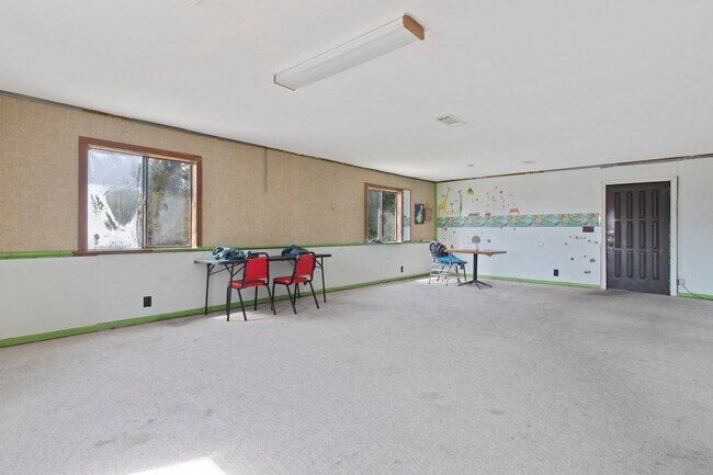
Property Record
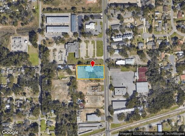
353 Courthouse Rd, Gulfport, MS 39507

NEARBY LISTINGS FOR SALE OR LEASE
Property Detail
353 Courthouse Rd
0911B-01-001.000
1.1 AC (C) BEG 73 FT W OF NE COR OF NW1/4 OF SEC 1 ON W MAR OF COURT- HOUSE RD W ALONG SEC LINE 301.6 FT S 152.7 FT E 305.1 F
Religious
Harrison
X
Mississippi
28047C0268G
1.10 AC
0
Biloxi/Gulfport
2025
Other Market Areas
001701
Gulfport-Biloxi-Pascagoula, MS
8,641 SF
DEMOGRAPHICS near 353 Courthouse Rd
1 Mile
3 Mile
5 Mile
2024 Total Population
5,110
31,812
63,056
2029 Population
5,292
32,972
65,035
Pop Growth 2024-2029
+ 3.56%
+ 3.65%
+ 3.14%
Average Age
41
41
40
2024 Total Households
2,226
13,686
26,196
HH Growth 2024-2029
+ 3.59%
+ 3.66%
+ 3.08%
Median Household Inc
$31,530
$44,701
$42,597
Avg Household Size
2.20
2.20
2.30
2024 Avg HH Vehicles
1.00
2.00
2.00
Median Home Value
$188,946
$184,378
$160,069
Median Year Built
1971
1978
1982
Nearby Places
Map Layers
Map Styles
 Street
 Aerial
- Restaurants
- Banks
- Shops
- Fitness
- Groceries
PUBLIC TRANSPORTATION
AIRPORT
Gulfport-Biloxi International
DRIVE
WALK
Distance
Gulfport-Biloxi International
13 min
4.7 mi
Freight Ports
Port of Gulf Port
DRIVE
WALK
Distance
Port of Gulf Port
7 min
3.6 mi
SALE & LEASE HISTORY
LISTING DATE
SALE/LEASE

Sep 24, 2016
For Sale
Jun 22, 2020
For Sale
Jan 25, 2017
For Sale
Nearby Properties
Address
Land Use
TOTAL SIZE
Lot Size
Zoning
Address
Land Use
TOTAL SIZE
Lot Size
Zoning
21,859 SF
18.40 AC
Address
Land Use
TOTAL SIZE
Lot Size
Zoning
16,831 SF
21.60 AC
Address
Land Use
TOTAL SIZE
Lot Size
Zoning
22,430 SF
12.50 AC
Address
Land Use
TOTAL SIZE
Lot Size
Zoning
23,280 SF
11.30 AC
Address
Land Use
TOTAL SIZE
Lot Size
Zoning
26,501 SF
16.70 AC
Address
Land Use
TOTAL SIZE
Lot Size
Zoning
89,522 SF
4.50 AC
Address
Land Use
TOTAL SIZE
Lot Size
Zoning
20,170 SF
2.70 AC
Address
Land Use
TOTAL SIZE
Lot Size
Zoning
10,796 SF
9.10 AC
Address
Land Use
TOTAL SIZE
Lot Size
Zoning
64,744 SF
2.20 AC
Address
Land Use
TOTAL SIZE
Lot Size
Zoning
11,314 SF
0.40 AC
Address
Land Use
TOTAL SIZE
Lot Size
Zoning
72,663 SF
2.80 AC
Address
Land Use
TOTAL SIZE
Lot Size
Zoning
68,209 SF
2.50 AC
Address
Land Use
TOTAL SIZE
Lot Size
Zoning
6,672 SF
33.80 AC
Address
Land Use
TOTAL SIZE
Lot Size
Zoning
12,761 SF
8.16 AC
Address
Land Use
TOTAL SIZE
Lot Size
Zoning
66,540 SF
2 AC
Address
Land Use
TOTAL SIZE
Lot Size
Zoning
147,457 SF
17.80 AC
Address
Land Use
TOTAL SIZE
Lot Size
Zoning
7,217 SF
7.90 AC
Address
Land Use
TOTAL SIZE
Lot Size
Zoning
28,297 SF
6 AC
Address
Land Use
TOTAL SIZE
Lot Size
Zoning
6,016 SF
13.62 AC
Address
Land Use
TOTAL SIZE
Lot Size
Zoning
152,696 SF
12.20 AC
Address
Land Use
TOTAL SIZE
Lot Size
Zoning
6,759 SF
3.20 AC
Address
Land Use
TOTAL SIZE
Lot Size
Zoning
14,936 SF
4.20 AC
Address
Land Use
TOTAL SIZE
Lot Size
Zoning
772 SF
7.90 AC
Address
Land Use
TOTAL SIZE
Lot Size
Zoning
35,826 SF
2.70 AC
Address
Land Use
TOTAL SIZE
Lot Size
Zoning
45,876 SF
5.60 AC
Address
Land Use
TOTAL SIZE
Lot Size
Zoning
2,739 SF
3.60 AC
Address
Land Use
TOTAL SIZE
Lot Size
Zoning
41,975 SF
4 AC
Address
Land Use
TOTAL SIZE
Lot Size
Zoning
6,293 SF
13.10 AC
Address
Land Use
TOTAL SIZE
Lot Size
Zoning
7,192 SF
8.60 AC
Address
Land Use
TOTAL SIZE
Lot Size
Zoning
177,099 SF
9.16 AC
The World's #1 Commercial Real Estate Marketplace
Connect with us
© 2025 CoStar Group
The information above has been obtained from sources believed reliable. While we do not doubt its accuracy we have not verified it and make no guarantee, warranty or representation about it. It is your responsibility to independently confirm its accuracy and completeness. Any projections, opinions, assumptions, or estimates used are for example only and do not represent the current or future performance of the property. The value of this transaction to you depends on tax and other factors which should be evaluated by your tax, financial, and legal advisors. You and your advisors should conduct a careful, independent investigation of the property to determine to your satisfaction the suitability of the property for your needs.