Property Record
675 Dorrell Ln, North Las Vegas, NV 89086
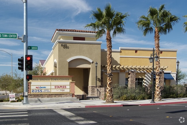

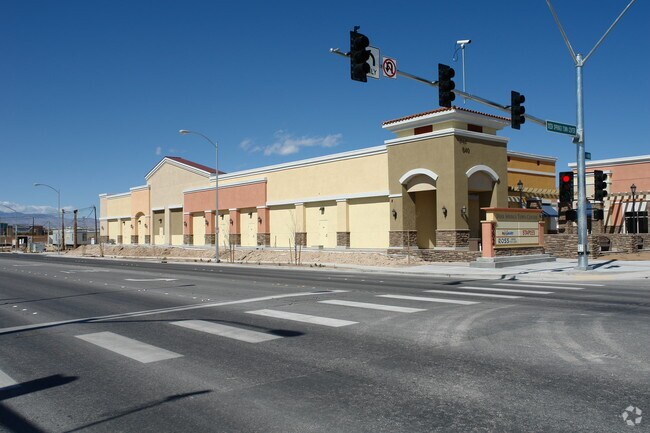
Property Detail
675 Dorrell Ln
Las Vegas-Henderson-North Las Vegas, NV
DEER SPRINGS TOWN CENTER PLAT BOOK 139 PAGE 57 PT LOT 2
124-23-210-013
CLARK
Storebuilding
Nevada
2026
2
2026
5.17 AC
003659
North Las Vegas
28,550 SF
Las Vegas
NEARBY LISTINGS FOR SALE OR LEASE
DEMOGRAPHICS near 675 Dorrell Ln
1 mile
3 mile
5 mile
2025 Total Population
17,310
120,120
267,501
2030 Population
18,540
127,962
282,757
Pop Growth 2025-2030
+ 7.11%
+ 6.53%
+ 5.70%
Average Age
35
37
37
2025 Total Households
5,803
38,852
86,017
HH Growth 2025-2030
+ 7.01%
+ 6.57%
+ 5.75%
Median Household Inc
$86,696
$88,129
$84,417
Avg Household Size
3.00
3.00
3.00
2025 Avg HH Vehicles
2.00
2.00
2.00
Median Home Value
$412,411
$424,599
$413,532
Median Year Built
2007
2005
2003
Nearby Places
Map Layers
Map Styles
 Street
 Aerial
Transit
 Traffic
 Biking
Places
Listings with unknown addresses are not visible on the map
- Restaurants
- Banks
- Shops
- Fitness
- Groceries
PUBLIC TRANSPORTATION
AIRPORT
Harry Reid International
Drive
Walk
Distance
Harry Reid International
28 min
16.8 mi
Boulder City Municipal
Drive
Walk
Distance
Boulder City Municipal
46 min
33.5 mi
SALE & LEASE HISTORY
LISTING DATE
SALE/LEASE

Sep 25, 2016
For Lease
Jul 24, 2019
For Lease
Aug 14, 2017
For Lease
Nearby Properties
Address
Land Use
TOTAL SIZE
Lot Size
Zoning
Address
Land Use
TOTAL SIZE
Lot Size
Zoning
33,783 SF
168.44 AC
Address
Land Use
TOTAL SIZE
Lot Size
Zoning
515,219 SF
40.68 AC
MPCPUD
Address
Land Use
TOTAL SIZE
Lot Size
Zoning
82.49 AC
PSP
Address
Land Use
TOTAL SIZE
Lot Size
Zoning
681,792 SF
29.65 AC
Address
Land Use
TOTAL SIZE
Lot Size
Zoning
696,064 SF
29.08 AC
Address
Land Use
TOTAL SIZE
Lot Size
Zoning
602,609 SF
27.33 AC
M2
Address
Land Use
TOTAL SIZE
Lot Size
Zoning
7,724 SF
108.84 AC
R1
Address
Land Use
TOTAL SIZE
Lot Size
Zoning
41.21 AC
PSP
Address
Land Use
TOTAL SIZE
Lot Size
Zoning
33.32 AC
R1
Address
Land Use
TOTAL SIZE
Lot Size
Zoning
3,735 SF
17.69 AC
R3
Address
Land Use
TOTAL SIZE
Lot Size
Zoning
478,096 SF
17.87 AC
R3
Address
Land Use
TOTAL SIZE
Lot Size
Zoning
35.49 AC
RE
Address
Land Use
TOTAL SIZE
Lot Size
Zoning
438,601 SF
16.84 AC
R4
Address
Land Use
TOTAL SIZE
Lot Size
Zoning
18.08 AC
PSP
Address
Land Use
TOTAL SIZE
Lot Size
Zoning
5,156 SF
9.46 AC
Address
Land Use
TOTAL SIZE
Lot Size
Zoning
17.69 AC
RE
Address
Land Use
TOTAL SIZE
Lot Size
Zoning
4,976 SF
14.44 AC
R3
Address
Land Use
TOTAL SIZE
Lot Size
Zoning
371,648 SF
17.30 AC
Address
Land Use
TOTAL SIZE
Lot Size
Zoning
16.48 AC
PUD
Address
Land Use
TOTAL SIZE
Lot Size
Zoning
4,365 SF
13.07 AC
R3
Address
Land Use
TOTAL SIZE
Lot Size
Zoning
626.08 AC
OL
Address
Land Use
TOTAL SIZE
Lot Size
Zoning
34,765 SF
16.85 AC
M2
Address
Land Use
TOTAL SIZE
Lot Size
Zoning
2,860 SF
14.35 AC
R3
Address
Land Use
TOTAL SIZE
Lot Size
Zoning
17.02 AC
OL
Address
Land Use
TOTAL SIZE
Lot Size
Zoning
10.45 AC
PUD
Address
Land Use
TOTAL SIZE
Lot Size
Zoning
392,040 SF
19.37 AC
M2
Address
Land Use
TOTAL SIZE
Lot Size
Zoning
8,663 SF
9.53 AC
Address
Land Use
TOTAL SIZE
Lot Size
Zoning
Address
Land Use
TOTAL SIZE
Lot Size
Zoning
340,704 SF
5.37 AC
The World's #1 Commercial Real Estate Marketplace
Connect with us
© 2026 CoStar Group
The information above has been obtained from sources believed reliable. While we do not doubt its accuracy we have not verified it and make no guarantee, warranty or representation about it. It is your responsibility to independently confirm its accuracy and completeness. Any projections, opinions, assumptions, or estimates used are for example only and do not represent the current or future performance of the property. The value of this transaction to you depends on tax and other factors which should be evaluated by your tax, financial, and legal advisors. You and your advisors should conduct a careful, independent investigation of the property to determine to your satisfaction the suitability of the property for your needs.