Property Record
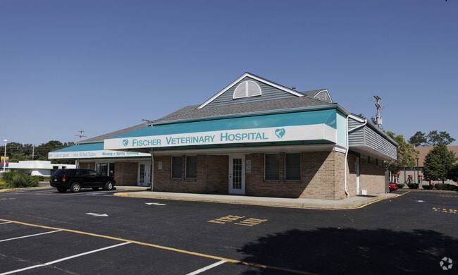
877 Fischer Blvd, Toms River, NJ 08753


Property Detail
877 Fischer Blvd
08-00444-07-00018-01
150X207
Commercialnec
Ocean
HB
New Jersey
B and X Area of moderate flood hazard, usually the area between the limits of the 100-year and 500-year floods.
18.1
2025
0.71 AC
2025
Ocean County
722600
Northern New Jersey
5,565 SF
Lakewood-New Brunswick, NJ
NEARBY LISTINGS FOR SALE OR LEASE
DEMOGRAPHICS near 877 Fischer Blvd
1 mile
3 mile
5 mile
2025 Total Population
8,033
51,832
150,329
2030 Population
8,161
53,125
157,434
Pop Growth 2025-2030
+ 1.59%
+ 2.49%
+ 4.73%
Average Age
39
40
43
2025 Total Households
2,762
18,668
60,338
HH Growth 2025-2030
+ 0.91%
+ 2.01%
+ 4.83%
Median Household Inc
$118,463
$106,307
$92,703
Avg Household Size
2.80
2.60
2.40
2025 Avg HH Vehicles
2.00
2.00
2.00
Median Home Value
$375,730
$425,612
$430,579
Median Year Built
1972
1974
1975
Nearby Places
Map Layers
Map Styles
 Street
 Aerial
Transit
 Traffic
 Biking
Places
Listings with unknown addresses are not visible on the map
- Restaurants
- Banks
- Shops
- Fitness
- Groceries
SALE & LEASE HISTORY
LISTING DATE
SALE/LEASE

Sep 25, 2016
For Lease
Dec 22, 2016
For Sale
Nearby Properties
Address
Land Use
TOTAL SIZE
Lot Size
Zoning
Address
Land Use
TOTAL SIZE
Lot Size
Zoning
70.33 AC
RC
Address
Land Use
TOTAL SIZE
Lot Size
Zoning
22,175 SF
30.21 AC
RC
Address
Land Use
TOTAL SIZE
Lot Size
Zoning
8,512 SF
25.67 AC
RC
Address
Land Use
TOTAL SIZE
Lot Size
Zoning
8,118 SF
72.32 AC
R75
Address
Land Use
TOTAL SIZE
Lot Size
Zoning
41,100 SF
14.63 AC
RC
Address
Land Use
TOTAL SIZE
Lot Size
Zoning
1,332 SF
13.76 AC
EM18
Address
Land Use
TOTAL SIZE
Lot Size
Zoning
57,008 SF
8.85 AC
SPLT
Address
Land Use
TOTAL SIZE
Lot Size
Zoning
54.25 AC
RC3
Address
Land Use
TOTAL SIZE
Lot Size
Zoning
15.68 AC
MF8
Address
Land Use
TOTAL SIZE
Lot Size
Zoning
3,997 SF
11.09 AC
RC
Address
Land Use
TOTAL SIZE
Lot Size
Zoning
4,264 SF
189.71 AC
R400
Address
Land Use
TOTAL SIZE
Lot Size
Zoning
71,285 SF
20.49 AC
HB
Address
Land Use
TOTAL SIZE
Lot Size
Zoning
9,874 SF
15.17 AC
RC
Address
Land Use
TOTAL SIZE
Lot Size
Zoning
8.82 AC
O15
Address
Land Use
TOTAL SIZE
Lot Size
Zoning
103,750 SF
24.23 AC
R120
Address
Land Use
TOTAL SIZE
Lot Size
Zoning
33.59 AC
R90
Address
Land Use
TOTAL SIZE
Lot Size
Zoning
116,030 SF
13.96 AC
O10
Address
Land Use
TOTAL SIZE
Lot Size
Zoning
54,855 SF
6.23 AC
O10
Address
Land Use
TOTAL SIZE
Lot Size
Zoning
83,294 SF
9.59 AC
RC3
Address
Land Use
TOTAL SIZE
Lot Size
Zoning
3,524 SF
10 AC
HB
Address
Land Use
TOTAL SIZE
Lot Size
Zoning
2,796 SF
13.55 AC
RC
Address
Land Use
TOTAL SIZE
Lot Size
Zoning
3,588 SF
6.81 AC
EM10
Address
Land Use
TOTAL SIZE
Lot Size
Zoning
5,876 SF
3.56 AC
O15
Address
Land Use
TOTAL SIZE
Lot Size
Zoning
36,168 SF
9.52 AC
HB
Address
Land Use
TOTAL SIZE
Lot Size
Zoning
55,052 SF
6.96 AC
O10
Address
Land Use
TOTAL SIZE
Lot Size
Zoning
54,648 SF
8.04 AC
HB
Address
Land Use
TOTAL SIZE
Lot Size
Zoning
88,355 SF
5.27 AC
HB
Address
Land Use
TOTAL SIZE
Lot Size
Zoning
59,100 SF
11.56 AC
HB
Address
Land Use
TOTAL SIZE
Lot Size
Zoning
1,296 SF
15.91 AC
R90
Address
Land Use
TOTAL SIZE
Lot Size
Zoning
61,176 SF
9.31 AC
HB
The World's #1 Commercial Real Estate Marketplace
Connect with us
© 2026 CoStar Group
The information above has been obtained from sources believed reliable. While we do not doubt its accuracy we have not verified it and make no guarantee, warranty or representation about it. It is your responsibility to independently confirm its accuracy and completeness. Any projections, opinions, assumptions, or estimates used are for example only and do not represent the current or future performance of the property. The value of this transaction to you depends on tax and other factors which should be evaluated by your tax, financial, and legal advisors. You and your advisors should conduct a careful, independent investigation of the property to determine to your satisfaction the suitability of the property for your needs.