Property Record
3101 Exposition Pl, Los Angeles, CA 90018
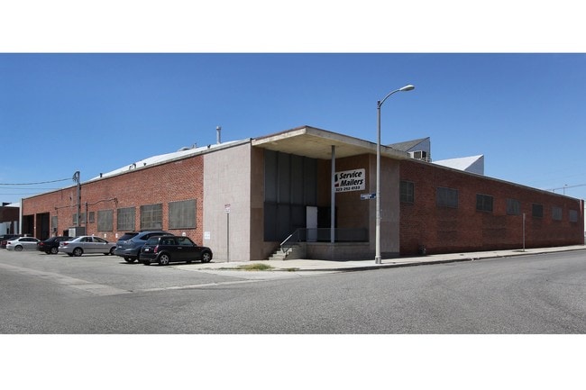


Property Detail
3101 Exposition Pl
5044-002-015
TR=12244 EX OF ST LOT 62 AND ALL OF LOTS 59,60 AND 61
Heavyindustrial
Los Angeles
LAM1
California
B and X Area of moderate flood hazard, usually the area between the limits of the 100-year and 500-year floods.
62
2025
0.91 AC
2025
Westside
234200
Los Angeles
32,047 SF
Los Angeles-Long Beach-Glendale, CA
NEARBY LISTINGS FOR SALE OR LEASE
DEMOGRAPHICS near 3101 Exposition Pl
1 mile
3 mile
5 mile
2025 Total Population
41,310
403,599
1,249,337
2030 Population
41,075
401,828
1,245,797
Pop Growth 2025-2030
(0.57%)
(0.44%)
(0.28%)
Average Age
41
39
39
2025 Total Households
15,362
139,829
468,279
HH Growth 2025-2030
(0.81%)
(0.60%)
(0.28%)
Median Household Inc
$64,413
$64,015
$69,261
Avg Household Size
2.60
2.70
2.50
2025 Avg HH Vehicles
2.00
2.00
1.00
Median Home Value
$919,017
$939,186
$941,327
Median Year Built
1948
1949
1958
Nearby Places
Map Layers
Map Styles
 Street
 Aerial
Layers
 Traffic
 Biking
Places
Listings with unknown addresses are not visible on the map
- Restaurants
- Banks
- Shops
- Fitness
- Groceries
PUBLIC TRANSPORTATION
TRANSIT/SUBWAY
Expo/Crenshaw (Expo Line - Los Angeles County Metropolitan Transportation Authority (Metro))
Drive
Walk
Distance
Expo/Crenshaw (Expo Line - Los Angeles County Metropolitan Transportation Authority (Metro))
0 min
7 min
0.4 mi
Farmdale (Expo Line - Los Angeles County Metropolitan Transportation Authority (Metro))
Drive
Walk
Distance
Farmdale (Expo Line - Los Angeles County Metropolitan Transportation Authority (Metro))
2 min
20 min
1.0 mi
COMMUTER RAIL
Los Angeles (Coast Starlight - Amtrak, Pacific Surfliner - Amtrak, Southwest Chief - Amtrak, Texas Eagle - Amtrak)
Drive
Walk
Distance
Los Angeles (Coast Starlight - Amtrak, Pacific Surfliner - Amtrak, Southwest Chief - Amtrak, Texas Eagle - Amtrak)
13 min
8.0 mi
Union Station (91 Line - Southern California Regional Rail Authority (Metrolink), Antelope Valley Line - Southern California Regional Rail Authority (Metrolink), Orange County Line - Southern California Regional Rail Authority (Metrolink), Riverside Line - Southern California Regional Rail Authority (Metrolink), San Bernardino Line - Southern California Regional Rail Authority (Metrolink), Ventura County Line - Southern California Regional Rail Authority (Metrolink))
Drive
Walk
Distance
Union Station (91 Line - Southern California Regional Rail Authority (Metrolink), Antelope Valley Line - Southern California Regional Rail Authority (Metrolink), Orange County Line - Southern California Regional Rail Authority (Metrolink), Riverside Line - Southern California Regional Rail Authority (Metrolink), San Bernardino Line - Southern California Regional Rail Authority (Metrolink), Ventura County Line - Southern California Regional Rail Authority (Metrolink))
15 min
8.1 mi
AIRPORT
Los Angeles International
Drive
Walk
Distance
Los Angeles International
17 min
8.7 mi
Bob Hope
Drive
Walk
Distance
Bob Hope
27 min
15.8 mi
Long Beach (Daugherty Field)
Drive
Walk
Distance
Long Beach (Daugherty Field)
31 min
22.7 mi
Freight Ports
Port of Long Beach
Drive
Walk
Distance
Port of Long Beach
34 min
24.6 mi
SALE & LEASE HISTORY
LISTING DATE
SALE/LEASE

Sep 24, 2016
For Sale
Sep 24, 2016
For Sale
Oct 04, 2016
For Sale
Oct 04, 2016
For Lease
Nearby Properties
Address
Land Use
TOTAL SIZE
Lot Size
Zoning
Address
Land Use
TOTAL SIZE
Lot Size
Zoning
969,516 SF
14.75 AC
Address
Land Use
TOTAL SIZE
Lot Size
Zoning
420,864 SF
63.07 AC
LAUSC-1A
Address
Land Use
TOTAL SIZE
Lot Size
Zoning
871,235 SF
14.56 AC
LAC2
Address
Land Use
TOTAL SIZE
Lot Size
Zoning
472,363 SF
3.24 AC
LAC4
Address
Land Use
TOTAL SIZE
Lot Size
Zoning
256,059 SF
Address
Land Use
TOTAL SIZE
Lot Size
Zoning
368,411 SF
10.91 AC
C2-2D-CPIO
Address
Land Use
TOTAL SIZE
Lot Size
Zoning
200,689 SF
5.79 AC
LAUSC-1A
Address
Land Use
TOTAL SIZE
Lot Size
Zoning
337,025 SF
14.59 AC
LAUSC-1A
Address
Land Use
TOTAL SIZE
Lot Size
Zoning
666,499 SF
10.63 AC
LAC2
Address
Land Use
TOTAL SIZE
Lot Size
Zoning
298,630 SF
4.64 AC
LAUSC-1B
Address
Land Use
TOTAL SIZE
Lot Size
Zoning
786,423 SF
11.74 AC
LAC2
Address
Land Use
TOTAL SIZE
Lot Size
Zoning
733,880 SF
3.53 AC
LAMR1
Address
Land Use
TOTAL SIZE
Lot Size
Zoning
377,946 SF
5.03 AC
LAUSC-1A
Address
Land Use
TOTAL SIZE
Lot Size
Zoning
106,000 SF
4.26 AC
LAMR 1
Address
Land Use
TOTAL SIZE
Lot Size
Zoning
237,673 SF
3.73 AC
M1-2D-CPIO
Address
Land Use
TOTAL SIZE
Lot Size
Zoning
190,164 SF
1.18 AC
LAR4
Address
Land Use
TOTAL SIZE
Lot Size
Zoning
73,918 SF
3.86 AC
LAM1
Address
Land Use
TOTAL SIZE
Lot Size
Zoning
31,358 SF
5.43 AC
LAMR
Address
Land Use
TOTAL SIZE
Lot Size
Zoning
303,775 SF
2.27 AC
Address
Land Use
TOTAL SIZE
Lot Size
Zoning
102,877 SF
8.69 AC
LAC2
Address
Land Use
TOTAL SIZE
Lot Size
Zoning
215,995 SF
1.05 AC
LAC4
Address
Land Use
TOTAL SIZE
Lot Size
Zoning
112,636 SF
24.20 AC
LAUSC-1A
Address
Land Use
TOTAL SIZE
Lot Size
Zoning
343,879 SF
4.26 AC
LAC2
Address
Land Use
TOTAL SIZE
Lot Size
Zoning
214,155 SF
3.33 AC
CCM1
Address
Land Use
TOTAL SIZE
Lot Size
Zoning
168,636 SF
1.44 AC
LARAS4
Address
Land Use
TOTAL SIZE
Lot Size
Zoning
203,272 SF
14.53 AC
LAC2
Address
Land Use
TOTAL SIZE
Lot Size
Zoning
199,495 SF
1.54 AC
LAR4
Address
Land Use
TOTAL SIZE
Lot Size
Zoning
188,130 SF
1.11 AC
LAC2
Address
Land Use
TOTAL SIZE
Lot Size
Zoning
146,163 SF
0.86 AC
LAR4
Address
Land Use
TOTAL SIZE
Lot Size
Zoning
188,146 SF
1.54 AC
LAUSC-1A
The World's #1 Commercial Real Estate Marketplace
Connect with us
© 2026 CoStar Group
The information above has been obtained from sources believed reliable. While we do not doubt its accuracy we have not verified it and make no guarantee, warranty or representation about it. It is your responsibility to independently confirm its accuracy and completeness. Any projections, opinions, assumptions, or estimates used are for example only and do not represent the current or future performance of the property. The value of this transaction to you depends on tax and other factors which should be evaluated by your tax, financial, and legal advisors. You and your advisors should conduct a careful, independent investigation of the property to determine to your satisfaction the suitability of the property for your needs.