Property Record
1 Roosevelt Ave, Peabody, MA 01960

Property Detail
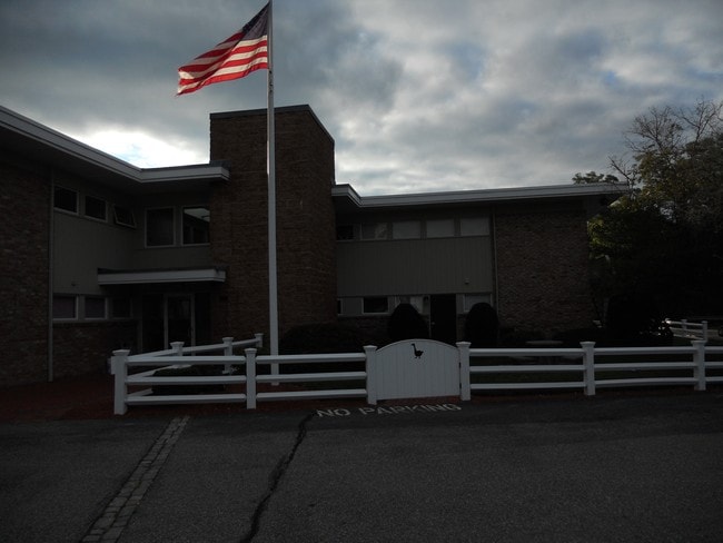
1 Roosevelt Ave
Medicalbuilding
ESSEX
R1
Massachusetts
AE The base floodplain where base flood elevations are provided. AE Zones are now used on new format FIRMs instead of A1-A30 Zones.
1.98 AC
2025
Peabody/Salem
2025
Boston
210100
Boston-Cambridge-Newton, MA-NH
13,544 SF
024-041
NEARBY LISTINGS FOR SALE OR LEASE
DEMOGRAPHICS near 1 Roosevelt Ave
1 mile
3 mile
5 mile
2024 Total Population
6,892
46,238
148,296
2029 Population
6,846
46,154
147,345
Pop Growth 2024-2029
(0.67%)
(0.18%)
(0.64%)
Average Age
46
46
43
2024 Total Households
2,476
18,429
57,412
HH Growth 2024-2029
(0.77%)
(0.21%)
(0.76%)
Median Household Inc
$127,539
$109,092
$105,601
Avg Household Size
2.70
2.40
2.50
2024 Avg HH Vehicles
2.00
2.00
2.00
Median Home Value
$623,940
$639,115
$621,759
Median Year Built
1965
1978
1966
Nearby Places
Map Layers
Map Styles
 Street
 Aerial
Transit
 Traffic
 Biking
Places
Listings with unknown addresses are not visible on the map
- Restaurants
- Banks
- Shops
- Fitness
- Groceries
PUBLIC TRANSPORTATION
COMMUTER RAIL
Wakefield (Haverhill Line - Massachusetts Bay Transportation Authority Commuter Rail (Purple Line))
Drive
Walk
Distance
Wakefield (Haverhill Line - Massachusetts Bay Transportation Authority Commuter Rail (Purple Line))
14 min
6.6 mi
Reading (Haverhill Line - Massachusetts Bay Transportation Authority Commuter Rail (Purple Line))
Drive
Walk
Distance
Reading (Haverhill Line - Massachusetts Bay Transportation Authority Commuter Rail (Purple Line))
15 min
6.8 mi
AIRPORT
General Edward Lawrence Logan International
Drive
Walk
Distance
General Edward Lawrence Logan International
28 min
15.6 mi
Freight Ports
Port of Boston
Drive
Walk
Distance
Port of Boston
31 min
18.6 mi
SALE & LEASE HISTORY
LISTING DATE
SALE/LEASE

Sep 25, 2016
For Lease
Nearby Properties
Address
Land Use
TOTAL SIZE
Lot Size
Zoning
Address
Land Use
TOTAL SIZE
Lot Size
Zoning
747,237 SF
36.70 AC
HW
Address
Land Use
TOTAL SIZE
Lot Size
Zoning
17 AC
R4
Address
Land Use
TOTAL SIZE
Lot Size
Zoning
198.74 AC
R3
Address
Land Use
TOTAL SIZE
Lot Size
Zoning
17.60 AC
R1A
Address
Land Use
TOTAL SIZE
Lot Size
Zoning
13.04 AC
HC
Address
Land Use
TOTAL SIZE
Lot Size
Zoning
49.85 AC
R1B
Address
Land Use
TOTAL SIZE
Lot Size
Zoning
40.20 AC
R1B
Address
Land Use
TOTAL SIZE
Lot Size
Zoning
215,057 SF
12 AC
RB
Address
Land Use
TOTAL SIZE
Lot Size
Zoning
249,477 SF
13.98 AC
RA
Address
Land Use
TOTAL SIZE
Lot Size
Zoning
206.65 AC
R1B
Address
Land Use
TOTAL SIZE
Lot Size
Zoning
217,937 SF
8.40 AC
I
Address
Land Use
TOTAL SIZE
Lot Size
Zoning
249,587 SF
5.79 AC
DDD
Address
Land Use
TOTAL SIZE
Lot Size
Zoning
19.10 AC
R114
Address
Land Use
TOTAL SIZE
Lot Size
Zoning
254,374 SF
34.70 AC
I
Address
Land Use
TOTAL SIZE
Lot Size
Zoning
71.68 AC
R3
Address
Land Use
TOTAL SIZE
Lot Size
Zoning
15.88 AC
BR
Address
Land Use
TOTAL SIZE
Lot Size
Zoning
24.54 AC
M1
Address
Land Use
TOTAL SIZE
Lot Size
Zoning
110,812 SF
32.87 AC
RA
Address
Land Use
TOTAL SIZE
Lot Size
Zoning
624 SF
45.60 AC
DDD
Address
Land Use
TOTAL SIZE
Lot Size
Zoning
4.26 AC
R114
Address
Land Use
TOTAL SIZE
Lot Size
Zoning
111,000 SF
0.90 AC
DDD
Address
Land Use
TOTAL SIZE
Lot Size
Zoning
160,000 SF
14.10 AC
I
Address
Land Use
TOTAL SIZE
Lot Size
Zoning
237,828 SF
12.53 AC
I
Address
Land Use
TOTAL SIZE
Lot Size
Zoning
181,659 SF
11.57 AC
R114
Address
Land Use
TOTAL SIZE
Lot Size
Zoning
155,000 SF
9.50 AC
I
Address
Land Use
TOTAL SIZE
Lot Size
Zoning
136,661 SF
27.50 AC
RB
Address
Land Use
TOTAL SIZE
Lot Size
Zoning
163,138 SF
11.44 AC
DDD
Address
Land Use
TOTAL SIZE
Lot Size
Zoning
149,500 SF
4.35 AC
I
Address
Land Use
TOTAL SIZE
Lot Size
Zoning
156,586 SF
9.80 AC
IP
Address
Land Use
TOTAL SIZE
Lot Size
Zoning
89,742 SF
10.78 AC
RC
The World's #1 Commercial Real Estate Marketplace
Connect with us
© 2026 CoStar Group
The information above has been obtained from sources believed reliable. While we do not doubt its accuracy we have not verified it and make no guarantee, warranty or representation about it. It is your responsibility to independently confirm its accuracy and completeness. Any projections, opinions, assumptions, or estimates used are for example only and do not represent the current or future performance of the property. The value of this transaction to you depends on tax and other factors which should be evaluated by your tax, financial, and legal advisors. You and your advisors should conduct a careful, independent investigation of the property to determine to your satisfaction the suitability of the property for your needs.