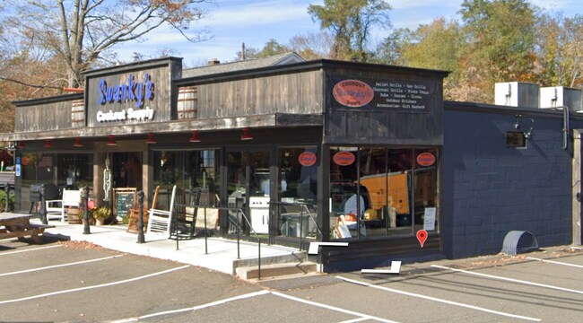
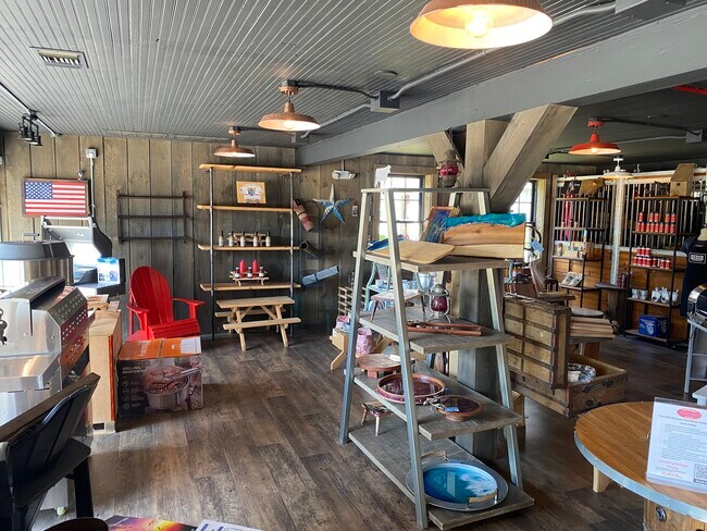
Property Record
5 Main St, Ivoryton, CT 06442
NEARBY LISTINGS FOR SALE OR LEASE
Property Detail
5 Main St
Duplex
Middlesex
X
Connecticut
09011C0432G
0.42 AC
2025
SW Midlsx/Old Saybrk/Rt 9
2025
Hartford
630101
Hartford-West Hartford-East Hartford, CT
1,994 SF
ESSE-000042-000000-000014
DEMOGRAPHICS near 5 Main St
1 Mile
3 Mile
5 Mile
2024 Total Population
2,793
10,544
26,894
2029 Population
2,794
10,525
26,974
Pop Growth 2024-2029
+ 0.04%
(0.18%)
+ 0.30%
Average Age
53
49
48
2024 Total Households
1,319
4,681
11,663
HH Growth 2024-2029
+ 0.15%
(0.30%)
+ 0.27%
Median Household Inc
$99,827
$98,304
$97,282
Avg Household Size
2.00
2.20
2.20
2024 Avg HH Vehicles
2.00
2.00
2.00
Median Home Value
$525,904
$422,507
$393,198
Median Year Built
1966
1970
1970
Nearby Places
Map Layers
Map Styles
 Street
 Aerial
- Restaurants
- Banks
- Shops
- Fitness
- Groceries
PUBLIC TRANSPORTATION
COMMUTER RAIL
Westbrook (Shore Line East - Shore Line East)
DRIVE
WALK
Distance
Westbrook (Shore Line East - Shore Line East)
10 min
5.6 mi
Old Saybrook (Shore Line East - Shore Line East)
DRIVE
WALK
Distance
Old Saybrook (Shore Line East - Shore Line East)
11 min
5.7 mi
AIRPORT
Tweed/New Haven
DRIVE
WALK
Distance
Tweed/New Haven
41 min
29.4 mi
Freight Ports
Port of New Haven
DRIVE
WALK
Distance
Port of New Haven
41 min
30.0 mi
SALE & LEASE HISTORY
LISTING DATE
SALE/LEASE

Oct 10, 2016
For Sale
Jan 18, 2023
For Sale
Feb 05, 2022
For Sale
Aug 01, 2022
For Sale
Nearby Properties
Address
Land Use
TOTAL SIZE
Lot Size
Zoning
Address
Land Use
TOTAL SIZE
Lot Size
Zoning
66.05 AC
PRD
Address
Land Use
TOTAL SIZE
Lot Size
Zoning
108.89 AC
RLC
Address
Land Use
TOTAL SIZE
Lot Size
Zoning
38.67 AC
R60
Address
Land Use
TOTAL SIZE
Lot Size
Zoning
39.32 AC
LI/LDR
Address
Land Use
TOTAL SIZE
Lot Size
Zoning
2,100 SF
434.75 AC
R80
Address
Land Use
TOTAL SIZE
Lot Size
Zoning
7.60 AC
VRD
Address
Land Use
TOTAL SIZE
Lot Size
Zoning
189,678 SF
44.72 AC
LI
Address
Land Use
TOTAL SIZE
Lot Size
Zoning
14.98 AC
VR
Address
Land Use
TOTAL SIZE
Lot Size
Zoning
18.49 AC
HDD
Address
Land Use
TOTAL SIZE
Lot Size
Zoning
120,144 SF
17.10 AC
RLM
Address
Land Use
TOTAL SIZE
Lot Size
Zoning
151,159 SF
6.30 AC
VID
Address
Land Use
TOTAL SIZE
Lot Size
Zoning
18,494 SF
10.40 AC
RU
Address
Land Use
TOTAL SIZE
Lot Size
Zoning
18.80 AC
RU
Address
Land Use
TOTAL SIZE
Lot Size
Zoning
13,739 SF
0.65 AC
VCD
Address
Land Use
TOTAL SIZE
Lot Size
Zoning
62.50 AC
RU
Address
Land Use
TOTAL SIZE
Lot Size
Zoning
849 AC
C
Address
Land Use
TOTAL SIZE
Lot Size
Zoning
3.87 AC
LI
Address
Land Use
TOTAL SIZE
Lot Size
Zoning
146,466 SF
13.55 AC
VID
Address
Land Use
TOTAL SIZE
Lot Size
Zoning
15,236 SF
4 AC
VR
Address
Land Use
TOTAL SIZE
Lot Size
Zoning
27,277 SF
C
Address
Land Use
TOTAL SIZE
Lot Size
Zoning
13.23 AC
WF
Address
Land Use
TOTAL SIZE
Lot Size
Zoning
5.12 AC
WF
Address
Land Use
TOTAL SIZE
Lot Size
Zoning
27,225 SF
2.45 AC
VCD
Address
Land Use
TOTAL SIZE
Lot Size
Zoning
0.78 AC
WF
Address
Land Use
TOTAL SIZE
Lot Size
Zoning
6.51 AC
R80
Address
Land Use
TOTAL SIZE
Lot Size
Zoning
8.10 AC
C
Address
Land Use
TOTAL SIZE
Lot Size
Zoning
14,382 SF
1.87 AC
VMU
Address
Land Use
TOTAL SIZE
Lot Size
Zoning
15,730 SF
2.19 AC
B
Address
Land Use
TOTAL SIZE
Lot Size
Zoning
25,248 SF
1.65 AC
B
Address
Land Use
TOTAL SIZE
Lot Size
Zoning
50.35 AC
CIP
The World's #1 Commercial Real Estate Marketplace
Connect with us
© 2025 CoStar Group
The information above has been obtained from sources believed reliable. While we do not doubt its accuracy we have not verified it and make no guarantee, warranty or representation about it. It is your responsibility to independently confirm its accuracy and completeness. Any projections, opinions, assumptions, or estimates used are for example only and do not represent the current or future performance of the property. The value of this transaction to you depends on tax and other factors which should be evaluated by your tax, financial, and legal advisors. You and your advisors should conduct a careful, independent investigation of the property to determine to your satisfaction the suitability of the property for your needs.